

Welcoming 2024 on Songer Butte, Ashland

Happy 2024—may we greet its challenges with peace and optimism. And what better way to bring in the new year, and focus on the positives, than to get out into nature. This post will highlight some of the geologic features that are visible from Songer Butte, where our Ashland Hiking Group went on New Years Day. Songer Butte is located...
Warner Range in the northeast corner of California

Because of its remote location far from urban centers, the Warner Mountain Range is relatively unknown. We have thought about visiting this place, and exploring its volcanic rocks, for many years. We knew about the Warners because my husband Jay traveled through them on the way to his geologic field site in the Black Rock Desert in northwestern Nevada (see...
Rafting the Owyhee River—Oregon’s Grand Canyon

On April 10–14, we rafted the Lower Owyhee River in easternmost Oregon with Ouzel Outfitters (https://www.oregonrafting.com/owyhee-river). Because this part of the river is not dammed, and the climate is arid, there is only enough flow for rafting during the earliest part of the season. The droughts of the past few years meant that most trips were cancelled, as ours was...
Bienvenidos a Colombia: welcome to the northwest corner of South America

In my continuing quest to learn more about South America’s geology, culture and history, I traveled for a month (mid February–mid March) in Colombia, located in the northwestern corner of South America. Colombia is at the northern end of the Andes, the longest mountain range on our planet. It is the only South American country with coasts on both the...
Not all of the rocks in the Italian Dolomites are dolomite

As explained in my last post (https://landscapes-revealed.net/trekking-through-an-ancient-sea-in-the-italian-dolomites/), the Dolomites were named after a French geologist, whose name was also given to the dolomite mineral. Indeed, the spectacular white peaks of dolomite are what catches the eye when in the Dolomite mountains. But there are other rock types with clues to the geologic history of the region, notably thick sequences of...
Iceland’s glaciers and features they create

Like other high-latitude locations on Earth, glaciers in Iceland have advanced and retreated many times during the past 2.5 million years, since we've been in a global Ice Age. The last glacial maximum was about 20,000 years ago, when ice completely covered the island and extended up to 200 km (120 miles) beyond the coastline to cover the marine shelf....
Volcanoes galore in Iceland

Iceland's "double whammy" position overlying both a mid-ocean ridge and a mantle hot spot produces vast outpourings of lava that have built the island up from the seafloor. Because of the hot spot, the volume of erupted material is about 10 times that found at normal mid-ocean locations that don't coincide with hot spots. In this post, I'll show some...
John Day Fossil Beds National Monument—stratigraphy

The John Day Fossil Beds is located in north-central Oregon. It was established as a national monument in 1974. The region has one of the world's most complete records of fossils during the Age of Mammals, a period of time also known as the Cenozoic Era (past 66 million years). There will be three blog posts: (1) stratigraphy—how layers of...
Mount Hood — Oregon’s highest peak

After smoky air deterred us from backpacking locations in northern California, we headed north to Mount Hood. There, the Timberline Trail promised an interesting trek around Oregon's highest mountain (3426 m / 11,240 ft), located about 80 km (50 miles) east of Portland. Mount Hood is the northernmost Cascade Range volcano in Oregon. See my post about Crater Lake for...
The geology of Yellowstone National Park, and its precursors in Oregon and Idaho

Yellowstone has the distinction of being the first national park in the U.S., and probably in the world. President Ulysses S. Grant signed the bill to protect more than one million acres—mostly in Wyoming—in 1872. Yellowstone was set aside because of its hydrothermal displays—the park contains more than 10,000 features, including the world’s greatest concentration of geysers, hot springs, mud...
South Sister—the third highest volcano in Oregon and one of its youngest

The Three Sisters volcanoes, located in the Three Sisters Wilderness west of Bend, Oregon, are part of the Cascade Range of volcanoes formed above the Cascadia subduction zone. "For magnificence of glacial scenery, for wealth of recent lavas, and for graphic examples of dissected volcanoes, no part of this range surpasses the area embracing the Sisters and McKenzie Pass", said...
Lassen Volcanic National Park—the southernmost Cascade Range volcano

The Cascadia Subduction zone extends along the entire coast of Washington and Oregon, but also along the northern coast of California. South of Mendocino, California, the plates change from converging with each other (the ocean plate loses and slides beneath the continental plate in the subduction zone) to sliding past each other along the San Andreas fault (a transform-type plate...
About the Blogger
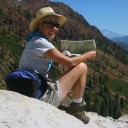 Karen (here with Mt. Shasta in background) is a geology professor emerita who aims to provide a "pocket geologist" for world travelers. Follow the blog to explore the landscapes of our planet and figure out what causes them to look the way they do.