After smoky air deterred us from backpacking locations in northern California, we headed north to Mount Hood. There, the Timberline Trail promised an interesting trek around Oregon’s highest mountain (3426 m / 11,240 ft), located about 80 km (50 miles) east of Portland. Mount Hood is the northernmost Cascade Range volcano in Oregon. See my post about Crater Lake for a map of Cascade volcanoes and a chart of their eruptions during the past 4,000 years (https://landscapes-revealed.net/the-geology-of-crater-lake-national-park/). Mount Hood has been active for at least 500,000 years; the most recent activity was about 1500 years ago and then again in the late 1700s to the 1800s. Like most of the other Cascade Range volcanoes, Mount Hood is a steep-sided stratovolcano built of both lava and pyroclastic flows. My Crater Lake post also illustrates types of volcanic products such as lava, pyroclastic flows, and lahars.
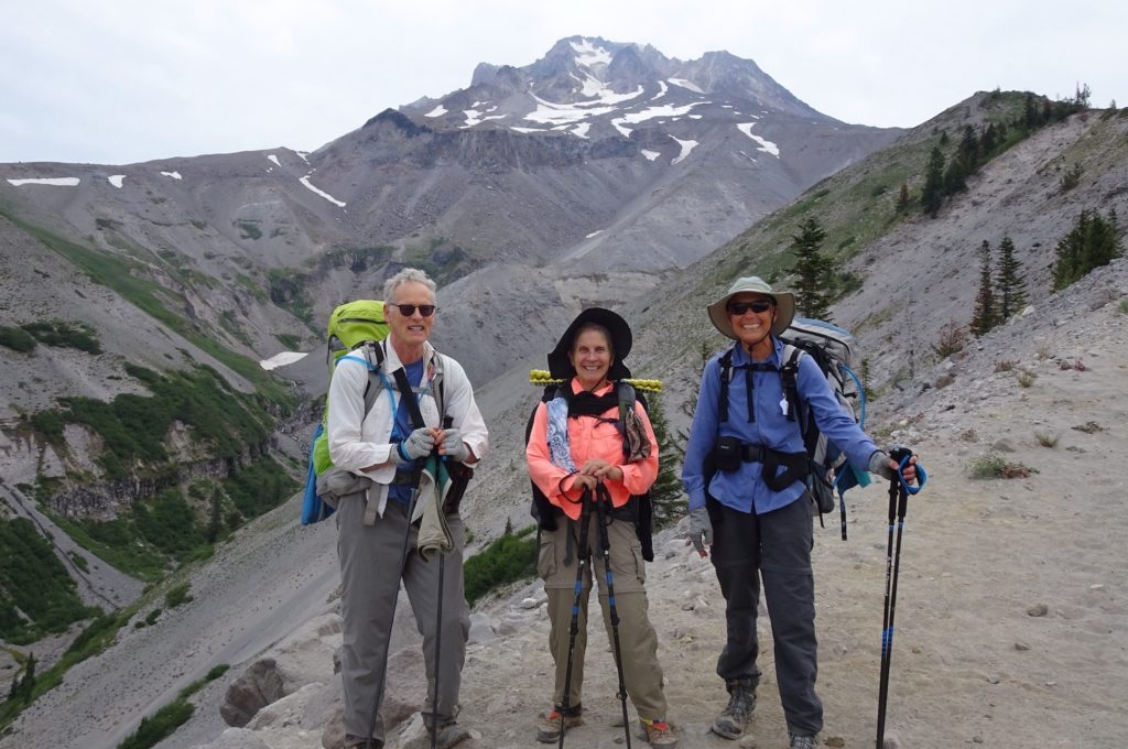
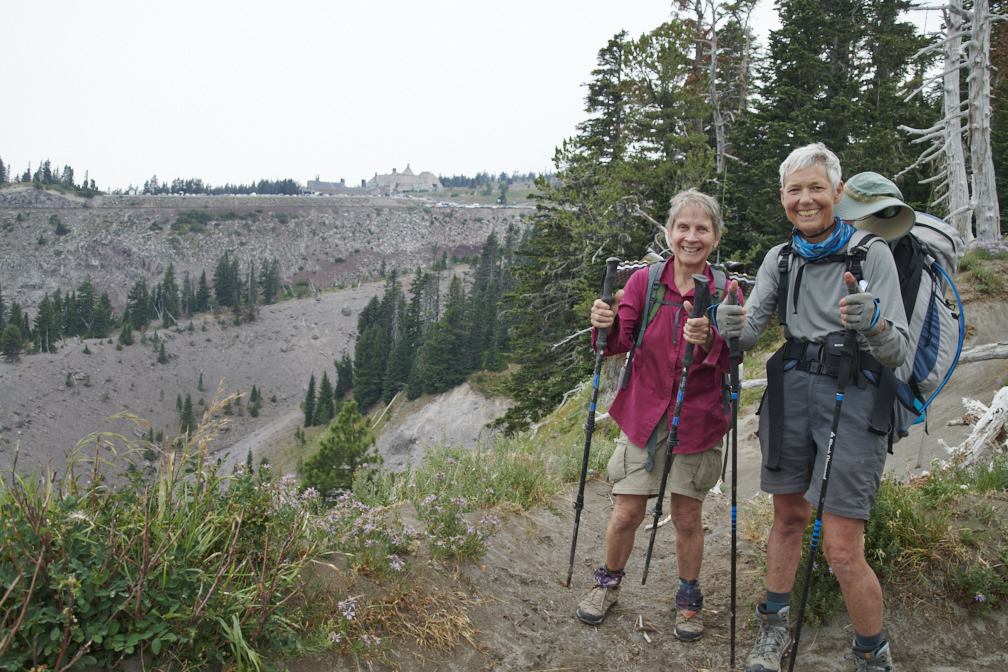
The backpacking team (Jay, Maria, me) on the west side of Mount Hood above the Sandy River Valley. During the past 1500 years, most of the volcanic activity has been lava domes that grow and then collapse to form rapidly-moving pyroclastic flows and lahars carrying large quantities of volcanic particles down the volcano’s flanks. When Lewis and Clark visited the mouth of the Sandy River in 1805-06, they described a river choked with volcanogenic sediment from an eruption in the late 1700s. Hikers can still see remnants of these pyroclastic flows on sides of the Sandy River valley.
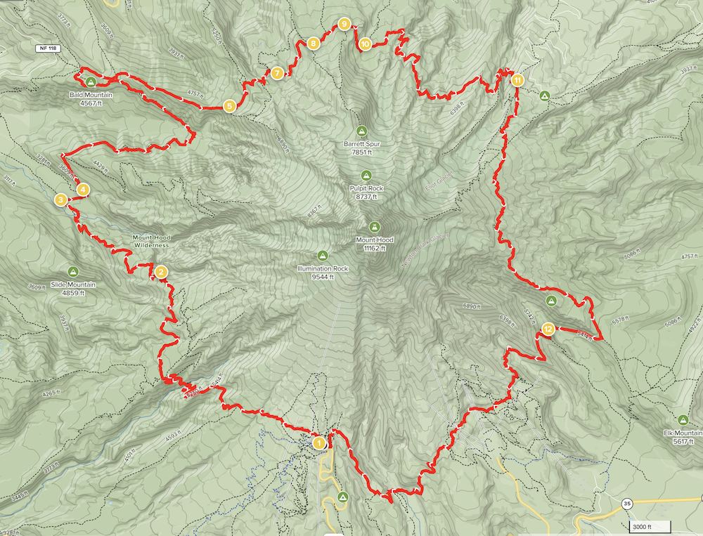
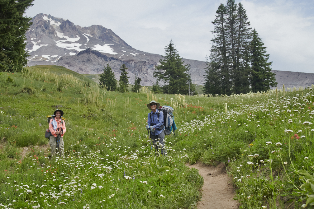
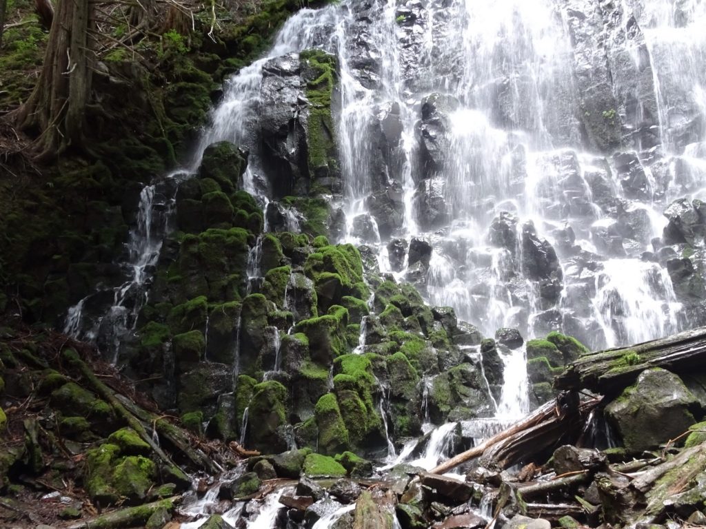
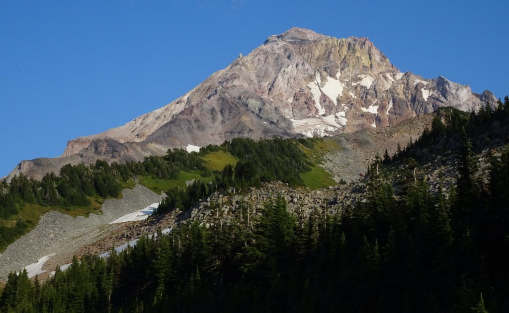
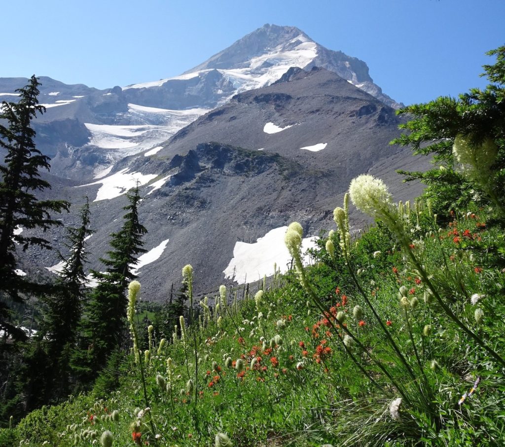
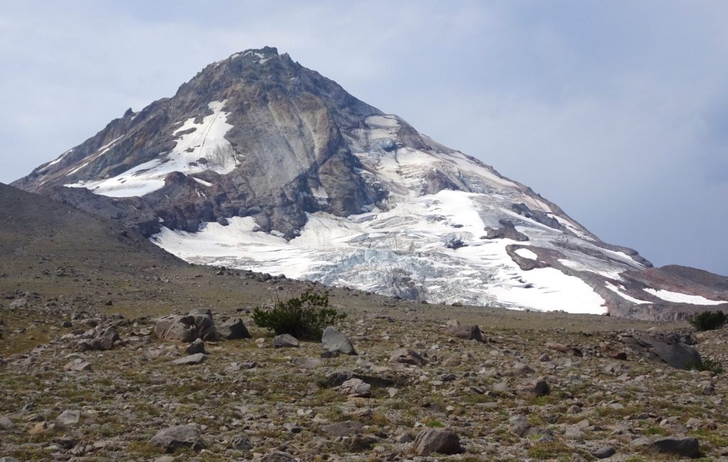
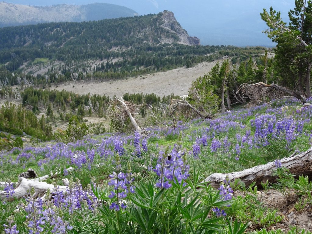
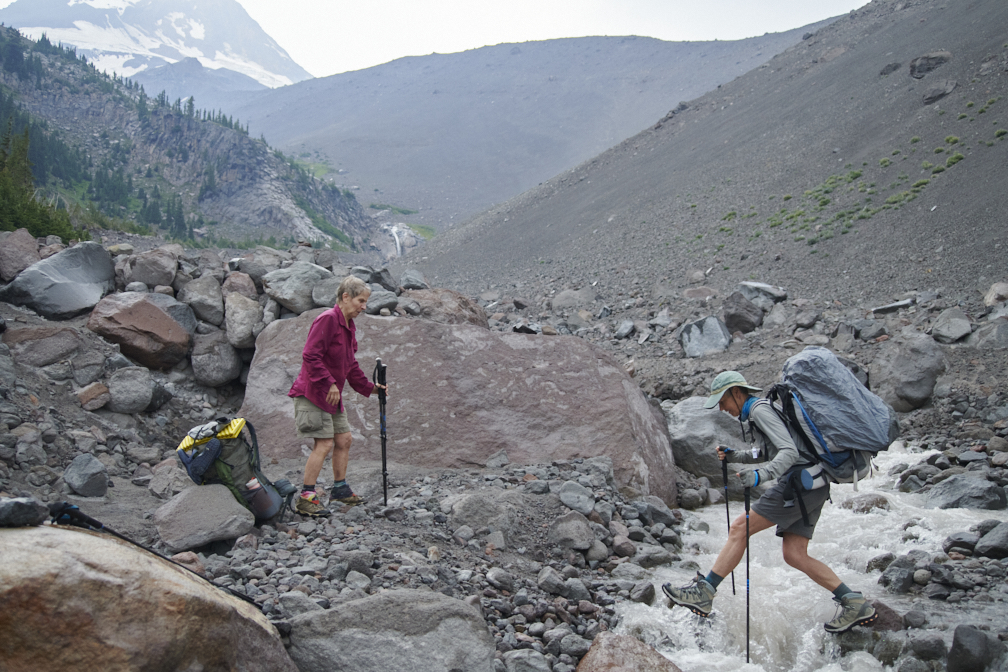
Crater Rock is the triangular-shaped lava dome at the top of the mountain (just right of the uppermost snow field) that has repeatedly grown and then collapsed to form pyroclastic flows. Lahars are often generated during eruptions. The hot volcanic particles cause ice and snow to melt, creating debris flows that are a mixture of volcanic material, water, soil, and plants. This map of Mount Hood shows our path on the Timberline Trail. We started at Timberline Lodge (waypoint 1) and did a clockwise circuit. The photo above the map was taken a little west of waypoint 2 by a fellow backpacker. The Sandy River is located at waypoint 3, where we camped the first night. In total, we hiked 72 km (43 miles) in 5 days (27–31 July 2021). We ascended (and descended) a total of about 2900 meters (9500 feet). Map is from AllTrails App. The west side of Mount Hood was green and lush, with dramatic fields of wild flowers, and flowing streams with clear water, a welcome change from the dry landscapes farther south. Since weather systems move from west to east at this latitude, the west side receives more precipitation than the east side, where the mountain creates a rain shadow. From this perspective, the triangular-shaped Crater Rock lava dome is poking just above the skyline. Photo by Jay.Ramona Falls (waypoint 4 on trail map) was a welcome stop on Day 2; it can also be accessed by day hikers from the west. The thick lava flow that created the falls consists of solid rocks that are more resistant to erosion than the loose particles of pyroclastic flows. The lava cooled into columnar shapes that look particularly lovely when covered in green moss. The individual columns have tops with diameters of about 30 cm (1 foot) and heights of a person.A view of Mount Hood, with evening glow, from our night 2 camping spot, located between waypoints 5 and 7 on trail map. This image reveals the complexity of the volcanic lava and pyroclastic flows that have successively erupted and then been eroded. The yellowish color is from sulfur dioxide, a common gas emitted from volcanoes. Glaciers, that are now shrinking, created the rounded valleys.We made slower progress on Day 3 because of the many stream crossings. Warm temperatures caused the mountain’s glaciers to melt rapidly, leading to swift, deep water that was progressively more difficult to cross toward the day’s end. Coe Creek was a particularly difficult crossing—the water level was up to the thighs of even 6-foot-tall Jay. He gallantly carried Maria’s and my backpacks across the creek so that we could focus on getting our shorter bodies safely across. In creeks like these, we first removed our boots and attached them to our backpacks. We then used water shoes and our hiking poles to cross.Despite the slow pace on Day 3, we enjoyed the beautiful mountain views, glimpsed through abundant fields of wildflowers. In this photo, note tall bear grass mixed with shorter paintbrush and western pasqueflower (the fuzzy whitish plant). Also note the glacier on upper slopes of Mount Hood, and the angular ridges formed by glacial erosion.
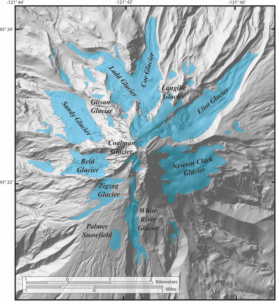
This map (from USGS web site) shows the existing extent of Mount Hood’s glaciers, now greatly shrunk from their positions during the last glacial maximum (~20,00 years ago), when they radiated up to 15 km (9.3 miles) from the peak and filled all of the valleys with ice. Note the ridges on the map adjacent to the valleys. These are moraines made of sediments carried down slope by the glaciers and left stranded as the glaciers retreated. Eruptions during the past 20,000 years have covered some parts of the moraines.
The Coe and Eliot Glaciers are the largest glaciers on Mount Hood. We heard harrowing stories about crossing Eliot Creek, so we camped (night 3) just west of the creek so we could cross it early in the morning. With the lower morning flow, and some strategically placed logs, we were able to cross the creek with little difficulty. However, the creek has incised deep into the Eliot Glacier’s moraine, creating steep slopes of loose sediment that made the hike down to the creek and back up again the most challenging part of the crossing.
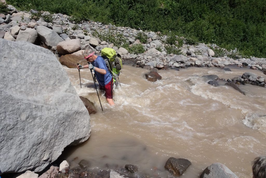
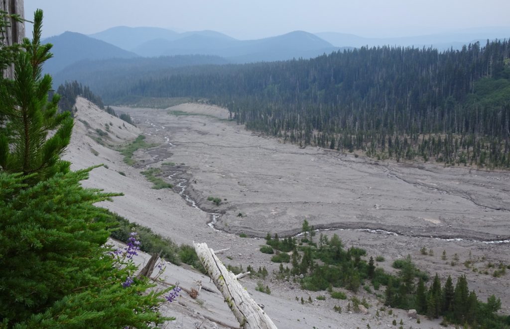
On Day 4 we trekked along the eastern side of Mount Hood, from Eliot Creek (waypoint 11 on the trail map) to Newton Creek (waypoint 12), where we camped on night 4. The mountain creates a rain shadow on the eastern side, which consists of barren rock slopes, a stark contrast to the lush green landscapes on the western side. The glacier shown above is the Newton Clark Glacier. As we headed south, we emerged from behind the rain shadow and saw a gradual increase in plants, including the spectacular lupine wildflowers in this photo. The ridge in the background is Lamberson Butte, which is underlain by lava flows that built up this side of the volcano 300-100,000 years ago. On the glacier map, this butte is a prominent ridge extending eastward from the Newton Creek Glacier. Our trail went up and over Lamberson Butte to the Newton Creek valley beyond. We crossed sediment-laden Newton Creek to find a camping spot on the south side of the creek, where a small stream provided clear water.Clouds and a little rain did not mar our Day 5 trek. Our last big challenge was to cross several channels of the White River, shown in the photo above. Like the Sandy River (top photo), the White River is in a valley laden with volcanogenic sediments supplied by eruptions in the late 1700s. Fortunately, we could cross channels of the White River without removing our boots. Notice the large boulders that are lava blocks carried down slope by glacial ice and river water. Photo by Jay.We were happy to see Timberline Lodge come into view, meaning that we had survived all of the stream crossings (the most difficult part of the trip) and that we could enjoy a well-deserved pizza and salad meal at Al Forno Ferruzza in the nearby village of Rhododendron. We highly recommend the trek, but it behooves backpackers to avoid stormy conditions and to check the condition of stream crossings.
Do geologists expect Mount Hood to erupt again soon? A late 1700 eruptive period provided pyroclastic materials that the Sandy and White Rivers are still carrying away from the mountain. In the mid 1800s, local residents reported minor explosive activity, but the volcano has been quiet since then. Nevertheless, it is clearly an active volcano and certainly has the potential to erupt again. Even a small eruption could supply enough heat to melt ice and snow, and create lahars that can surge down river valleys to locations far from the volcano. Debris avalanches from unstable rocks at the top of Mount Hood can create debris flows, especially during the rainy months, even without an eruption.
Because of its proximity to Portland and other smaller communities, the U.S. Geologic Survey has monitoring stations on the mountain to detect any changes that might herald an impending eruption. Just 2 months ago, on 5 June 2021, a 3.9-magnitude earthquake was detected. Fortunately, it was associated with movements on a small fault and was not a result of magma moving underground. So enjoy the mountain, but be aware of current conditions.


Amazing post!! What elevation were you at on this trail? ❤️❤️
We were mostly around 7000 feet, although we dropped to nearly 3000 feet at Sandy River.
I was gonna guess around 6000’. Looks like quite a hike. Especially the river conditions. How’s the smoke level in Ashland now?
It’s been bad…
☹️ 😜 😷