The Rogue Valley region in SW Oregon: displaying 300 million years of geologic time
Typically, I post blogs when traveling away from my home in Ashland, Oregon. But with COVID-19 keeping us all at home, it seems a good time to investigate the landscape of my local region. Ashland is a tourist town best known as the home of the Oregon Shakespeare Festival (OSF), an eight-month season of 11 plays—four by Shakespeare and seven...
Craters of the Moon National Monument—a little bit of Hawai’i in Idaho
If you ignore the arid climate and sagebrush vegetation in the Snake River Plain of Idaho, and just look at the landscape of lava, you can imagine yourself on the Big Island of Hawai'i. This photograph shows basalt-type lava in pahoe'oe and a'a flows, with cinder cones in the background. The area is still considered to be volcanically active, with...
Human interactions with the Lava Beds landscape
The Modoc group of Native Americans have lived in the region that is now the Lava Beds National Monument for thousands of years. They left little imprint on the land, but they did leave some rock art that is interesting to examine. Two caves—Big Painted Cave and Symbol Bridge Cave—contain pictographs that are painted onto the rocks with a charcoal-based...
Lava lava everywhere—Lava Beds National Monument, NW California
I've said there are just two Cascade Range volcanoes in California—Mt. Lassen and Mt. Shasta. But there is a third called Medicine Lake Volcano, as shown on the map below (from https://en.wikipedia.org/wiki/Cascade_Volcanoes). Lava Beds National Monument is located just north of the volcano, where numerous flows have completely covered the landscape during the past 500,000 years. Because it is a...
Climbing Mount McLoughlin—one of the lesser known Cascade volcanoes
Mount McLoughlin is located 63 kilometers (38 miles) east of Ashland, Oregon, where I now live. As shown on this map by the U.S. Geological Survey, Mount McLoughlin is located between the volcanoes of Mount Shasta and Crater Lake, which is the remnant of Mount Mazama that exploded to become a caldera 7,700 years ago. All of the Cascade Range...
Volcanoes past and present
The lake district is in the northwestern part of Patagonia, where the landscape has changed somewhat. In Argentina, the lakes are still on the dry side of the Andes, but the country border here jogs a little westward to capture more of the cordillera with its mountains and green forests. The nothofagus is still here—southern beech tree that evolved when...
- « Previous
- 1
- 2
About the Blogger
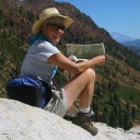
 Karen (here with Mt. Shasta in background) is a geology professor emerita who aims to provide a "pocket geologist" for world travelers. Follow the blog to explore the landscapes of our planet and figure out what causes them to look the way they do.


