

Iceland’s glaciers and features they create

Like other high-latitude locations on Earth, glaciers in Iceland have advanced and retreated many times during the past 2.5 million years, since we've been in a global Ice Age. The last glacial maximum was about 20,000 years ago, when ice completely covered the island and extended up to 200 km (120 miles) beyond the coastline to cover the marine shelf....
How did the Himalayas get to be Earth’s highest mountain range?

In my last four posts, I described the 21-day trek we did in the Everest region in November 2021, including some of our geologic observations along the way. In this final post, I explain how these mountains evolved to achieve such immense size and beauty. Here's how Earth's continents were distributed 50 million years ago (Ma). At about 200 Ma,...
Trekking in the Khumbu region of the Nepal Himalayas, Part 4: from Gokyo back to Lukla

The last leg of our 21-day trek extended west from Goyko to cross the Renjo La (pass), then south down the Bhote Koshi valley back to Namche, and finally down the Dudh Koshi valley to Lukla, where we flew back to Kathmandu. Please see my first post for a map of the trek, including this last leg: https://landscapes-revealed.net/trekking-in-the-khumbu-region-of-the-nepal-himalayas-part-1-from-kathmandu-to-namche/. The area...
Trekking in the Khumbu region of the Nepal Himalayas, Part 3: to Everest Base Camp and Goyko

From Chhukhung (end of Part 2 post: https://landscapes-revealed.net/trekking-in-the-khumbu-region-of-the-nepal-himalayas-part-2-all-hail-to-ama-dablam/), our next destination was Gorak Shep and Everest Base Camp. We trekkers split into two groups: one group hiked from Chhukhung over the Kongma La (pass) to Lobuche; the other group hiked down the valley from Chhukhung to Dingboche, then followed another valley northward to Lobuche. See my first post for a...
Trekking in the Khumbu region of the Nepal Himalayas, Part 2: All hail to Ama Dablam

This second post about trekking in our planet's highest mountains is a tribute to Ama Dablam, the mountain we saw all along the route to the northeast from Namche to Chhukhung, where we reached the highest elevation of the trek. As we continued uphill, we found steeper trails, more primitive lodges, and lots of in-your-face geology! Link to my first...
Mount Hood — Oregon’s highest peak

After smoky air deterred us from backpacking locations in northern California, we headed north to Mount Hood. There, the Timberline Trail promised an interesting trek around Oregon's highest mountain (3426 m / 11,240 ft), located about 80 km (50 miles) east of Portland. Mount Hood is the northernmost Cascade Range volcano in Oregon. See my post about Crater Lake for...
The geology of Yosemite National Park

With stunning vistas of shear rock walls, cascading waterfalls, rounded granite domes and jagged spires, it's no surprise that Yosemite is one of the most popular national parks in the U.S. While most visitors are drawn to Yosemite Valley, the park has numerous other wonders beyond the valley and even the park boundaries in the Sierra Nevada (=snowy mountain range...
Traversing the Swiss Alps on the Haute Route—the eastern end

After three days of traversing steep rocky passes in the cold and snow, we were ready for warm, clear weather and green valleys with quaint Swiss villages. The last snowy impediment was the Pas de Chévres, which was a little intimidating because of its vertical steel ladders. But by the time we had crossed over the glacier east of Cabane...
Traversing the Swiss Alps on the Haute Route—the western end

The Haute Route was established as a route for skiers but is now also very popular for hikers in the summer. The route extends from Chamonix (France) to Zermatt (Switzerland). There are many variations on the route; most people choose a 7–14 day transect that could include "short cuts" of chair lifts, trains and/or buses. The map below (from https://www.pinterest.com/pin/205828645448998187/)...
A mecca for climbers—and anyone who loves mountains

We are back in Parque Nacional Los Glaciares (Glacier National Park), this time in the sturdy little town of El Chaltén, located right at the edge of the park. It consists of lodging, restaurants, excursion companies—everything geared to the people who come here from all over the world to climb and hike during the summer season. Here is a photo...
Ushuaia – el fin del mundo (the end of the world)

Ushuaia is the southernmost city in the world, at 50 degrees south latitude. True, there is the small town of Puerto Williams that is slightly more south, on the south shore of the Beagle Channel, and there is a small scientific settlement (McMurdo Station) in Antarctica, but Ushuaia is a bustling city of about 70,000 people that takes full advantage...
When glaciers dominated this landscape

The photo below is from Cerro Cristales, looking northeast across the valley now occupied by Lago Argentina (lake in the distance) and its narrow western arms (lakes in the foreground). Twenty thousand years ago this valley was filled with glaciers. El Calafate, the popular tourist town that sits on the south shore of Lago Argentina, and that is the base...
About the Blogger
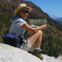 Karen (here with Mt. Shasta in background) is a geology professor emerita who aims to provide a "pocket geologist" for world travelers. Follow the blog to explore the landscapes of our planet and figure out what causes them to look the way they do.