Not all of the rocks in the Italian Dolomites are dolomite
October 9, 2022
As explained in my last post (https://landscapes-revealed.net/trekking-through-an-ancient-sea-in-the-italian-dolomites/), the Dolomites were named after a French geologist, whose name was also given to the dolomite mineral. Indeed, the spectacular white peaks of dolomite are what catches the eye when in the Dolomite mountains. But there are other rock types with clues to the geologic history of the region, notably thick sequences of volcanic rock that underlie and overlie the carbonate platforms of dolomite. Underlying the carbonate rock are also terrigenous sedimentary rocks made of sand and mud.
Volcanic rocks
Most of the igneous rocks we saw are younger than the carbonate platforms. Here is some of the evidence we saw. For locations, refer to the map in my last post (link above).
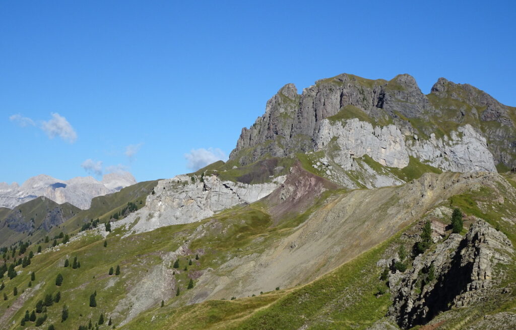
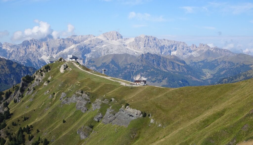
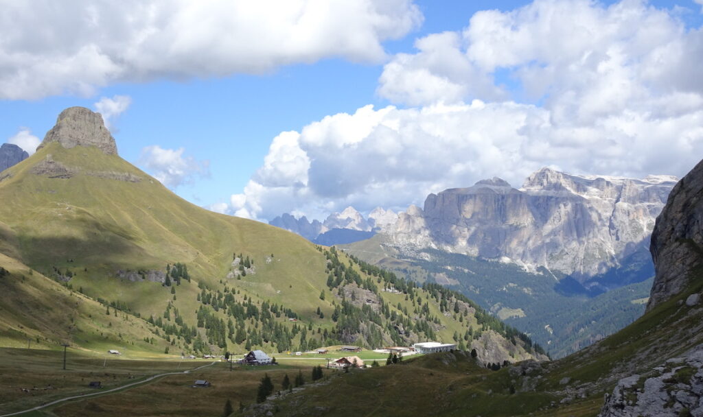
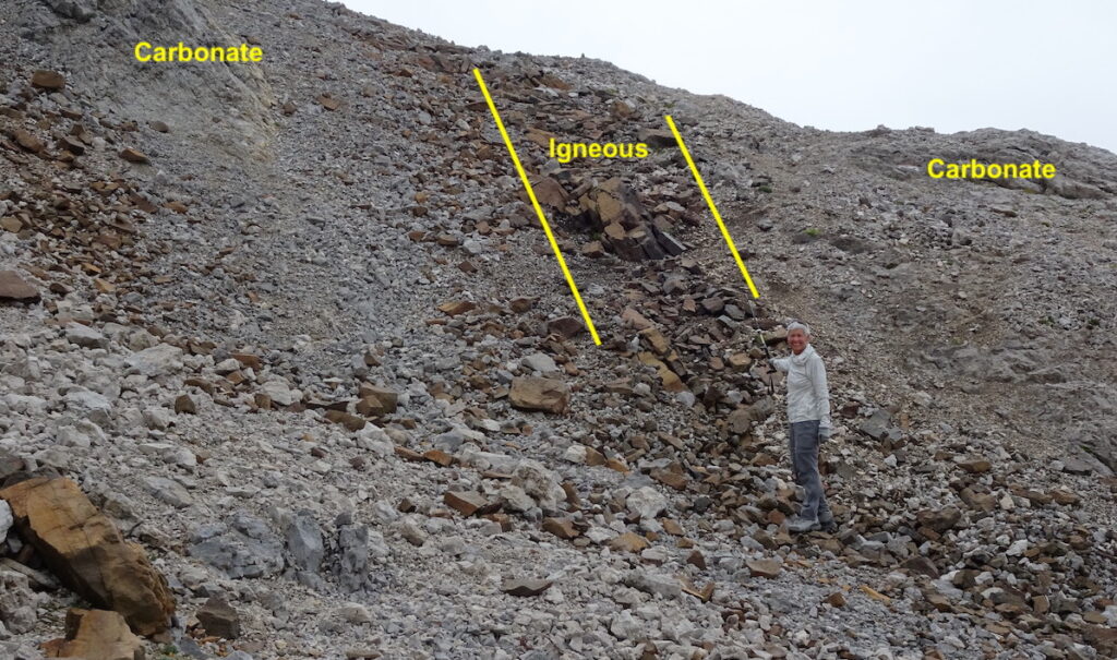
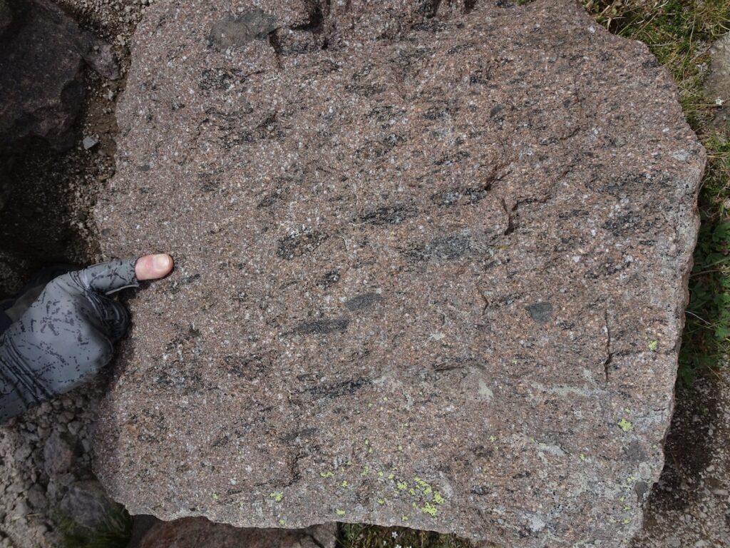
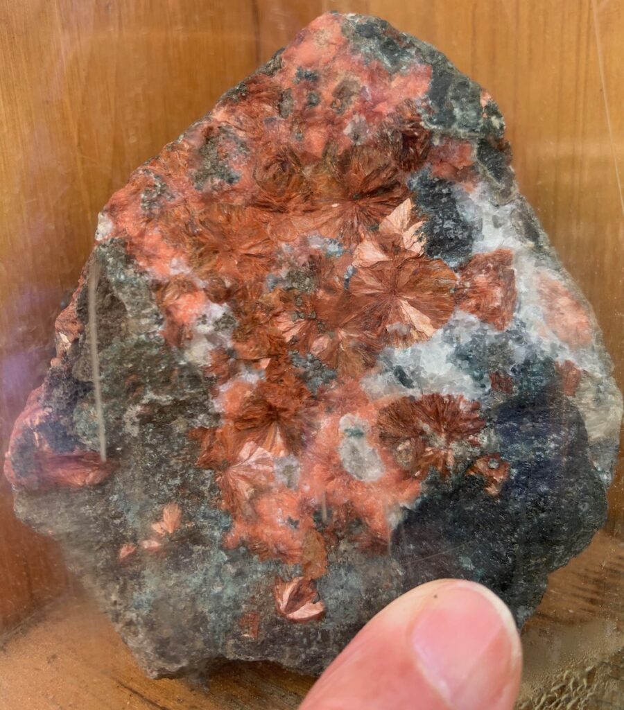
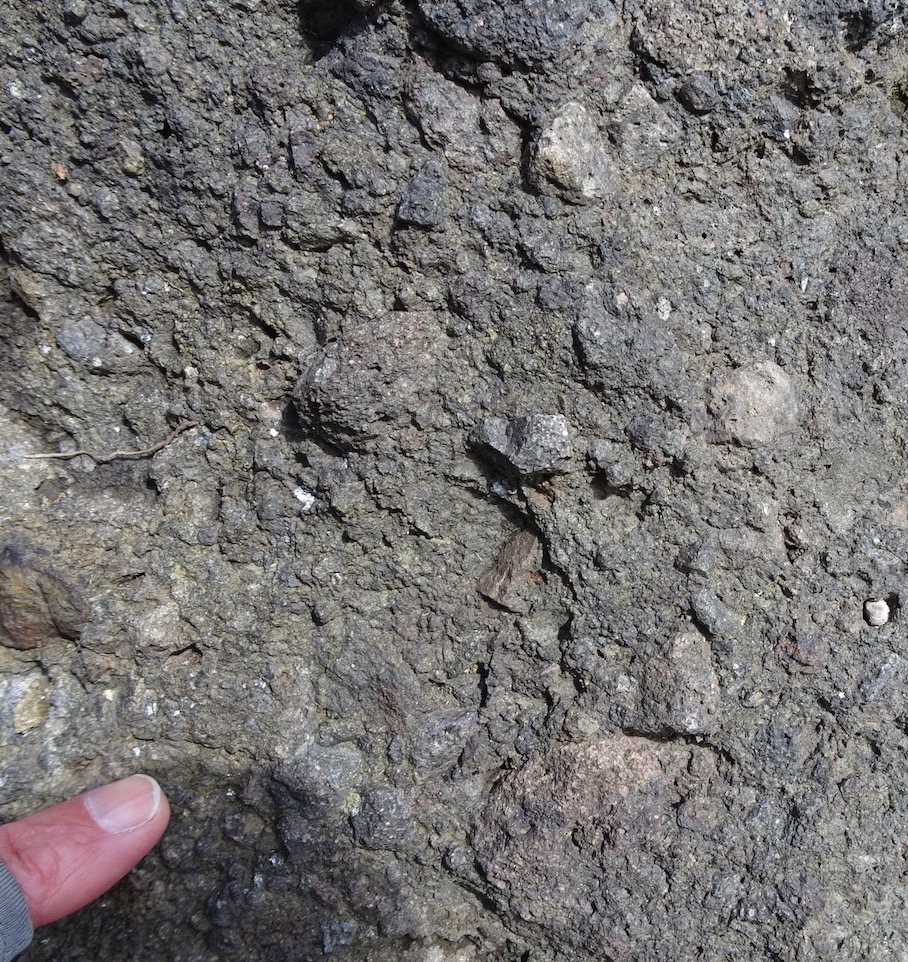
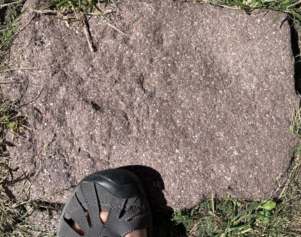
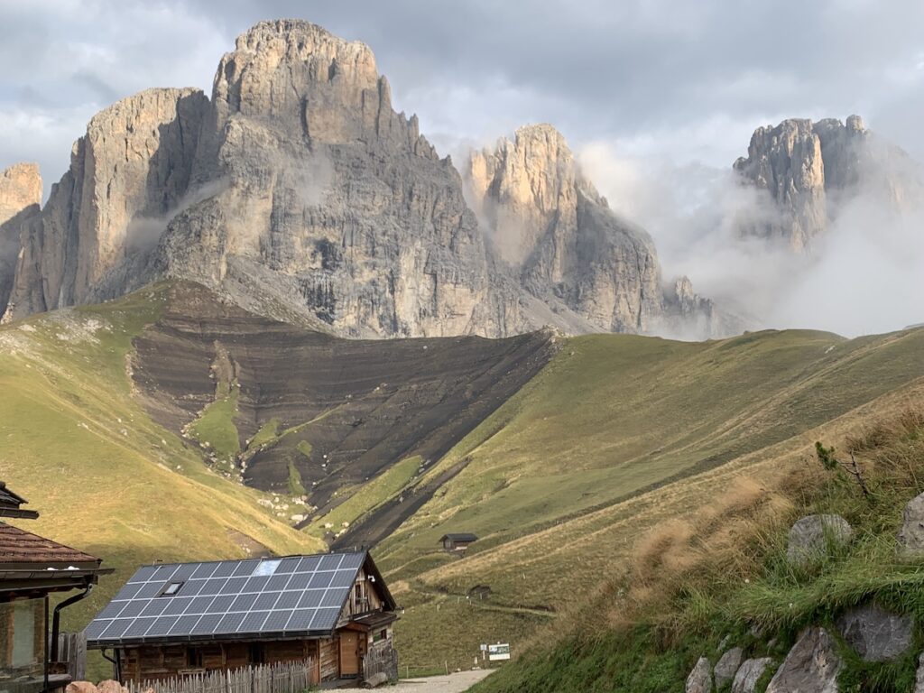
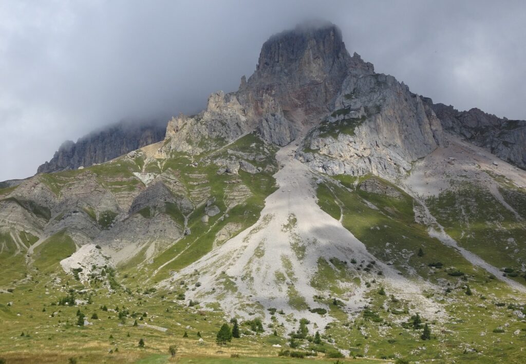
This photo was taken on the trail heading west from the Contrin Valley, looking toward the northwest. The dark rocks at the top of this ridge, and extending westward, are igneous rocks that formed when volcanoes erupted and completely covered the underlying light-colored carbonate rocks. The volcanic rocks have a range of compositions and were probably a result of continental rifting. Also note some red-colored layers and some thin layers in the foreground. These rock types have terrigenous (land-sourced) components and are discussed below.This photo is from the trail heading upward and westward from Lago di Fedeia, at the upper end of the Fassa Valley. The view is westward toward Rifugio Baita Federola, the top of a chairlift to the Fassa Valley below, and a more western ridge of carbonate rocks. All of the darker-colored rocks in the foreground and in front of the distant carbonate ridge are volcanic. They may appear to be beneath the light-colored rocks, but they are not—they filled in the valleys adjacent to the already-formed isolated carbonate platforms. In fact, the carbonate platforms were completely buried by younger volcanic rocks. Because the volcanic rocks are weaker, they have eroded and left the more-resistant carbonate rocks as the highest peaks. This photo is of Refugio Tobia del Giagher (where we had lunch!) and another chair lift that descends to the Fassa Valley. That is Piz Boe mountain on the horizon on the right. On the left is a peak made wholly of volcanic rocks. Apparently some of the carbonate and volcanic activity occurred at the same time, so this may be an atoll—a volcanic island with a fringing carbonate platform. Alternatively, this peak could be an erosional remnant of volcanic rocks that completely filled the space between the older carbonate platforms.On our climb up to Pas de la Ciréle (pass) from San Pelligrino we kept seeing igneous rocks (probably of basaltic composition) without an apparent source. Once we got to the pass, however, the source was revealed. We saw igneous dikes (one is delineated by yellow lines) that had intruded into the carbonate sediments. Because the dikes cut the carbonate, they are clearly younger. A close-up of these rocks is shown below. (NOTE: Magma—liquid rock—can flow into fractures and then cool into solid igneous rock.)Here are some of the igneous rocks we saw along our trek. Top row, left to right: (1) Ash-flow tuff formed from an explosive volcanic eruption. The black “blobs” are pieces of pumice that got flattened by the weight of the overlying volcanic material. (2) The red-colored mineral heulandite is a mineral that crystallizes in the cavities of volcanic rocks. We kept seeing red specks in the igneous rocks. Along the trail we found a sign with this rock sample, informing us that the red specks are heulandite crystals. (3) A volcanic rock with large pieces that may have formed as a lahar, a type of volcanic debris flow. Bottom row, left to right: (1) Pieces of igneous rock from the dikes at Pas de la Ciréle (shown in photo above). The crystals are large because the magma cooled underground. (2) Piece of porphyritic volcanic rock. If you read my post about Ravenna (https://landscapes-revealed.net/rock-art-in-ravenna-italy/), you know that porphyry is the name for volcanic rocks with larger crystals in a fine-grained groundmass. The name of the rock type is from the place in Egypt where it was found by Romans in 18 A.D. Although the Italian rock is not “imperial porphyry”, it has a very similar appearance.
Terrigenous rocks
Terrigenous means sediments that have an on-land origin. Whereas carbonate sediments form in-situ, in the ocean, by carbonate-secreting organisms, terrigenous sediments originate on land, by erosion of pre-existing rocks, and are then carried to the ocean by rivers.
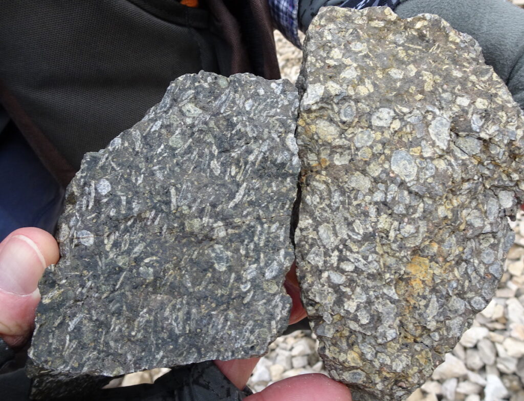
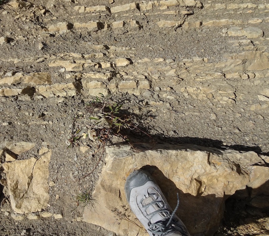
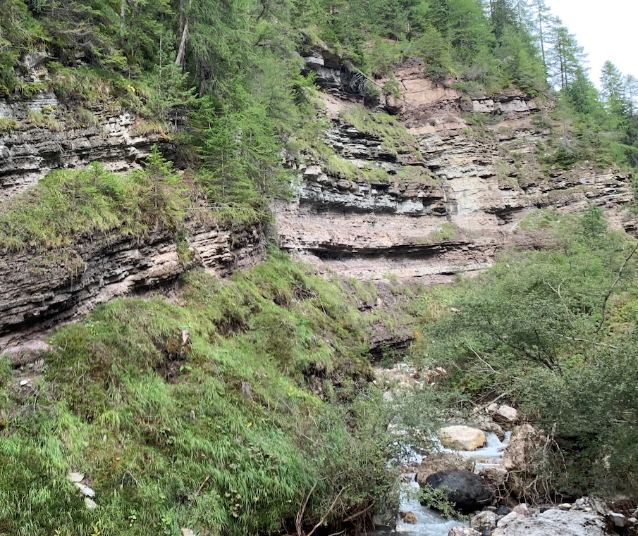
This photo is from Refugio Friedrich August, located near Sassolungo peak. Here we could see a clear transition from dark-colored sediments of sand and mud to overlying light-colored sediments of carbonate. When the carbonate platforms were building up, they were isolated from any source of sediment from land. The layers of sand and mud beneath the platforms tell us that sediments eroded from land were reaching this part of the ocean prior to the development of the platforms. The alternating darker and lighter colors are alternating thin mud and sand layers.This photo was taken on the trail ascending from San Pelligrino to Pas de la Ciréle. Notice the thin beds that underlie the massive carbonates. In this case, the sediments are marl, which means a mixture of limestone and terrigenous mud. This tells us that carbonates were being deposited in the ocean (but not on a platform) along with mud from erosion of rocks on land. This photo shows a distinct debris cone of modern sediment derived from erosion of the massive carbonate peak above it.These photos are close-ups of terrigenous sedimentary rocks. Left-side photo: Alternating layers of sandstone and mudstone that are sediments derived from the land and carried into the ocean. Right-side photo: Alternating layers of limestone and terrigenous mudstone, a sediment combination called “marl”.
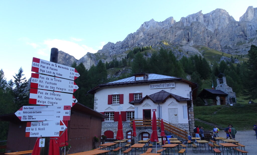
Refugio Contrin and Marmolada
I’ll end this post with a photo of a popular refugio—Refugio Contrin—with the south slope of Marmolada peak in the background. At an elevation of 3,343 m (10,968 ft), Marmolada is the highest peak in the Dolomites. It was completely buried by younger volcanic rocks, but because the volcanic rocks are less resistant to erosion, they have been mostly removed, leaving the carbonate peak behind.
In my last post about the Dolomites, I’ll explain how they got uplifted to their present elevations.


I am really enjoying your well-documented excursions!
Thanks Jane! Appreciate your comments!
Such stunning photos! So informative. ❤️
Thanks Kim!