Welcoming 2024 on Songer Butte, Ashland
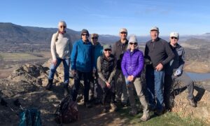
Happy 2024—may we greet its challenges with peace and optimism. And what better way to bring in the new year, and focus on the positives, than to get out into nature. This post will highlight some of the geologic features that are visible from Songer Butte, where our Ashland Hiking Group went on New Years Day. Songer Butte is located...
How does the Rogue Valley fit into the larger tectonic picture?
In the last three posts, we explored the geologic makeup of the Rogue Valley region. Most people know that there is a subduction zone off the coast of the Pacific NW and you might wonder: how does the Rogue Valley region fit into this larger picture? We will explore the tectonic setting in this post. This diagram shows the present...
Sedimentary rocks tell stories about the Rogue Valley region’s geologic history
In the previous two posts, we explored the distribution of rock units in the Rogue Valley region, and how the different resistances of these rock types to weathering and erosion has created the topographic variations we see in the landscape. The different rock types also produce a large variety of soil types that are important for gardeners and vintners in...
Why is the Rogue Valley a valley?
In the April 19 post, we examined the geologic units that are exposed in the Rogue Valley region, and saw that the units are all tilted toward the NE, with the oldest units located to the SW (between the valley and the coast), and the younger units located toward the NE (toward the active volcanoes of the High Cascades like...
The Rogue Valley region in SW Oregon: displaying 300 million years of geologic time
Typically, I post blogs when traveling away from my home in Ashland, Oregon. But with COVID-19 keeping us all at home, it seems a good time to investigate the landscape of my local region. Ashland is a tourist town best known as the home of the Oregon Shakespeare Festival (OSF), an eight-month season of 11 plays—four by Shakespeare and seven...
What is so special about the Cascade-Siskiyou National Monument?
This national monument spans the border between Oregon (Jackson County) and California (Siskiyou County) immediately east of the I-5 freeway. It was first established in 2000 by President Bill Clinton and expanded in January 2017 by President Obama as one of his last actions before leaving office. The monument is managed by the Bureau of Land Management (BLM) from the...
About the Blogger
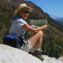
 Karen (here with Mt. Shasta in background) is a geology professor emerita who aims to provide a "pocket geologist" for world travelers. Follow the blog to explore the landscapes of our planet and figure out what causes them to look the way they do.


