Iceland’s “double whammy” position overlying both a mid-ocean ridge and a mantle hot spot produces vast outpourings of lava that have built the island up from the seafloor. Because of the hot spot, the volume of erupted material is about 10 times that found at normal mid-ocean locations that don’t coincide with hot spots. In this post, I’ll show some of the volcanoes we visited in July, as examples of the vast variety ranging from long fissures to cones of many sizes and eruptive styles.
A puzzling aspect of Iceland is the range of igneous rock compositions. Hot spot and mid-ocean ridges typically produce almost all basaltic (silica-poor) lava. But fully 11% of the volcanic rocks in Iceland are high-silica rhyolite, and 14% have levels of silica intermediate between basalt and rhyolite—these are types of lava usually associated with continental crust. Most researchers link the more silica-rich rocks to magma segregation in oceanic crust that is much thicker than normal ocean crust. Although it’s an outlier view, some researchers postulate that small pieces of continent are trapped beneath the island.
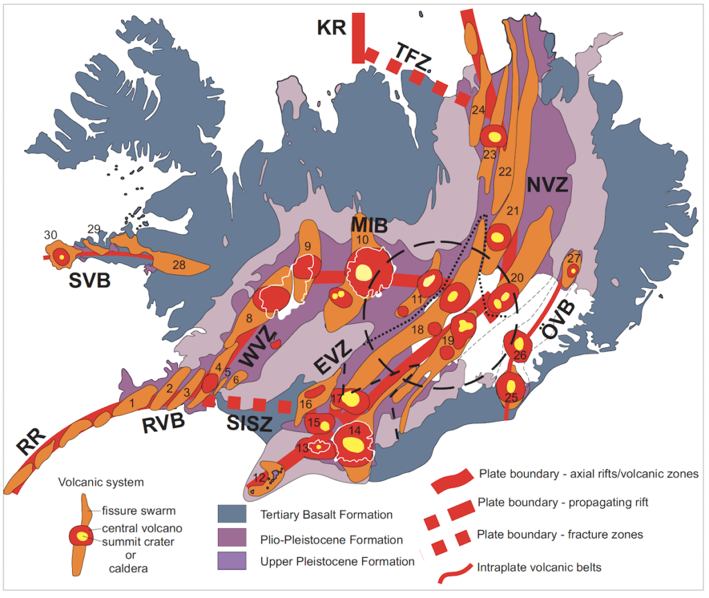
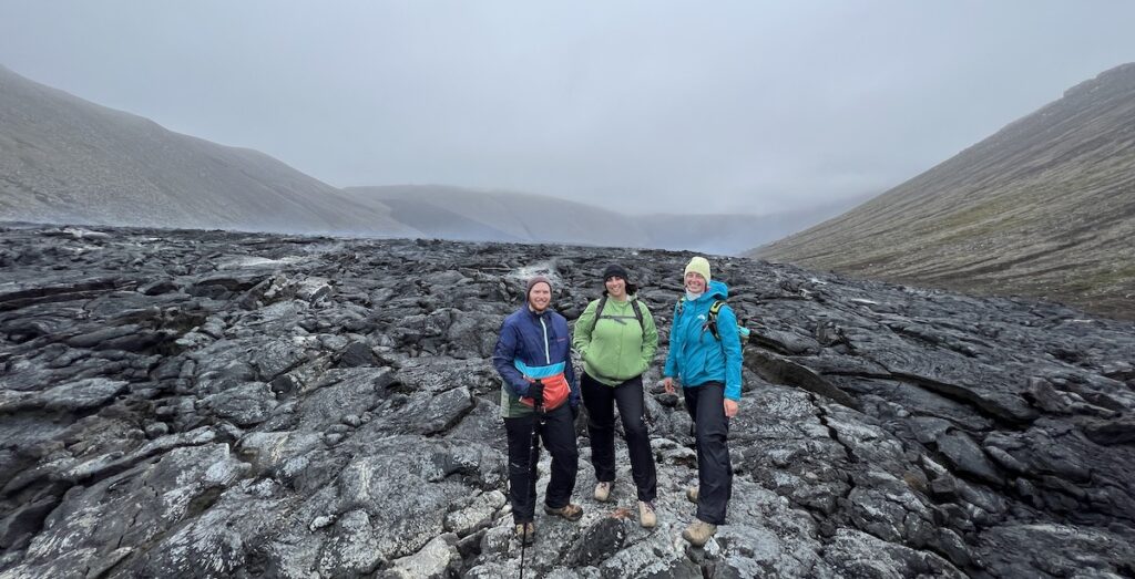
This geologic map of Iceland shows the active volcanoes along plate boundary segments. Please see my previous post, about the plate tectonic setting of Iceland, for the names of the abbreviations (e.g., EVZ=Eastern Volcanic Zone): https://landscapes-revealed.net/standing-between-tectonic-plates-in-iceland/. Two active volcano belts are outside the present-day plate boundary: Snæfellsnes Volcanic Belt (SVB), which may have been the plate boundary before it jumped eastward, and Öræfi Volcanic Belt (OVB), which is near the current location of the mantle hot spot. The numbers (1–30) are active volcanoes, some of which I’ll refer to in this post. The two main types of volcanism in Iceland are fissure swarms and central volcanoes. Note that most central volcanoes are also associated with fissure swarms, whereas many of the fissure swarms lack a central volcano. Figure is from Thordarson & Höskuldsson, 2008 (reference below).Ethan, Annie and Daphne (three members of our geology group) are standing on fresh basaltic lava from the 2021 eruption of the Fagradalsfjall fissure, located between fissure swarms 1 and 2 on the map above. We were there on a cloudy, windy day, but hopefully you can still see the black patch on the distance slope, which is where lava poured down into the valley from a long fissure on the ridge top. Steam was still rising from the lava flow and although we were instructed not to walk on the lava, the edge where this photo was taken was solid and safe. Photo courtesy of Joe Cook, trip co-leader.
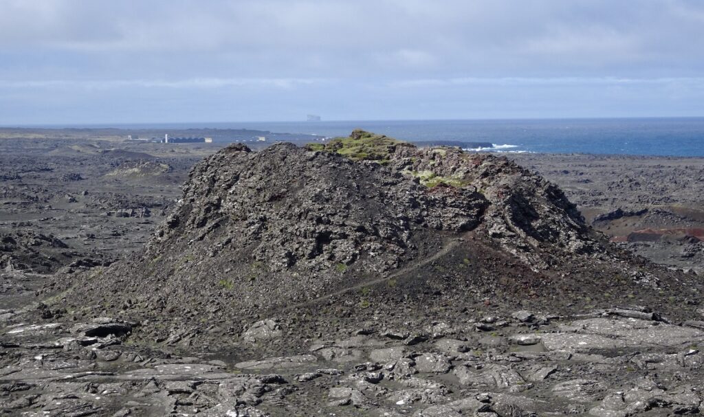
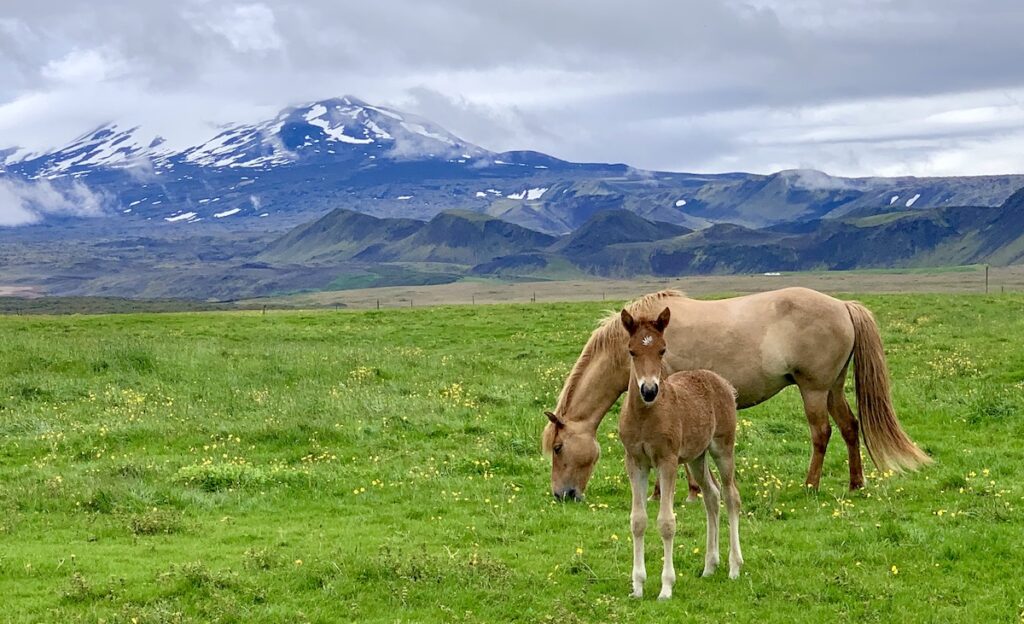
The 2021 eruption was the first in the Reykjanes Peninsula Belt (RPB) for 781 years. Basalt is the low-silica type of lava that is typical of eruptions at hot-spot volcanoes such as Hawaii and along any mid-ocean ridge. Because of the low silica and gas content, flows tend to be runny and non-explosive. As long as people don’t get too close to the flow, they can watch safely from the adjacent slope, which thousands of people did in 2021. The 2021 eruption, which continued for 6 months, may have heralded a new eruptive period on the peninsula. On August 3, 2022, just 2 weeks after I returned from Iceland, Fagradalsfjall began erupting again, this time to the northeast of the 2021 eruption. The volume of lava emitted this year is larger than in 2021, and geologists are expecting this eruption to last longer. “Visit Iceland” has a good web site with practical information about viewing Fagradalsfjall: https://www.visiticeland.com/article/fagradalsfjall-eruption. Right now, there are links to information about the 2022 eruption, including a live camera stream.At the western end of the Reykjanes Peninsula is Stampar Cone Row, a string of spatter cones formed during a historic eruptive event between 1211 and 1240 called the “Reykjanes Fires”. Icelanders refer to extended eruptive events, which occur during distinct rifting periods, as “eldar”, which translates as “fires”. Spatter cones form when lava blobs spit out and pile up on each other to form a cone-shaped structure. The cone is surrounded by basaltic lava that flowed like a river, as shown in the Fagradalsfjall photo above.One day we stayed at the Leirubakki guesthouse and horse farm, located a short distance north of Hekla (number 16 on map above), one of the most active volcanoes in Iceland and a good example of a central volcano. Whereas fissures are flows from long linear cracks, central volcanoes build up after repeated eruptions from a central vent. It’s what we usually think of when we hear the word “volcano”. Iceland has both low-profile shield volcanoes formed by lava, like those found on Hawaii, and steeper-sided stratovolcanoes built up by both lava and pyroclastic material, like those in the Cascade Range of the U.S. Pacific Northwest. Hekla is notorious because it typically erupts with only a 20-minute warning. Don’t think I’d want to buy a property in this beautiful, yet hazardous, location. For your entertainment, you can watch a live stream from Hekla: https://www.livefromiceland.is/webcams/hekla.
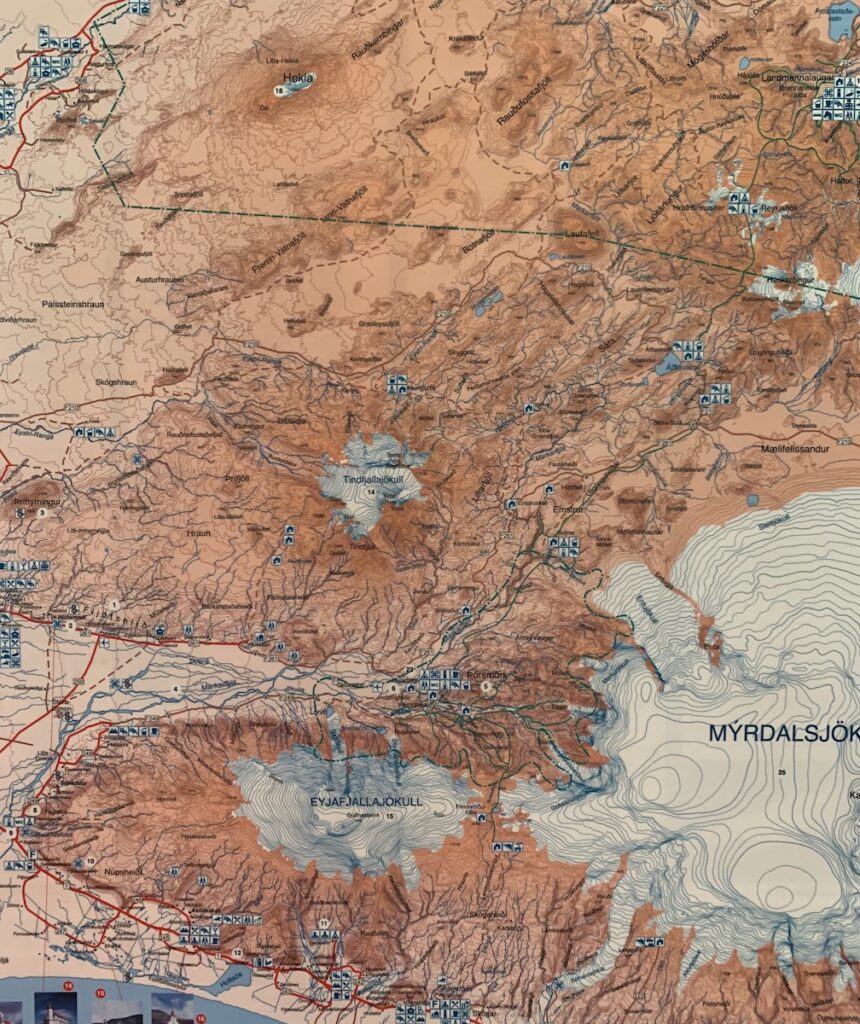
Records document 18 historical eruptions of Hekla. Some of the material erupted from Hekla is more silica-and-gas-rich and therefore more explosive. Think of eruptions like Mt. St. Helens, where tephra (pieces of ash and larger particles) spread out over large distances. These tephra layers are important time markers that help historians understand the settlement history of the island. I took a photo of this topographic map at the Leirubakki guesthouse. Hekla, with its elongated cone, is at the top of this map. Directly south of Hekla is the Eyjafjallajökull volcano (number 13 on the map at the top of the post; Hekla is number 16 on that map), another stratovolcano that became famous in 2010, when it erupted after 200 years of dormancy. A fissure eruption was succeeded by massive blasts of ash-sized tephra that went into the atmosphere and disrupted air traffic—you may remember this event that got extensive international attention. Like many volcanoes in Iceland, Eyjafjallajökull is under a glacier of the same name (jökull=glacier). When water from the melting glacier met molten lava, it shattered the lava into tiny knife-edged shards that were extremely hazardous.
Next, we go to the north side of Iceland, to the Northern Volcanic Zone (NVZ), where a variety of interesting volcanic features can be easily viewed.
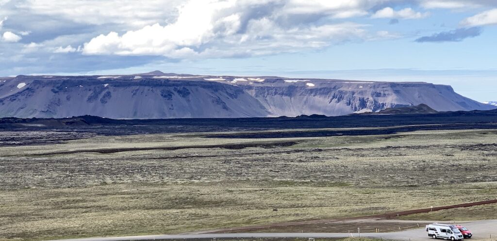
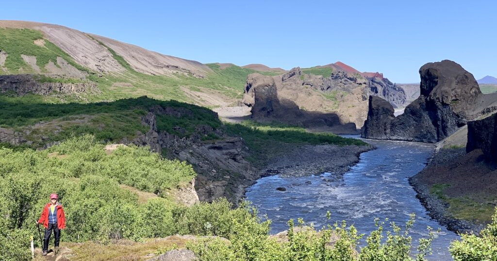
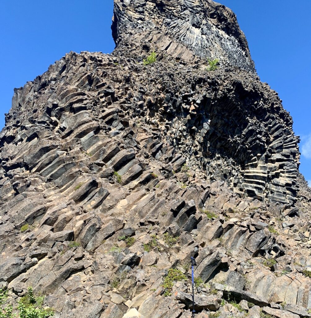
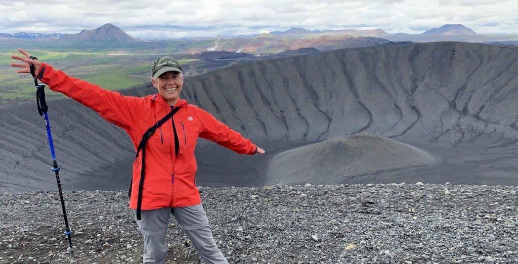
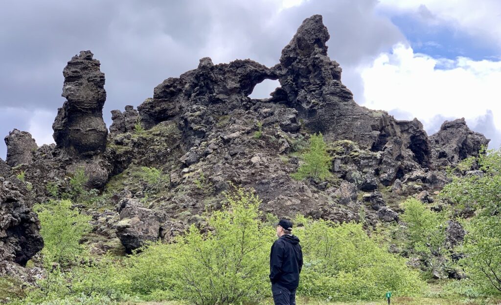
This westward view is across the NVZ rift graben, just south of where the plate boundary heads back out to sea (see top map). The black flow just this side of the ridge is “Krafla Fires” lava that erupted in 1975–1984. The Krafla volcano is number 23 on the map at the top of the post. Because of this eruption in modern times, Krafla is one of the best studied volcanoes in Iceland. Geothermal heat from this volcano powers a nearby electricity-generating plant that is the oldest in Iceland. Construction began in 1975 and was disrupted by eruptions until 1984, when it became fully operational.In the vicinity of Krafla is the Hljöðaklettar line of cinder cones that were erupted about 9,000 years ago and subsequently dissected by erosion by glaciers and their large-magnitude out-wash floods. Here is Nancy along the river where isolated volcanic plugs and necks—underlying sources for the cones—are exposed. It’s a beautiful place to walk, especially on a sunny day.This photo is a closeup of an eroded Hljöðaklettar cone. Since moving to Oregon, I’ve seen lots of basalt columns, but I’ve never seen any like these. The swirling patterns reflect a complex cooling history at shallow depths and with effects of water.Speaking of water, Hverfjall is another type of volcano, called a “maar”. A maar is a broad, low-relief volcanic crater caused by a phreatomagmatic eruption—an explosion that occurs when groundwater comes into contact with hot lava (at the surface) or magma (underground). Basaltic magma is around 1200°C (~2000°F), so when magma encounters water, the water instantly vaporizes and causes a steam eruption. A maar often fills with rain water to form a shallow crater lake that, in the case of Hverfjall, has drained away. In this view to the north, notice the distance steam from the Krafla geothermal plant and and various cones in the Northern Volcanic Zone (NVZ). Mývatn (vatn=lake) is located just west of Hverfjall, to the right of the photo. Yes, I was thrilled to be in this geological wonderland!Another notable event on the Northern Volcanic Zone was the Mývatn Fires of 1724–1729 that produced some unusual volcanic features called “rootless cones”. Unlike the maar in the preceding photo, these cones did not overlie a vent, but were some distance from where lava was erupting. The lava erupted from fissures, flowed over highly saturated soil and turned the water to steam. In some cases, the steam reaction was strong enough to blast through the overlying lava and create a cone. The photo shows rootless cones around Mývatn (lake). The 18th century eruptions contaminated the lake, killed the fish local people depended on, and caused severe economic disruption.Another attraction in the Mývatn region is Dimmubotgir, a fantasy-land of oddly-shaped igneous rock formed by unusual lava-water interactions. Icelanders have many stories about gnomes and fairies, and the shapes in Dimmubotgir give some credence to their beliefs! Tom is apparently contemplating these stories, after our guide told us about the 13 mischievous Yule Lads (Icelandic Santa Clauses).
Earthquakes. You might be asking yourself: with all of this geologic action, does Iceland have earthquakes. The answer is yes—LOTS! Earthquake swarms typically herald a new rifting event and the resulting eruptions. They are caused by movement on faults during rifting and movement of magma beneath the surface. The largest recorded earthquake was ~7 magnitude, but most are smaller. You may feel an earthquake in Iceland, but most are too small to cause damage.
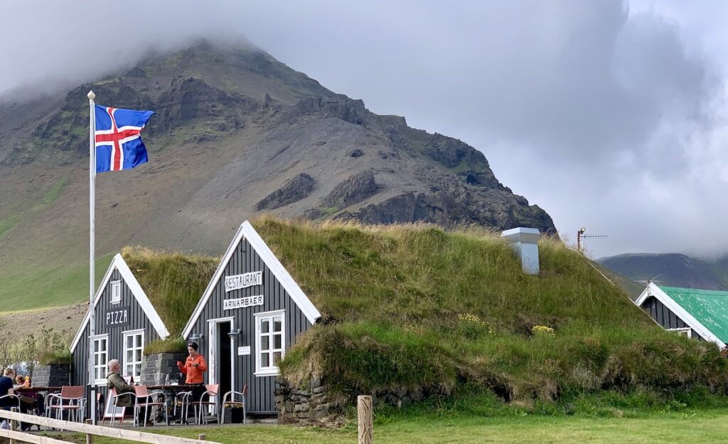
I’ll end this post with a charming scene along the road west of Reykjavik. The Icelandic flag waves proudly in front of an earth-sheltered restaurant featuring pizza, with volcanic rocks (always) in the background.
My next post will show the effects of glacial action, including spectacular interactions between volcanoes and the glaciers that often cover them.
Resources
Iceland, the formation and evolution of a young, dynamic, volcanic island—a field trip guide: Geological Society of America Field Guide 54, 2019, by Jordan, Carley, and Banik.
Iceland: tectonics, volcanics, and glacial features, 2020, by Tamie Jovanelly.
Iceland, Third Edition (Classic Geology in Europe series), 2022, by Thordarson & Höskuldsson.
Postglacial volcanism in Iceland: Jökull journal, no. 58, 2008, by Thordarson & Höskuldsson.