

Welcoming 2024 on Songer Butte, Ashland

Happy 2024—may we greet its challenges with peace and optimism. And what better way to bring in the new year, and focus on the positives, than to get out into nature. This post will highlight some of the geologic features that are visible from Songer Butte, where our Ashland Hiking Group went on New Years Day. Songer Butte is located...
Mount Hood — Oregon’s highest peak

After smoky air deterred us from backpacking locations in northern California, we headed north to Mount Hood. There, the Timberline Trail promised an interesting trek around Oregon's highest mountain (3426 m / 11,240 ft), located about 80 km (50 miles) east of Portland. Mount Hood is the northernmost Cascade Range volcano in Oregon. See my post about Crater Lake for...
The Geology of Crater Lake National Park

Like most of our national parks, the spectacular beauty of Oregon's only national park is a result of the geologic processes that created it. But whereas most of our parks were created by gradual processes over long periods of time—for example, erosion by the Colorado River to create the Grand Canyon—Crater Lake was created in a few days during a...
South Sister—the third highest volcano in Oregon and one of its youngest

The Three Sisters volcanoes, located in the Three Sisters Wilderness west of Bend, Oregon, are part of the Cascade Range of volcanoes formed above the Cascadia subduction zone. "For magnificence of glacial scenery, for wealth of recent lavas, and for graphic examples of dissected volcanoes, no part of this range surpasses the area embracing the Sisters and McKenzie Pass", said...
Lassen Volcanic National Park—the southernmost Cascade Range volcano

The Cascadia Subduction zone extends along the entire coast of Washington and Oregon, but also along the northern coast of California. South of Mendocino, California, the plates change from converging with each other (the ocean plate loses and slides beneath the continental plate in the subduction zone) to sliding past each other along the San Andreas fault (a transform-type plate...
Sedimentary rocks tell stories about the Rogue Valley region’s geologic history

In the previous two posts, we explored the distribution of rock units in the Rogue Valley region, and how the different resistances of these rock types to weathering and erosion has created the topographic variations we see in the landscape. The different rock types also produce a large variety of soil types that are important for gardeners and vintners in...
Mount St. Helens—the most active Cascade volcano

The 1980 eruption of Mt St Helens was the most deadly and costly volcanic event in U.S. history, which is not to say that it will be the most dangerous volcano in the future—that honor may go to Mt Rainier. In contrast to Hawaiian shield-type volcanoes, whose eruptions can damage property but are easy to get away from, Cascade composite-type...
What is so special about the Cascade-Siskiyou National Monument?

This national monument spans the border between Oregon (Jackson County) and California (Siskiyou County) immediately east of the I-5 freeway. It was first established in 2000 by President Bill Clinton and expanded in January 2017 by President Obama as one of his last actions before leaving office. The monument is managed by the Bureau of Land Management (BLM) from the...
Climbing Mount McLoughlin—one of the lesser known Cascade volcanoes

Mount McLoughlin is located 63 kilometers (38 miles) east of Ashland, Oregon, where I now live. As shown on this map by the U.S. Geological Survey, Mount McLoughlin is located between the volcanoes of Mount Shasta and Crater Lake, which is the remnant of Mount Mazama that exploded to become a caldera 7,700 years ago. All of the Cascade Range...
About the Blogger
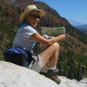 Karen (here with Mt. Shasta in background) is a geology professor emerita who aims to provide a "pocket geologist" for world travelers. Follow the blog to explore the landscapes of our planet and figure out what causes them to look the way they do.