

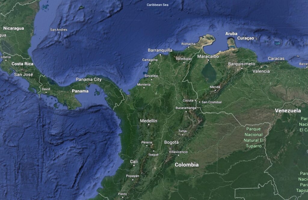
Bienvenidos a Colombia: welcome to the northwest corner of South America
In my continuing quest to learn more about South America’s geology, culture and history, I traveled for a month (mid February–mid March) in Colombia, located in the northwestern corner of South America. Colombia is at the northern end of the Andes, the longest mountain range on our planet. It is the only South American country with coasts on both the Pacific and Atlantic Oceans. Colombia is situated at the intersection of many tectonic plates, which gives the region a particularly complex geologic history. Not only is the Nazca (Pacific oceanic) plate subducting beneath the continent from the west, but the Caribbean (oceanic) plate is subducting beneath the continent from the north. And the continental micro-plate of Panama is crashing into Colombia from the northwest. Let’s take a look.
Colombia’s tectonic setting
Because of its complexity, the geology of Colombia is still being deciphered. The map below provides a snapshot of the tectonic plates and their interactions today. Although it probably appears impossibly complex, I’ll try to wrangle the chaos into something comprehensible. Please also use the Google Map above for reference.
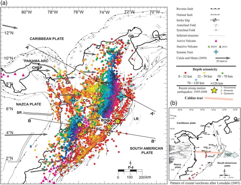
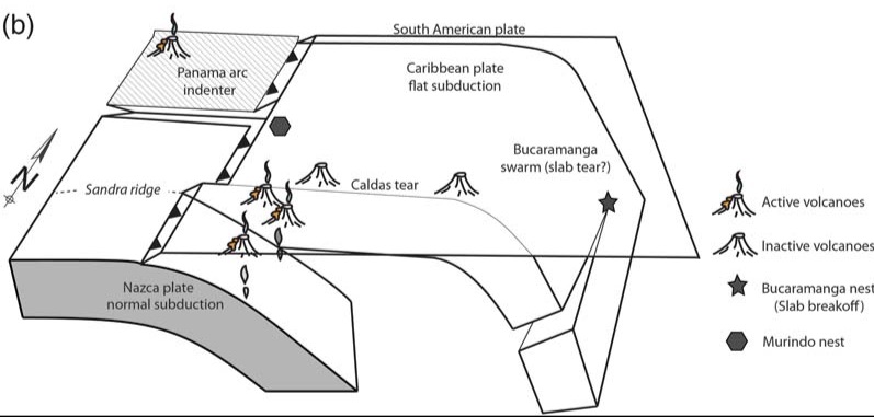
But why do the volcanoes end just north of the B-B’ line? Now look at the earthquake colors (Depth seismicity on legend). Notice that the earthquakes are deeper farther from the offshore plate boundary. But there is an abrupt change in the location of the deep earthquakes north of where the active volcanoes stop. Deep earthquakes are farther from the offshore plate boundary, implying that the subducting oceanic plate is descending at a shallower angle. Deep earthquakes can only occur in the relatively cold, solid plate that is descending, and seismic data confirm that the Nazca (oceanic plate) is descending more steeply to the south and more gently to the north. In Part (b) the boundary is shown as a pink line called the ”Caldas tear”, referring to a split (tear) in the descending plate. Note that it aligns with an offshore irregularity in the Nazca plate called the Sandra ridge (SR).
The shallower earthquakes that are east of the deep earthquakes are a result of motion on the strike-slip Llanos fault system (LFS).
The grey arrows are directions of plate motion measured by GPS stations (locations are 4-letter abbreviations such as BOGO). These arrows indicate that not only is the Nazca plate colliding with—and subducting beneath—the continental plate, but the Panama micro-plate is also colliding with the northwest corner of Colombia. In Part (b), thrust faults (black lines with black triangles) and strike-slip faults (arrows parallel to black fault lines—see legend) show that a large part of the northwest corner of Colombia is being shoved eastward (102 degrees) by the force of the impinging Panama arc.
To the north, the earthquake distribution changes again. This is where subduction of the Caribbean plate from the north dominants. You may also notice that subduction is occurring on both sides of Panama and creating active volcanoes there. Keep in mind that much of the action is happening deep beneath Earth’s surface, where plates are descending and interacting. It’s no wonder that geoscientists are still trying to figure out the details.
Other symbols on the map: yellow stars are large (~6 magnitude) earthquakes along the Caldas tear; blue 4-pointed stars are “earthquake nests”—earthquake concentrations resulting from the complex plate interactions. As if to prove the point, there was a 5.5 magnitude earthquake in the area of the BN (Bucaramanga nest) on March 10, while we were in Bogotá. Although we did not feel it while sleeping, our driver that day was already awake and felt a sharp jolt.
.
For a deeper explanation of how subduction zones work, please see my post about what happens when tectonic plates converge: https://landscapes-revealed.net/plate-tectonics-101-what-happens-when-plates-move-toward-each-other/. Another post explains how strike-slip faults work: https://landscapes-revealed.net/plate-tectonics-101-what-happens-when-plates-slide-past-each-other/.
How the continents evolved over time
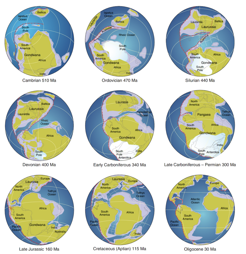
But Colombia’s position at the northwest corner of South America has created additional complexities. Notice how the northern end of South America snuggled up against North America when the continents came together to create the Pangea supercontinent 300 million years ago (Ma). Since then, the continents have separated but Colombia has been caught up in the rearrangement of the Caribbean plate, which is now moving eastward with respect to South America.
The figure is from The Geology of Colombia, a 4-volume set that is freely available to download, if you really want to get into some details: https://www.researchgate.net/project/The-Geology-of-Colombia-Multivolume-book.
My subsequent posts will provide some information about the locations I visited: Medellín, in the Central Cordillera; Santa Marta and the Sierra Nevada, on the Caribbean coast in the north; and Bogotá, in the Eastern Cordillera.
Reference
Vargas and Mann, 2013, Tearing and breaking off of subducted slabs as the result of collision of the Panama Arc-Indenter with northwestern South America: Bulletin of the Seismological Society of America.
Very very interesting! I now know why volcanoes occur.
You can teach the twins!
You really do a great job breaking things down to clarify the setting!
Thanks Sarah!