The area around Goyko, including Goyko Ri (peak) and Renjo La (pass), was my favorite part of the trek. We were adjusted (mostly!) to the altitude by then, and the panoramic views from the peak and pass were stupendous.
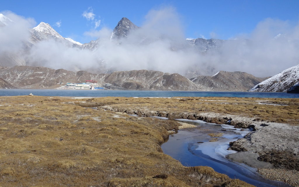
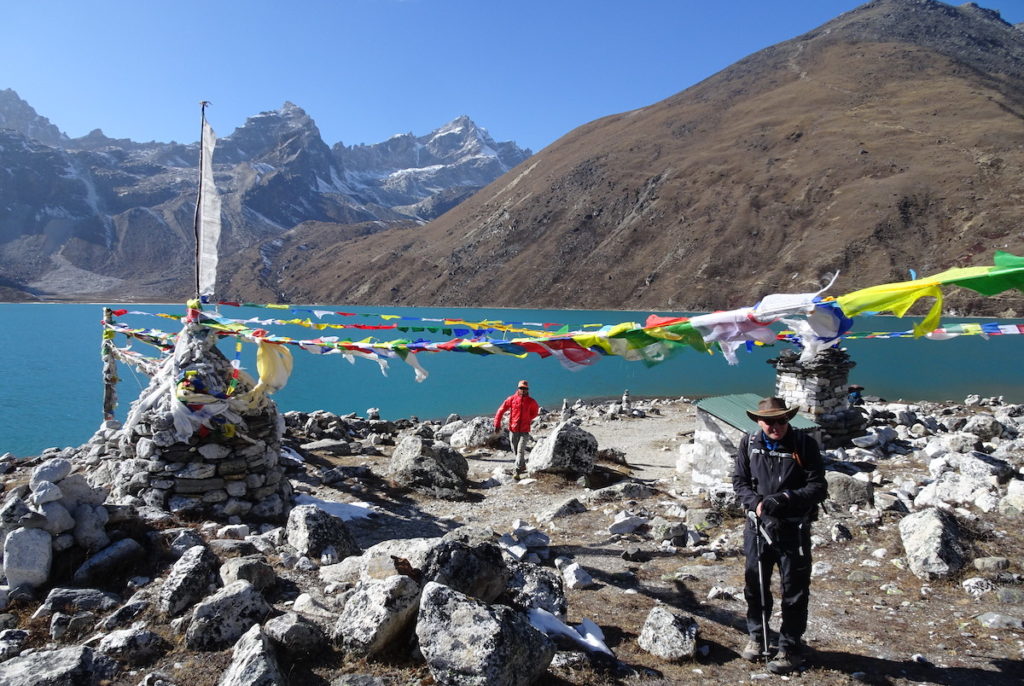
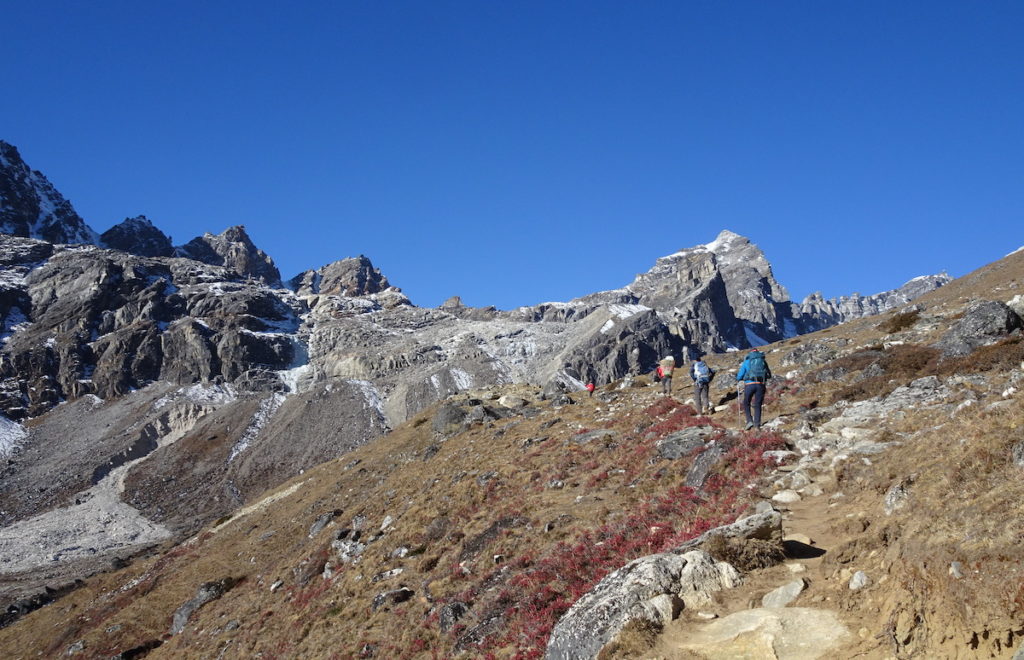
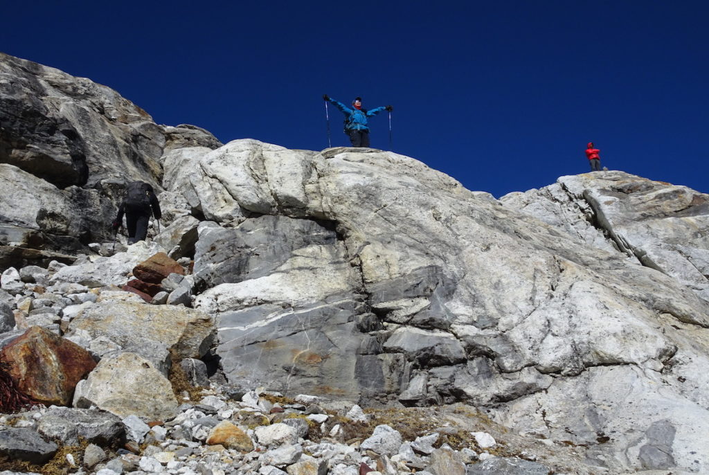
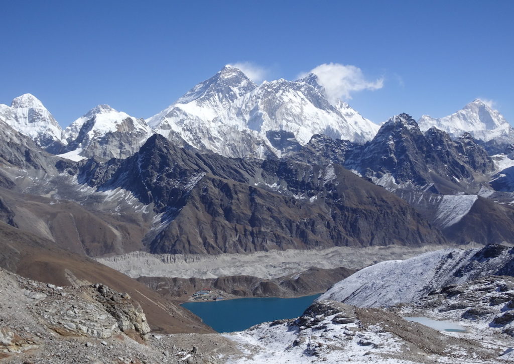
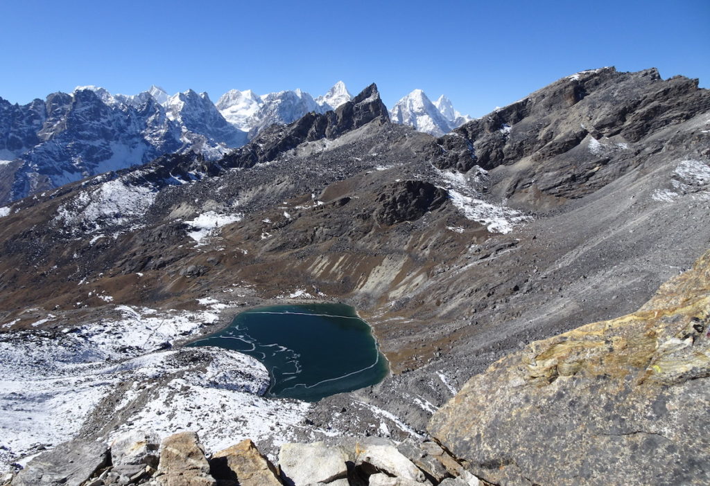
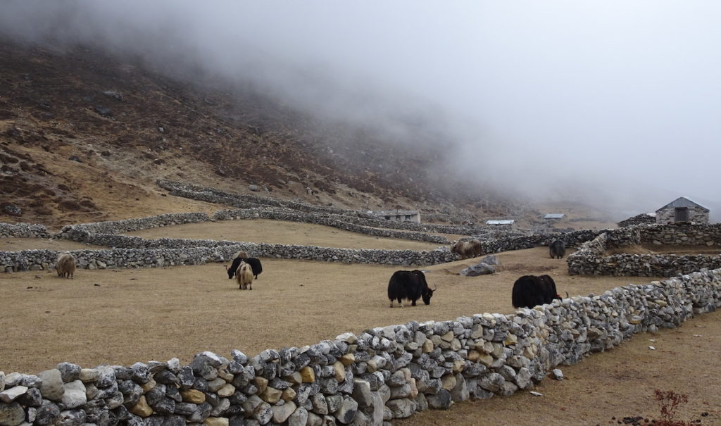
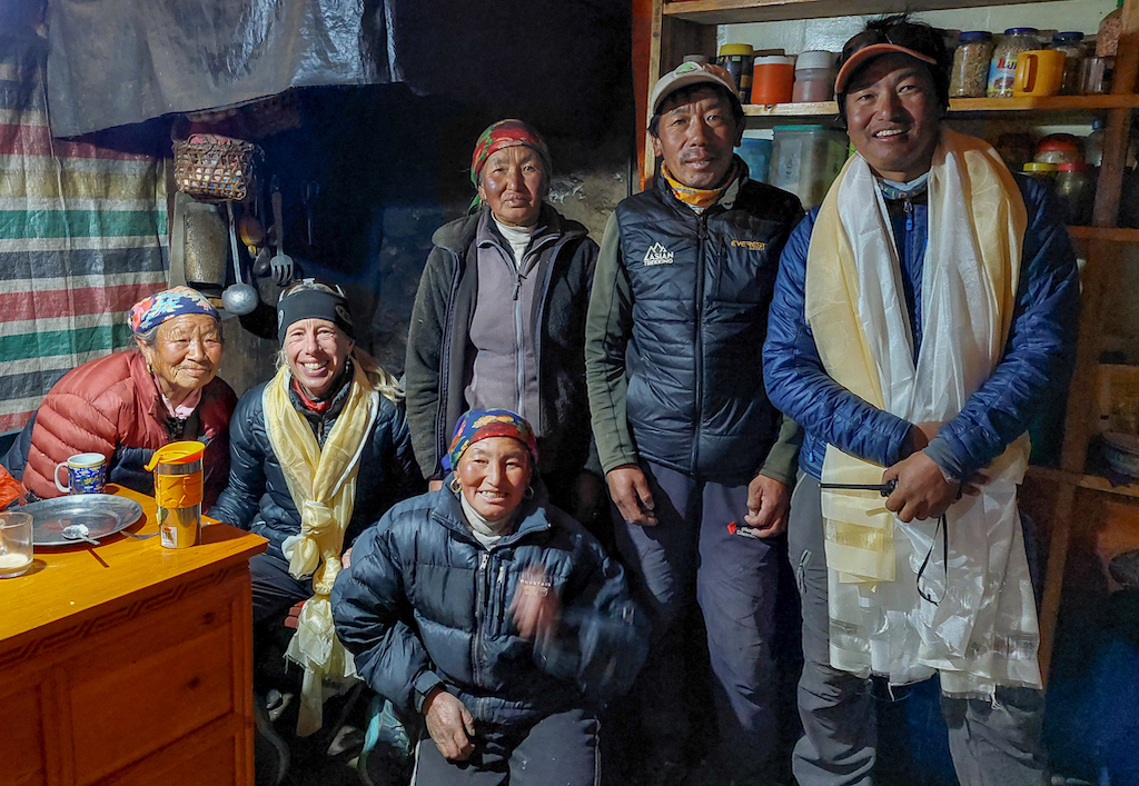
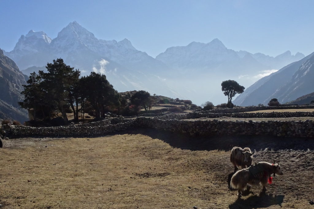
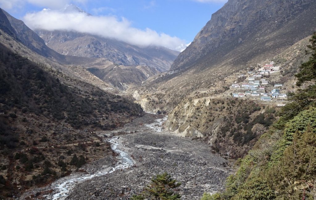
Here is a view eastward, across Goyko Lake to the Goyko settlement, taken while we circled the lake one afternoon, when the fog was beginning to move in from the valley below.This view is toward the west, looking over Goyko Lake to Renjo La, the pass we crossed after leaving Goyko. The brown peak on the right is Goyko Ri. Go to the last photos in my previous post to see some panoramic views from the summit of Goyko Ri: https://landscapes-revealed.net/trekking-in-the-khumbu-region-of-the-nepal-himalayas-part-3-to-everest-base-camp-and-goyko/. The people in this photo are Mekh (orange jacket—Kamzung Journey staff), and Stephen, fellow trekker from London. Prayer flags flutter, sending blessings into the universe.And we’re off (day 17), on the trail westward to cross Renjo La—at the ridge line in this photo. Our yaks could not navigate the rocky trail to the pass, so they went up the steep talus slope on the left side of the photo. These sure-footed beasts gave their name to the strap-on traction cleats called Yaktrax—and now we know why!Kristy (fellow trekker) celebrates our arrival at Renjo La (5415 m / 17,760 ft). Most of the trek was in valleys where we saw pieces of rock that had been ground up and transported downhill by glaciers. But on the passes, we could see the in-place bedrock. The exposure above is another example of the region’s complex geologic history, including burial of the rocks to great depths. The dark grey rock is metamorphosed sedimentary rock that was intruded by the white rock—leucogranite that solidified from rock that melted because it was buried so deeply. One of the Kamzung staff is standing on the rock to the right—you can tell he is staff by his orange jacket.Above is shown one of the most stunning panoramas of the trek. The view is eastward from Renjo La to Mt. Everest (leftmost peak in center group), and companion peaks Nuptse (to the right of Everest—note the leucogranite “balloon”), and Lhotse (to the right and behind Nuptse). The air was so clear—Everest is 105 km (63 miles) east of Renjo La, yet it looks much closer. In the valley is the Ngozumpa glacier we crossed to get to the small Goyko settlement, visible on the other side of Goyko Lake. The brown hill sloping toward the lake from the north is Goyko Ri. Here is the view westward from Renjo La to another ridge of snowy peaks. We climbed down from the pass to the lake at the top of the Bhote Koshi valley. After lunch we headed downhill (left in the photo) to the settlement of Lungden, where we stayed the night. It was downhill from Renjo La—with some small ascents mixed in—so we kept feeling stronger, regaining our normal pace, as we descended.Yak enclosures in Lungden (4375 m / 14,350 ft). The primary settlements in the Khumbu (e.g., Namche, Thame, Phortse) are <4000 m elevation. Higher-elevation settlements (e.g., Lungden, Goyko, Dingboche) were established for yak grazing during the summer months. As tourism has increased, these settlements have grown to include lodging for trekkers. On days 17–19, afternoon fog rolled in from lower parts of the valley, but the mornings were still sunny and beautiful.From Lungden, we continued down the Bhote Koshi (means Tibetan river) valley to Thame (3805 m / 12,480 ft). Lhakpa (our Sherpa guide) grew up in Thame and we had the good fortune to meet members of his family. His sister even hosted our group for local-style potato pancakes! This photo is in the kitchen of Lhakpa’s sister’s home. The house was completely destroyed during the 2015 earthquake, but the family rebuilt it. From left to right: a friend of the family, Kim Bannister (Kamzang Journeys owner and guide), Lhakpa’s two sisters, one of the sister’s husband (Pasang), and Lhakpa (Kim’s business partner and fellow guide). We learned that, impressively, Pasang has climbed Everest 14 times, in his role as expedition guide. He had certificates on the wall acknowledging his climbing achievements. Note the khata scarfs worn by Kim and Lhakpa. Lhakpa’s family presented us all with khatas—a heart-warming gesture to wish us a continued safe journey. Photo courtesy of Kim Bannister.Our yak herder was Lhakpa’s cousin Mingma, who lives in Thame, where the yaks got to return to their enclosure and eat buckets of potatoes, probably a welcome meal after carrying our gear and eating only grass for weeks. Here are 2 of the yaks in their home enclosure, with a view southeastward down the Bhote Koshi valley toward Namche, where we stayed again on day 20. In Thame, we stayed in a lodge (Valley View) owned by Lhakpa’s aunt and uncle, and we were hosted for tea in the homes of several other relatives. This photo is a southeast view along the Bhote Koshi that joins the Dudh Koshi just south of Namche. The valley is full of rock boulders that were eroded from the high peaks and carried downstream by glaciers to the river. In about 1990, an ice dam broke and sent a catastrophic amount of water and rock pieces down this valley, destroying infrastructure along the way. This type of hazard is becoming more common, as our planet continues to get warmer. Note the flat terrace at the bottom of the settlement on the right side of the river. As described in previous posts, settlements take advantage of these flat surfaces that were created at river level and then uplifted to higher elevations. Also note that we are again at an elevation where trees and other larger vegetation can survive.
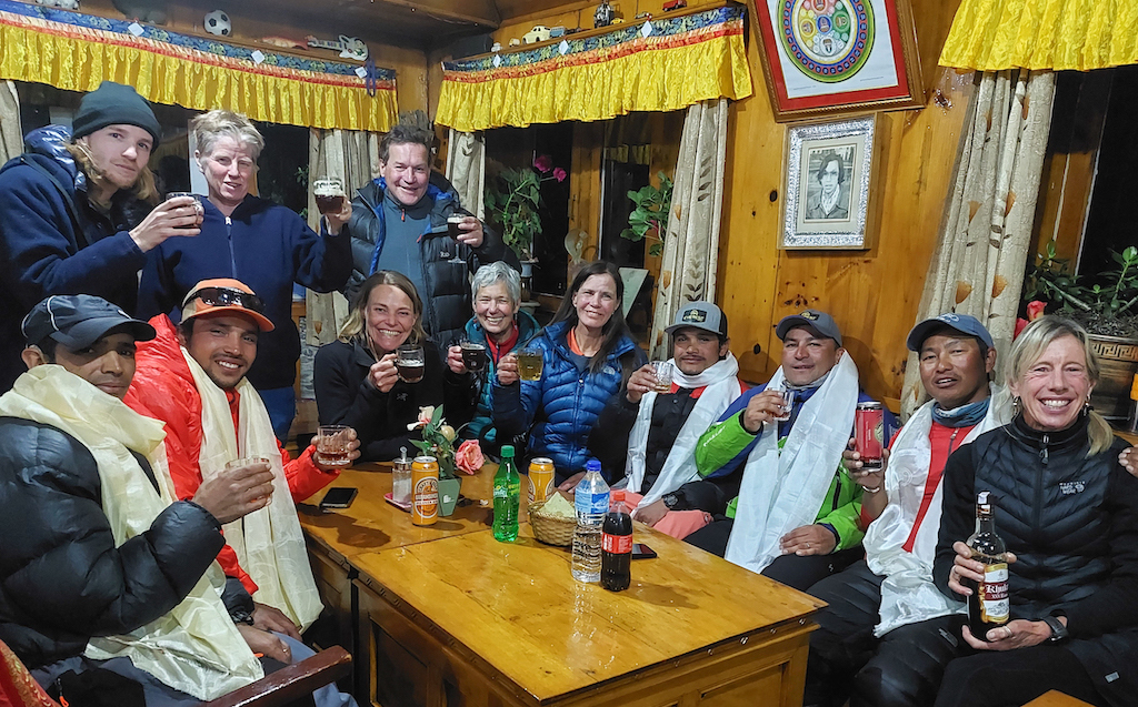
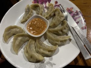
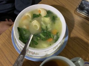
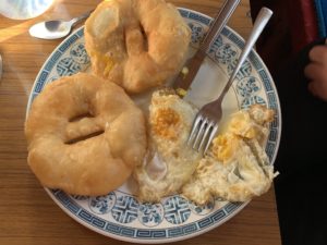
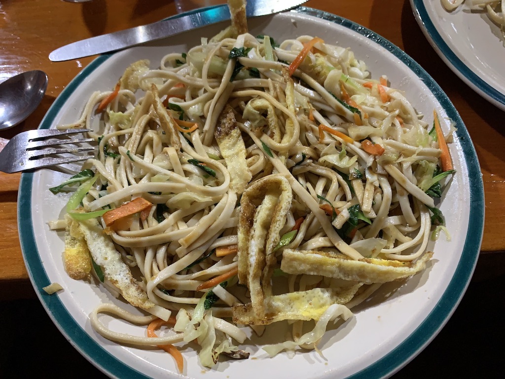
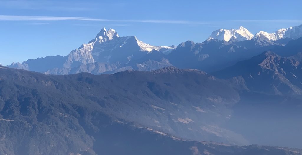
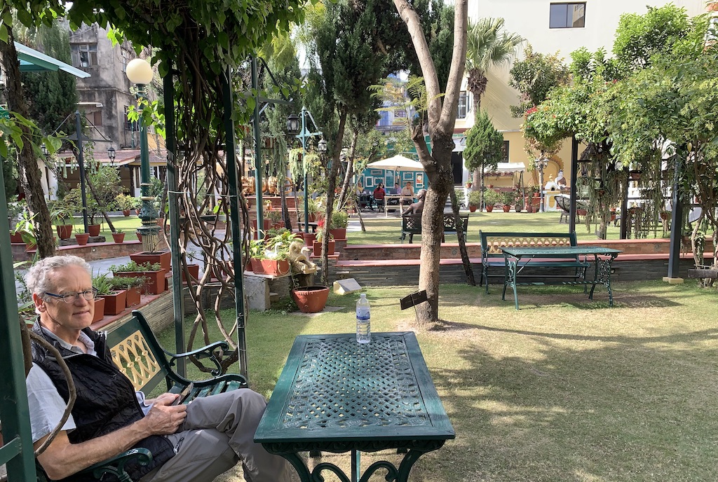
Dudh Koshi means milky river, the milky color the result of glacial “flour” that is suspended in the river. We continued along this river from Namche to Lukla, repeating in reverse on day 21 the path we had ascended on days 1 and 2. We felt like we were flying—at elevations <3500 m (11,500 ft) we regained our usual stamina and could walk quickly and without effort, even when going uphill. During our last night, at the Shangri-La Lodge in Lukla, we celebrated our successful completion of the challenging 21-day trek. We even had beer—a treat since alcohol was not a good idea at high elevations. We trekkers acknowledged the help of our guides and staff and bestowed them with khata scarfs as a symbol of our thanks. Standing (left to right): trekkers Griffen, Rebecca, and Stephen. Seated (left to right): staff Yam and Mekh; trekkers Allison, me, Kristy; staff Suresh and Junar; our intrepid guides Lhakpa and Kim. Kamzang Journeys provided us with a truly stellar trekking experience—highly recommended! Photo courtesy of Kim Bannister.Before leaving the mountains, here’s a few more photos of typical food on the trek. Clockwise from upper left: momos, a popular meat- or vegetable-filled dumpling similar to pot stickers; sherpa stew with greens, carrots, pasta or dumplings, and potatoes; eggs and Tibetan bread similar to native American fry bread; vegy-fried noodles with egg. Food was basic and repetitive, but nutritious.View of the Himalayan range from our small plane as we flew westward, back from Lukla to Kathmandu.Jay at the Kathmandu Guest House where we stayed both before and after the trek. The large interior garden was a tranquil, restful oasis from the chaotic street scene in the surrounding city.
I will post one more blog about the Nepali Himalayas: “How did the Himalayas get to be Earth’s highest mountain range?” This post will be more geologically intensive!
Fantastic post! You’ve got a lot more good info in there than I remembered or included—I think I’ll send my readers over here to get the full scoop :).
Landscapes Revealedon February 25, 2022 at 8:34 am
What a beautiful and remarkable trek. It’s a joy to relive it with you through your photos and commentary. I feel like I was there (the easy way)! Looking forward to your next geologic post. 🏔
Landscapes Revealedon February 25, 2022 at 5:19 pm
So happy you’re following along!
Karen S Smithon February 27, 2022 at 10:49 am
You are truly remarkable, Karen!! Your journey is one I am too told and compromised to consider so it is a genuine gift to do some armchair traveling with you and Jay. Thank you for sharing, in great detail, your incredible adventure. Much love, ksue
Landscapes Revealedon February 27, 2022 at 12:20 pm


Fantastic post! You’ve got a lot more good info in there than I remembered or included—I think I’ll send my readers over here to get the full scoop :).
Thanks Rebecca!
What a beautiful and remarkable trek. It’s a joy to relive it with you through your photos and commentary. I feel like I was there (the easy way)! Looking forward to your next geologic post. 🏔
So happy you’re following along!
You are truly remarkable, Karen!! Your journey is one I am too told and compromised to consider so it is a genuine gift to do some armchair traveling with you and Jay. Thank you for sharing, in great detail, your incredible adventure. Much love, ksue
Thanks KSue – I so appreciate readers like you!