

Welcoming 2024 on Songer Butte, Ashland

Happy 2024—may we greet its challenges with peace and optimism. And what better way to bring in the new year, and focus on the positives, than to get out into nature. This post will highlight some of the geologic features that are visible from Songer Butte, where our Ashland Hiking Group went on New Years Day. Songer Butte is located...
Oregon’s Erratic Rock State Natural Site

One of Oregon's smallest natural areas is Erratic Rock State Natural Site, located 12 km (seven miles) southwest of McMinnville on State Highway 18. The site is located 75 km (45 miles) southwest of Portland. In March, while in McMinnville on a wine-tasting excursion with friends, Jay and I visited the erratic rock. What is an erratic rock? During most...
Rafting the Owyhee River—Oregon’s Grand Canyon

On April 10–14, we rafted the Lower Owyhee River in easternmost Oregon with Ouzel Outfitters (https://www.oregonrafting.com/owyhee-river). Because this part of the river is not dammed, and the climate is arid, there is only enough flow for rafting during the earliest part of the season. The droughts of the past few years meant that most trips were cancelled, as ours was...
John Day Fossil Beds National Monument—climate

My previous post about paleontology explored how plants and animals changed during the 44-million-year time period represented in the John Day Fossil Beds. The evolution of species, in general, occurs because species eventually become extinct and new species arise to take their places. Today, human activities are contributing to organisms' extinction, but there are many natural factors that have caused...
John Day Fossil Beds National Monument—paleontology

Paleontology is the study of plant and animal fossils to understand how life has evolved through geologic time. The John Day Fossil Beds are a world-class locality for such studies. According to Dr. Ralph W. Chaney, a paleontologist at the University of California Berkeley (UCB) who worked in the area from the 1920s through the 1960s: “No region in the...
John Day Fossil Beds National Monument—stratigraphy

The John Day Fossil Beds is located in north-central Oregon. It was established as a national monument in 1974. The region has one of the world's most complete records of fossils during the Age of Mammals, a period of time also known as the Cenozoic Era (past 66 million years). There will be three blog posts: (1) stratigraphy—how layers of...
Mount Hood — Oregon’s highest peak

After smoky air deterred us from backpacking locations in northern California, we headed north to Mount Hood. There, the Timberline Trail promised an interesting trek around Oregon's highest mountain (3426 m / 11,240 ft), located about 80 km (50 miles) east of Portland. Mount Hood is the northernmost Cascade Range volcano in Oregon. See my post about Crater Lake for...
The Geology of Crater Lake National Park

Like most of our national parks, the spectacular beauty of Oregon's only national park is a result of the geologic processes that created it. But whereas most of our parks were created by gradual processes over long periods of time—for example, erosion by the Colorado River to create the Grand Canyon—Crater Lake was created in a few days during a...
South Sister—the third highest volcano in Oregon and one of its youngest

The Three Sisters volcanoes, located in the Three Sisters Wilderness west of Bend, Oregon, are part of the Cascade Range of volcanoes formed above the Cascadia subduction zone. "For magnificence of glacial scenery, for wealth of recent lavas, and for graphic examples of dissected volcanoes, no part of this range surpasses the area embracing the Sisters and McKenzie Pass", said...
How does the Rogue Valley fit into the larger tectonic picture?

In the last three posts, we explored the geologic makeup of the Rogue Valley region. Most people know that there is a subduction zone off the coast of the Pacific NW and you might wonder: how does the Rogue Valley region fit into this larger picture? We will explore the tectonic setting in this post. This diagram shows the present...
Sedimentary rocks tell stories about the Rogue Valley region’s geologic history

In the previous two posts, we explored the distribution of rock units in the Rogue Valley region, and how the different resistances of these rock types to weathering and erosion has created the topographic variations we see in the landscape. The different rock types also produce a large variety of soil types that are important for gardeners and vintners in...
Why is the Rogue Valley a valley?

In the April 19 post, we examined the geologic units that are exposed in the Rogue Valley region, and saw that the units are all tilted toward the NE, with the oldest units located to the SW (between the valley and the coast), and the younger units located toward the NE (toward the active volcanoes of the High Cascades like...
About the Blogger
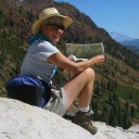 Karen (here with Mt. Shasta in background) is a geology professor emerita who aims to provide a "pocket geologist" for world travelers. Follow the blog to explore the landscapes of our planet and figure out what causes them to look the way they do.