

The silver mines of Guanajuato Mexico: bringing riches to the region

The city of Guanajuato was founded in 1559 due to the region's rich silver and gold deposits. The conquistador Juan de Tolosa observed the native people with shiny rocks. He started looking in Zacatecas (a state located farther north in Mexico) and in 1546 found silver mines that made him very rich. Other conquistadors started looking too, and in 1548...
Dinosaur National Monument—more public lands worth preserving

My last four posts have been about our public spaces—two national parks and two national monuments. With increased petroleum and mineral exploration and drilling in and near our preserved lands, it behooves us to learn more about the places that may be threatened by the current U.S. administration. In June we visited Dinosaur National Monument, an out-of the way park...
Craters of the Moon National Monument—a little bit of Hawai’i in Idaho

If you ignore the arid climate and sagebrush vegetation in the Snake River Plain of Idaho, and just look at the landscape of lava, you can imagine yourself on the Big Island of Hawai'i. This photograph shows basalt-type lava in pahoe'oe and a'a flows, with cinder cones in the background. The area is still considered to be volcanically active, with...
Mount St. Helens—the most active Cascade volcano

The 1980 eruption of Mt St Helens was the most deadly and costly volcanic event in U.S. history, which is not to say that it will be the most dangerous volcano in the future—that honor may go to Mt Rainier. In contrast to Hawaiian shield-type volcanoes, whose eruptions can damage property but are easy to get away from, Cascade composite-type...
Kilauea in Hawai’i—safely visiting an active volcano

Kilauea grabbed the attention of the media and the public when it began a new eruption on May 4, 2018. This is normal business for one of the most active (maybe THE most active) volcanoes on Earth. The Big Island of Hawai'i is located on top of a hot spot that is providing the fuel for continuing volcanic activity—imagine a...
What is so special about the Cascade-Siskiyou National Monument?

This national monument spans the border between Oregon (Jackson County) and California (Siskiyou County) immediately east of the I-5 freeway. It was first established in 2000 by President Bill Clinton and expanded in January 2017 by President Obama as one of his last actions before leaving office. The monument is managed by the Bureau of Land Management (BLM) from the...
The Great American Biotic Interchange

With its many excellent fossil sites, Argentina has lots of evidence for how life evolved through time. One of the largest effects on how organisms evolved was the position of the continents. For example, when the continents were united into the "super continent" called Pangea at the end of the Paleozoic, land animals could migrate for huge distances. In contrast,...
Earthquakes tell the story of changing tectonic plates along the Andes

We are now in Córdoba city (capital of the province of Córdoba), which is nearly 600 km (360 miles) east of the Cordillera Principal (high Andes). To the east of Córdoba are the flat plains of the pampa; to the west are the Sierras de Córdoba that, together with the other ranges lying eastward of the Cordillera Principal, are referred...
Argentina—a paradise for fossils of dinosaurs and proto-mammals

We visited Parque (park) Ischigualasto, which means "the place animals go to die" in the local indigenous language. The native people saw many bones in the region, which was the reason for this name. Later, of course, these bones were recognized as animals that have long been extinct. We also visited the Museo de Ciencias Naturales (museum of natural sciences)...
The second highest mountain range in the world—and still rising

After the Himalayas, the Andes Mountains are the second highest range in the world—but you have to go to the right place. Many parts of the Andes are beautiful but have elevations more similar to other, relatively low-elevation subduction-zone ranges like the Cascades in the Pacific NW (USA). But at 6964 meters (22,841 feet), Alconcagua is the highest peak in...
Climate, culture and history of the Quebrada de Humahuaca

Because the Quebrada de Humahuaca is such a long north-south valley with readily available water from the river (Rio Grande) that cut it, it has been a well-used route connecting Peru, Bolivia and Argentina for thousands of years. The region was also important in the revolution for independence from Spain (1810). To the west, the highest part of the Andes,...
La Quebrada de Humahuaca—colorful landscape in NW Argentina

A quebrada is a valley or canyon formed by the action of flowing water. The Quebrada de Humahuaca is located in the northwesternmost corner of Argentina, on the eastern side of the Andes, where active uplift of the land has caused rivers to cut down and create quebradas of many sizes and shapes, resulting in a stunning landscapes of shear...
About the Blogger
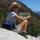 Karen (here with Mt. Shasta in background) is a geology professor emerita who aims to provide a "pocket geologist" for world travelers. Follow the blog to explore the landscapes of our planet and figure out what causes them to look the way they do.