

The Great American Biotic Interchange

With its many excellent fossil sites, Argentina has lots of evidence for how life evolved through time. One of the largest effects on how organisms evolved was the position of the continents. For example, when the continents were united into the "super continent" called Pangea at the end of the Paleozoic, land animals could migrate for huge distances. In contrast,...
Earthquakes tell the story of changing tectonic plates along the Andes

We are now in Córdoba city (capital of the province of Córdoba), which is nearly 600 km (360 miles) east of the Cordillera Principal (high Andes). To the east of Córdoba are the flat plains of the pampa; to the west are the Sierras de Córdoba that, together with the other ranges lying eastward of the Cordillera Principal, are referred...
Argentina—a paradise for fossils of dinosaurs and proto-mammals

We visited Parque (park) Ischigualasto, which means "the place animals go to die" in the local indigenous language. The native people saw many bones in the region, which was the reason for this name. Later, of course, these bones were recognized as animals that have long been extinct. We also visited the Museo de Ciencias Naturales (museum of natural sciences)...
The second highest mountain range in the world—and still rising

After the Himalayas, the Andes Mountains are the second highest range in the world—but you have to go to the right place. Many parts of the Andes are beautiful but have elevations more similar to other, relatively low-elevation subduction-zone ranges like the Cascades in the Pacific NW (USA). But at 6964 meters (22,841 feet), Alconcagua is the highest peak in...
Climate, culture and history of the Quebrada de Humahuaca

Because the Quebrada de Humahuaca is such a long north-south valley with readily available water from the river (Rio Grande) that cut it, it has been a well-used route connecting Peru, Bolivia and Argentina for thousands of years. The region was also important in the revolution for independence from Spain (1810). To the west, the highest part of the Andes,...
La Quebrada de Humahuaca—colorful landscape in NW Argentina

A quebrada is a valley or canyon formed by the action of flowing water. The Quebrada de Humahuaca is located in the northwesternmost corner of Argentina, on the eastern side of the Andes, where active uplift of the land has caused rivers to cut down and create quebradas of many sizes and shapes, resulting in a stunning landscapes of shear...
From the cordillera to the capital

Last night in the cordillera—where to stay? Not in Bariloche but west of it, where it's possible to be immersed in mountains, lakes, and sky, rather than atrocious architecture and consumer products. We splurged with a night in a 5-star hotel: the Charming Hotel—who came up that rather silly name? It is on a cliff overlooking Lago Nahuel Huapi with...
The prettiest town in Argentina

We have not visited all of the towns in Argentina, but San Martín de los Andes is the prettiest one we've visited so far. It is situated at the east end of Lago Lácar and at the edge of Parque Nacional Lanín. San Martín is a ski town in the winter; in the summer it's a tranquil base for kayaking,...
Volcanoes past and present

The lake district is in the northwestern part of Patagonia, where the landscape has changed somewhat. In Argentina, the lakes are still on the dry side of the Andes, but the country border here jogs a little westward to capture more of the cordillera with its mountains and green forests. The nothofagus is still here—southern beech tree that evolved when...
La Ruta 40—now and 9,000 years ago

You may be familiar with Highway 50 in Nevada—it is the slow road going east–west. A book about this road is titled "The Loneliest Road in America". It gives a mile by mile description of features along the way (ghost towns, sand dunes, gold mines, etc.). For La Ruta 40 in Argentina, this would be a boring book indeed! Travel...
Whispers of rock

If climbers are straining to conquer the scream of raw stone, geologists are straining to hear the whispers of rock that often yields its secrets reluctantly. Learning to "read the rocks"—to decipher Earth's history—is like reading a story where most of the pages are missing, and the pages that remain are shuffled into a random order. So learning to interpret...
Scream of stone

"Scream of Stone"—an aptly named, feature-length film by Werner Herzog documents the personalities, egos, and drama involved with a climbing expedition to Cerro Torre. It's shot on location and includes stunning footage of the mountains here. Although lower in elevation than Cerro FitzRoy (3100 meters compared to 3400 meters) Cerro Torre makes up for its diminutive stature with steeper slopes,...
About the Blogger
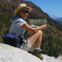 Karen (here with Mt. Shasta in background) is a geology professor emerita who aims to provide a "pocket geologist" for world travelers. Follow the blog to explore the landscapes of our planet and figure out what causes them to look the way they do.