The beautiful turquoise-blue waters of Chiapas, Mexico
May 21, 2024
Chiapas is Mexico’s southernmost state. It is celebrated for its natural beauty and strong indigenous culture. In late February to early March (2024), we spent 16 days in Chiapas. After a week in San Cristobal de las Casas, known for its well-preserved colonial architecture and excellent tourist infrastructure, we completed an eight-day circuit to visit natural sites and ancient Mayan ruins. This post focuses on the natural beauty, especially the gorgeous blue waters in lakes and waterfalls.
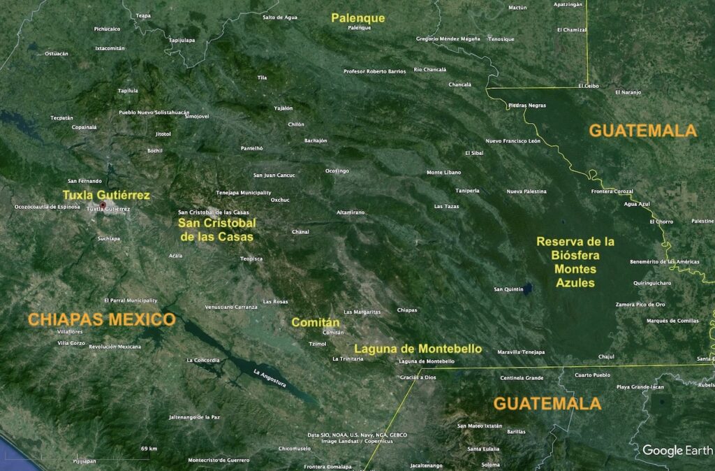
This Google Earth (GE) map of Chiapas shows the borders with Guatemala (yellow lines) and highlights locations referred to in this post. The airport is located in the capital city of Tuxla Gutiérrez, which is located at 530 m (1,740 feet) elevation. From Tuxla, it is about a one hour, 15 minute drive to San Cristobal de las Casas, which is located in the highlands at 2,200 m (7,200 feet) elevation. Our eight-day tour was a counter-clockwise loop from Tuxla to Lagunas de Montebello to Reserva de la Biósfera Montes Azules to Palenque and back to San Cristobal and Tuxla, with various stops along the way. The roads are rough and public transportation is sparse. I found a company that provides private tours and recommend their services: https://www.ecotourschiapas.com/.
Cascada El Chiflón (waterfalls)
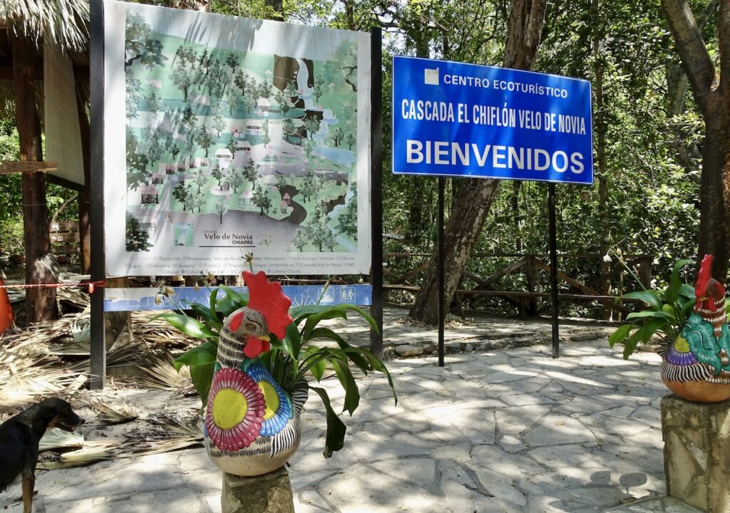
The first site we visited with dazzlingly beautiful blue water was El Chiflón Falls, a community-run enterprise located a short distance south of Comitán (see map).
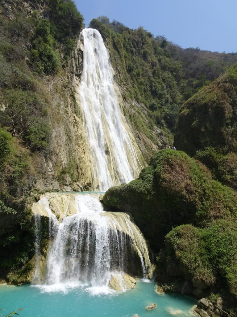
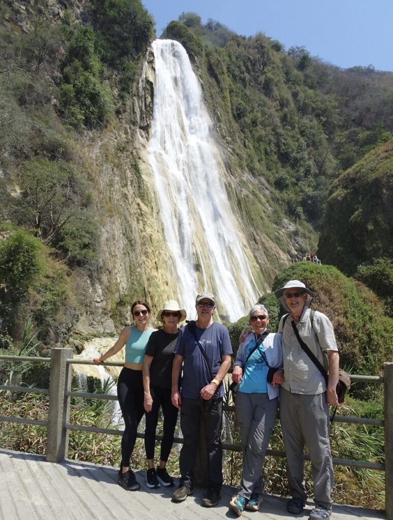
The entry to Cascada El Chiflón, where a park ranger escorts visitors up a steep path along a series of waterfalls to the main “Velo de Novia”, meaning “Bride’s Veil”. Visitors can swim in some of the shallow pools along the way to the top.At the top of the path is the main Velo de Novia waterfall that cascades down an impressive 120 m (~400 feet). Left-side photo: The water tumbles over an escarpment and falls into a brilliant turquoise-blue pool. Right-side photo: Beside me and Jay, our tour group consisted of friends Jeff and Roseanne and their daughter Samantha, who is wearing a water-matching top.
What is responsible for the brilliant aqua-blue color of water in the eastern half of Chiapas? First, we need to think about the blue color we see in most water. When visible light goes through water, the red end of the spectrum is quickly absorbed, whereas the blue end of the spectrum is not. So what we see is blue. The varieties of blue mostly depend on particles in the water that scatter the light.
As in many locations, the turquoise-blue color in Chiapas is due to limestone. Calcium carbonate (CaCO3), the mineral component of limestone, is easily dissolved or re-precipitated, depending on chemical conditions such as pH level. As groundwater passes through limestone, it readily dissolves, producing dissolution features such as caves and cenotes (basically sink holes). When the groundwater flows onto the surface, different chemical conditions (e.g., warm temperature) cause small particles of calcium carbonate to precipitate into the water. Another factor is the agitation in a waterfall that releases CO2, thus lowering the pH and causing CaCO3 particles to precipitate.
In the photos above, note the tannish color beneath the falling water. This is CaCO3 that has precipitated onto the underlying rock. The pool of water at the bottom of the falls has a turquoise-blue color because the minute CaCO3 particles selectively scatter the light as it passes through the water.
Lagunas de Montebello
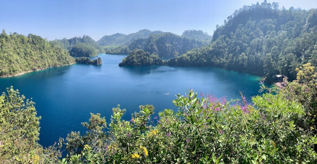
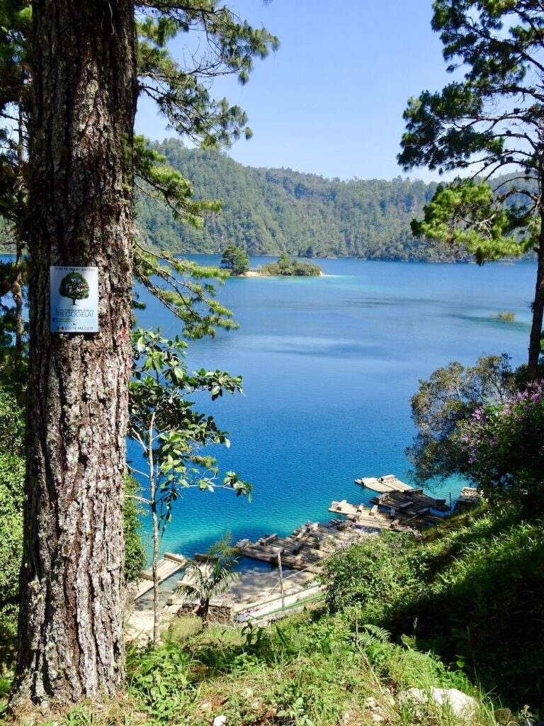
We continued south to Lagunas de Montebello (see map above), created in 1959 as the first national park in Chiapas. In 2009 the park was designated a Biosphere Reserve by UNESCO. The park consists of 59 lakes that are considered to be the bluest and most beautiful lakes in all of Mexico. The lakes are cenotes (sink holes) that have coalesced to become various-sized lakes.
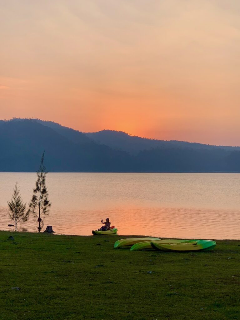
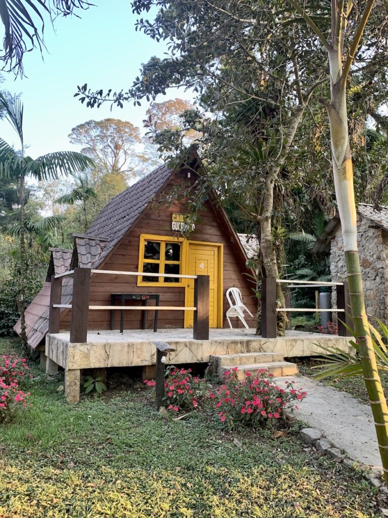
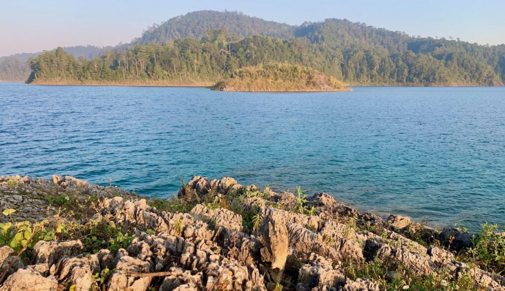
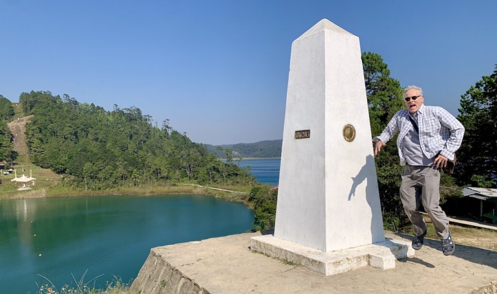
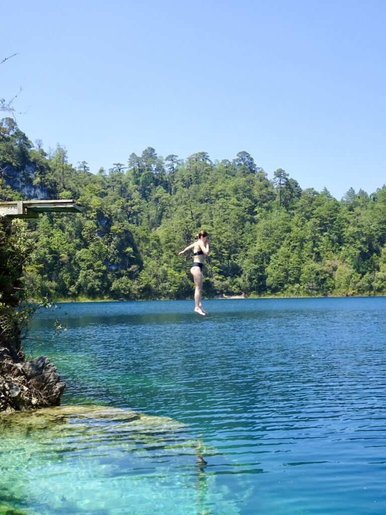
View over one of the largest lakes in the park. The air is not completely clear because farmers were burning their fields during this time of year, in preparation for planting a new harvest. We stayed at Cabañas Tziscao, located on the largest lake—Lago Tziscao. The slightly smokey skies created a beautiful sunset over the lake.This exposure of rock along the edge of Lago Tziscao shows how limestone weathers to form jagged surfaces because parts of the rock dissolve.This lake is called Lago Internacional, because it spans the border between Mexico and Guatemala. Jay is jumping over the border, here marked by a monument. The strip without trees on the other side of the lake is a continuation of the international border.We got to directly experience the water of Lago Pojol. Left-side photo: There are wooden rafts tied up at the edge of the lake. With a guide, we paddled around the lake on one of these rafts and then disembarked to swim at the island in the center. Right-side photo: Samantha found a place that was deep enough to jump in.
Reserva de la Biósfera Montes Azules
From the Lagunas de Montebello, we traveled east and a little north to an ecotourist center located in the eastern edge of Reserva de la Biósfera Montes Azules (Blue Mountains Biosphere Reserve; see map above). On the map, notice the stripes of lighter and darker green colors that trend NW–SE. These stripes are valleys and ridges that are obvious in the landscape when traveling west–east across this part of Chiapas. The valleys and ridges are a fold-and-thrust belt created by compression of limestone rock. During the Cretaceous Period (~140–70 million years ago), this part of Mexico was a shallow carbonate platform where the shells of marine organisms collected to form limestone. Later, the rearrangement of crustal blocks caused compression across the region.
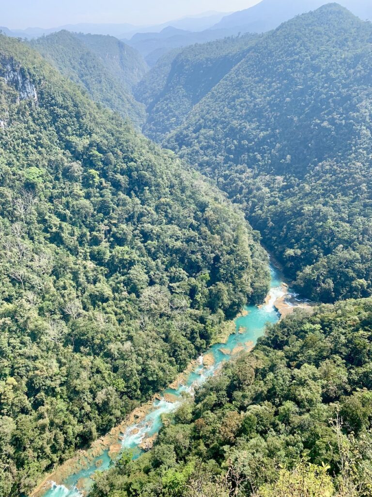
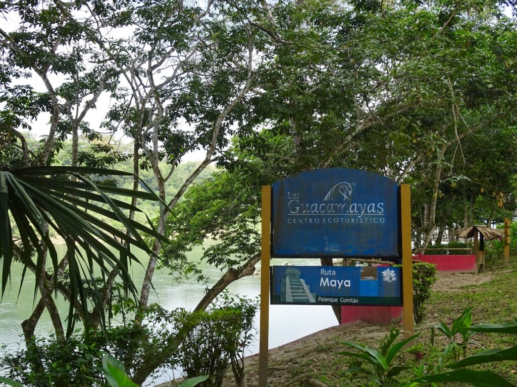
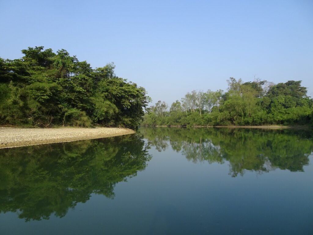
Left-side photo: A river with more aqua-blue water has cut down through the limestone rock. View is southward into Guatemala along the road heading east from Lagunas de Montebello. Again, the air is smoky because the farmers were burning their fields. Right-side photo: Sign at the entrance to Centro Ecoturistico las Guacamayas in the Reserva de la Biósfera Montes Azules. Guacamaya is the indigenous name for the colorful macaw pictured on the sign. We were fortunate to see a guacamaya and some monkeys on the property.Left-side photo: We stayed overnight at the ecotourist center, located adjacent to the Sandales River. Right-side photo: In the morning, we took a lancha (small boat) ride along the tranquil, scenic Sandales River. We saw a crocodile, small bats, monkeys, and a large variety of trees that are native to this jungle.
From the Centro Ecotouristico we continued north to visit two Mayan ruins at Bonampak and Palenque (to be described in a subsequent post). After Palenque, we traveled southwest to San Cristobal de las Casas (see map), stopping at two more beautiful water features along the way.
Cascadas de Misol-Ha
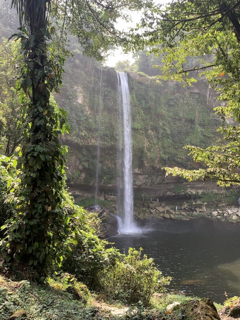
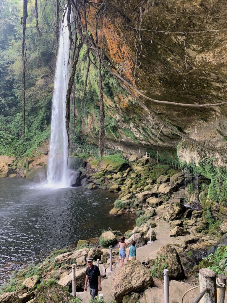
We first stopped at the Cascadas de Misol-Ha, named after the river Misol-Ha, which means “streaming water”. Indeed, the river streams over a precipice to create an impressive 35-m-high (115-ft-high) waterfall. It reminded me of Silver Falls State Park in my home state of Oregon. There are apparently caves here—it’s limestone after all—but we did not have time to explore them.
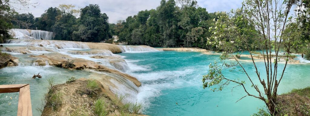
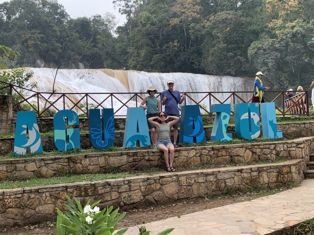
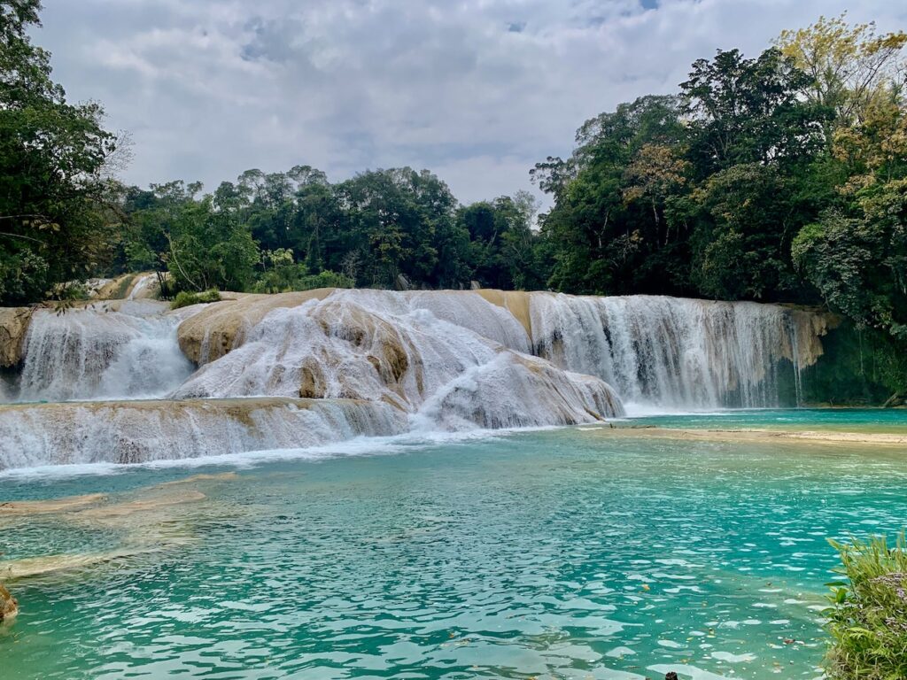
Cascadas Agua Azul
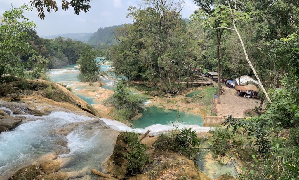
We next stopped at Agua Azul, where the Rio Xumul-Ha (meaning River of Blue Water, or in Spanish, Agua Azul) cascades down from a limestone ridge to form a series of waterfalls and pools. The area was designated a Federally Protected Forest and Wildlife Refuge in 1980 and a Biosphere Special Reserve some years later. Note that, as at Cascada El Chiflón, the agitation of the water flowing over the falls causes calcium carbonate (tan-colored coating) to precipitate from the water. More photos of the beautiful turquoise water at Agua Azul.A view looking down the river from one of the upper falls. To the right are a series of basic buildings that house vendors who hark their artisanal products and food to visitors as they climb upward to the higher falls.
When to visit
To see these beautiful blue colors, you need to visit Chiapas during the dry season—usually the months of November to April. During the wet season, the heavy rains carry mud into the water, turning it a murky brown color from the suspended sediments. By December, the water has typically cleared and the beautiful blue colors return. My next post will focus on the Mayan ruins we visited on this tour.


WOW. How beautiful! I’ve been to Mexico countless times but never to Chiapas. Thanks for the tour.
Thanks for reading Maria!