Trekking in the Khumbu region of the Nepal Himalayas, Part 1: from Kathmandu to Namche
January 26, 2022
What geologist doesn’t yearn to experience the grandeur of our planet’s highest mountain range? Certainly, I was exhilarated by the opportunity to gaze upon the breathtaking landscapes of the Himalayas, formed during the past 50 million years, as the sub-continent of India has been colliding with the continent of Asia. We spent the month of November 2021 in Nepal—the main event was a 21-day trek in the Everest region that is also referred to as the Khumbu. This is the first of a series of four posts describing highlights of the trek and the geology along the way. The fourth post will explain the large-scale tectonic evolution of the Himalaya.
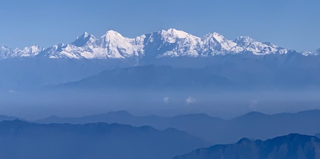
Excitement levels rose as we flew east toward Kathmandu, and first glimpsed the Himalaya, which means abode of snow in Sanskrit. The snowy peaks to the north are the High Himalaya, where we trekked. The lower hills in the foreground are the Lesser Himalaya that are developing as India and the rest of Asia continue to collide, and the mountains are thrust upward and southward.
It was a good month to trek in Nepal, since the country had just re-opened for tourists after a spike in Coronavirus infections, and the number of trekkers was small compared to a normal year. We trekked with a small company called Kamzang Journeys—Kim (from the U.S.) and her business partner Lhakpa (who grew up in the Khumbu region) have been leading treks for nearly 20 years and are highly recommended. For a description of the treks they lead, see https://www.kamzangjourneys.com/.
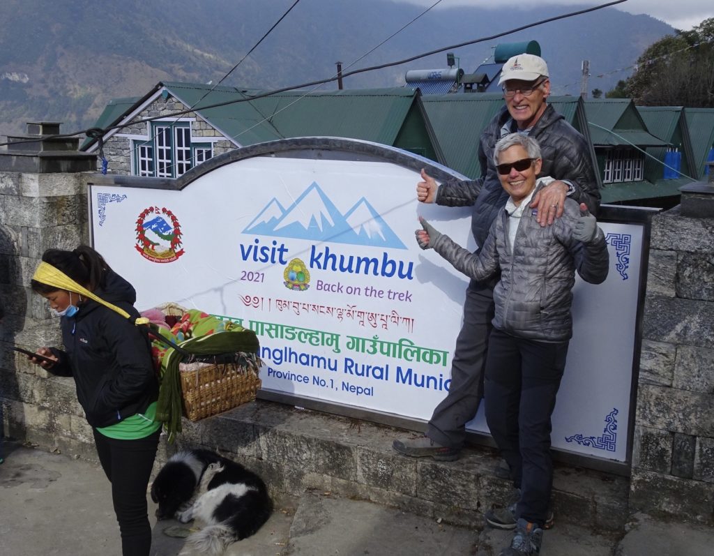
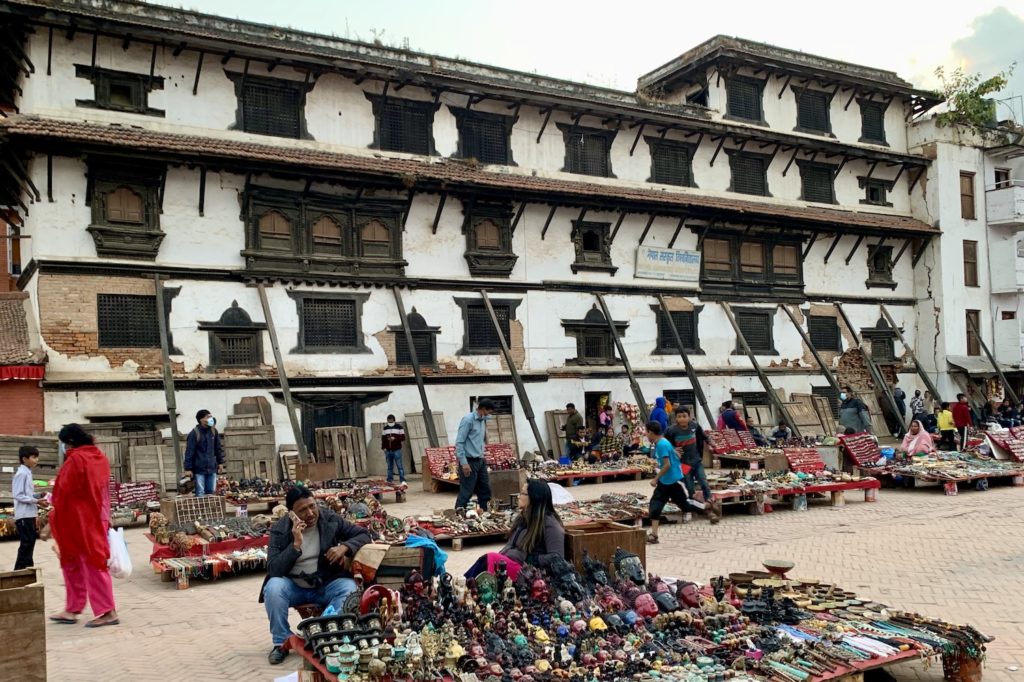
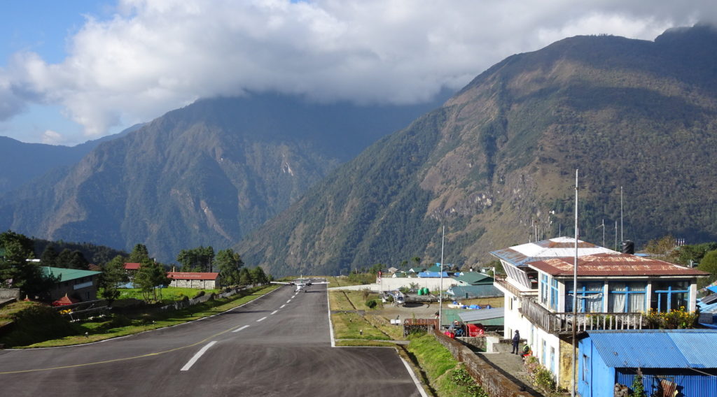
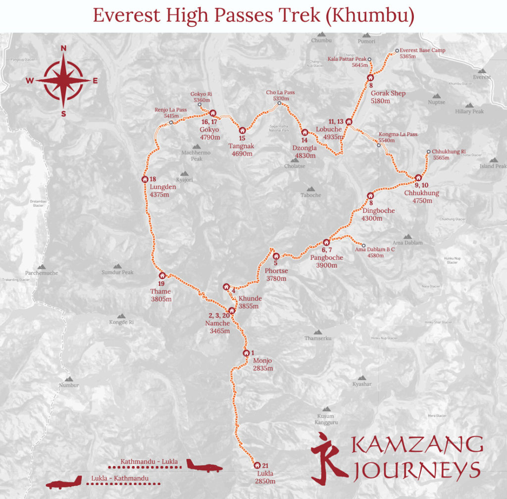
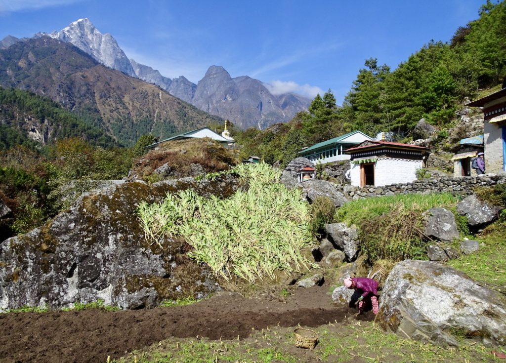
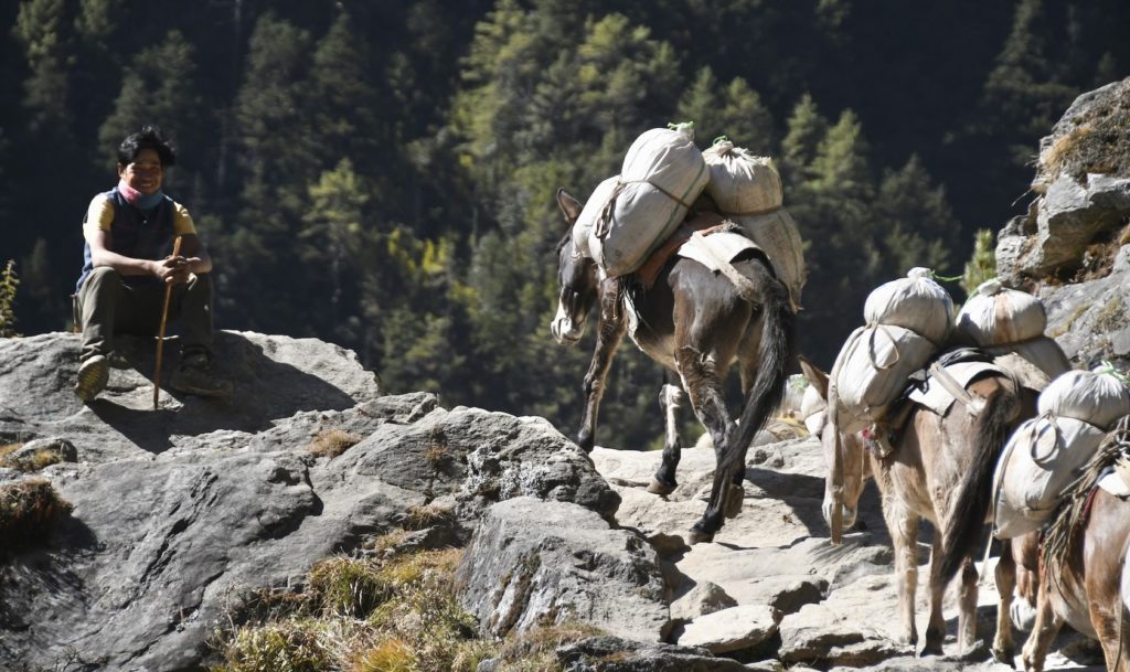
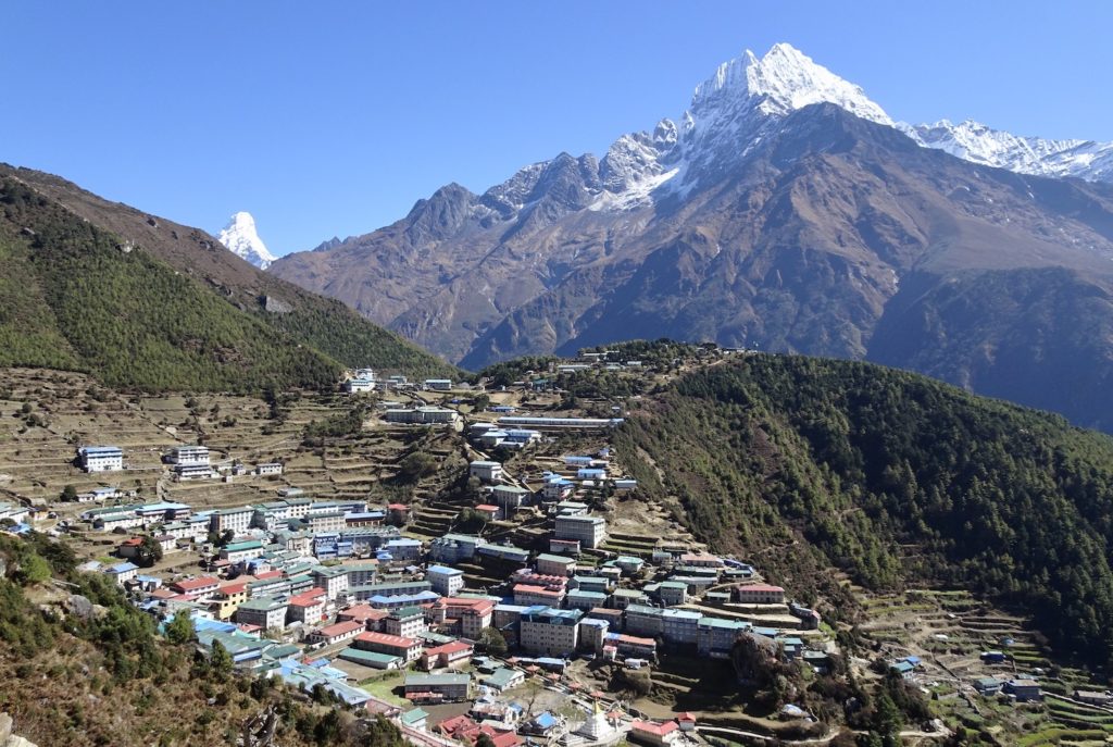
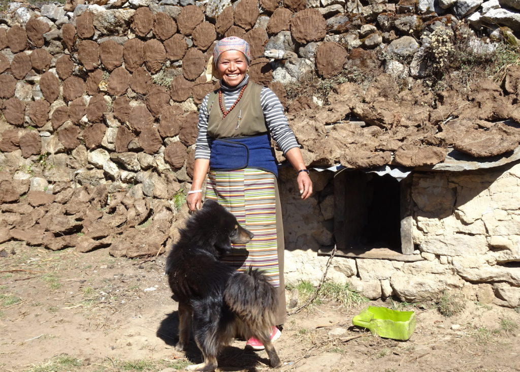
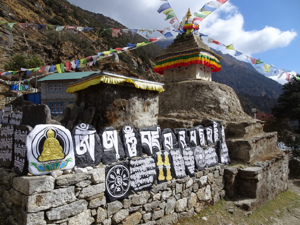
A welcome sign greeted us at Lukla, where we flew from Kathmandu to start the trek. Lodge owners greeted us enthusiastically, because there had been few visitors during the previous year. Note the local woman with strap across her forehead attached to a basket that contains her baby. This technique enables porters to carry loads that weigh more than their body weight. (The baby in the basket is not THAT weighty though!)Most treks to the Everest region start in Kathmandu, the capital and cultural center of Nepal. I choose this photo because it shows a building that was damaged by the 2015 magnitude 7.8 earthquake. This building is at the edge of Durbar Square, one of the three royal palaces of the former Kathmandu Kingdom. Many damaged buildings are being renovated with international aid, including from the U.S. Our guides were leading a trek when the 2015 earthquake occurred. They described the difficulties that ensued because most communications were cut off and many structures collapsed or were badly damaged.From Kathmandu, most trekkers take a 30-minute flight to Lukla. The Lukla airport has been called “the most dangerous airport in the world” because the runway is short, with a steep drop-off at the downhill side (shown in this southward view) and a steep cliff on the up-hill side (right behind where I am standing to take the photo). Pilots must land by sight, without other navigational aids. Still, despite the anxiety of passengers, most planes take off and land safely.From Lukla, trekkers hike northward on a variety of routes. The route we accomplished was the Everest High Passes Trek shown on the map above. The numbers correspond to the places where we stayed each night during the 21-day trek, which was a counterclockwise loop with some offshoots.The landscape between Lukla (2860 m / 9383 ft) and Namche (3430 m / 11286 ft) differs from the rest of the trek. At these lower elevations below tree line, farming is easier. But not so easy—notice that this woman is using hand tools to plow her field. Because there are no roads, equipment such as tractors and other heavy equipment cannot be brought to the region. The stalks she has cut are probably food for her animals. The green shoots above her, near the path, are onions. Note the white building with a decorated roof—it is a chortan with a prayer wheel inside.The hiking trails are used by everyone, including mule trains and human porters loaded down with food, fuel, and building supplies. These mules are carrying loads of rice uphill to the lodges for an anticipated busy season in 2022, while their tender takes a rest. Photo courtesy of Jay Ach.Namche (trek days 2, 3, and 20) is a bustling community—with many lodges, restaurants, and souvenir stores—that is the gateway to higher elevation trails. Treeline is ~4000 m (13,000 ft), not far above Namche, so most of the trek was through landscapes of mostly rock and ice. This view is eastward toward the Thamserku peak (6608 m / 21,700 ft). Barely poking above the skyline to the northeast is the top of Ama Dablam peak that we would see for many days while trekking up the valley to Chhukung.Although still below tree line, wood is scarce around Namche and the most reliable fuel is dried yak dung. This Sherpa woman living just above Namche has yak patties drying on a wall next to her house. She well captures the internal and external beauty of the Sherpa people.
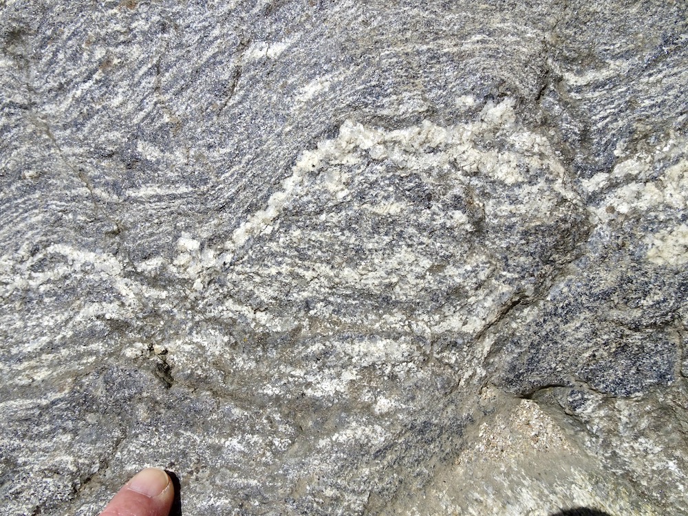
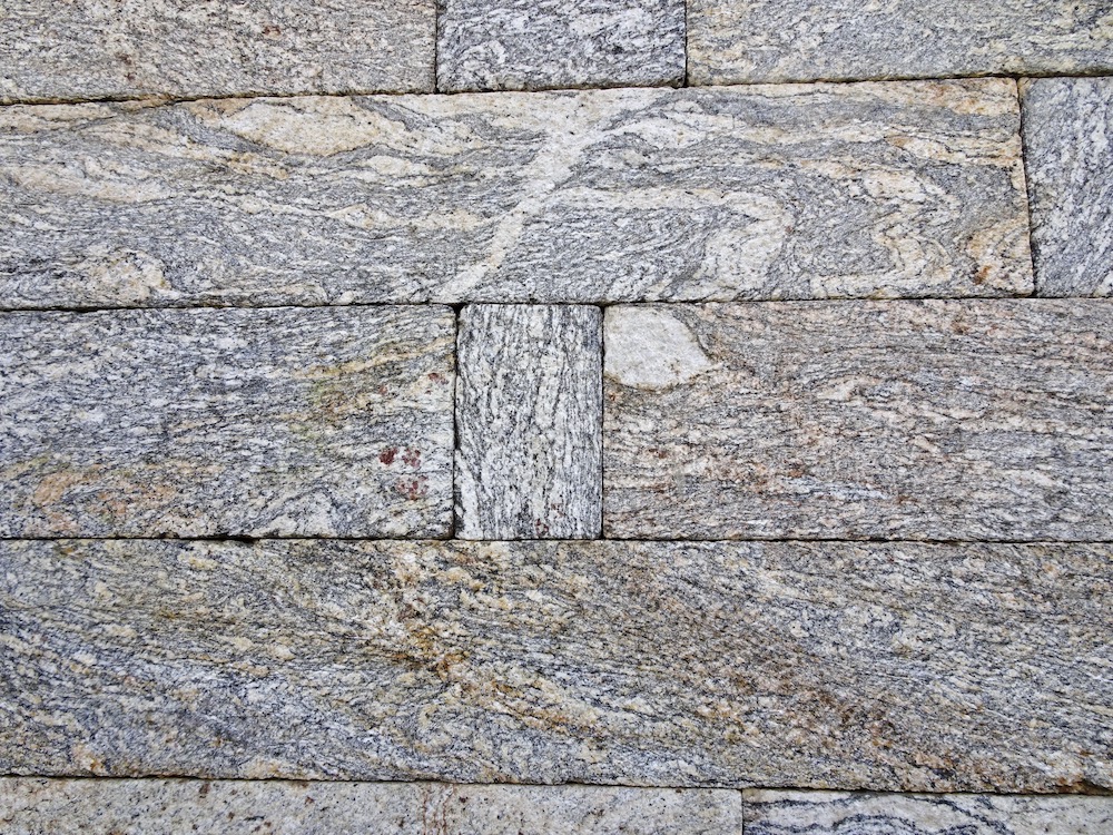
We of course saw lots of rock along the way—these photos are of a rock called migmatite that is common around Namche. All of the rocks in the Everest region have been highly metamorphosed—that is, minerals were changed after being buried to great depths where they were subjected to high temperature and pressure. Some of the rocks were buried so deep that they melted and became igneous rocks—that is, rocks that have cooled from a melt.
Migmatite is a hybrid of metamorphic and igneous rock. The light-colored components are more silica rich and so melt at lower temperatures than the dark-colored components with less silica. These rocks were buried to a depth great enough to melt the silica-rich components (making the light-colored part igneous rock), but not enough to melt the silica-poor components (making the dark-colored part metamorphic rock).
The left-side photo is an outcrop of migmatite, where the melted part is the white part in the center. The right-side photo is migmatite rock that was precisely hand-cut into blocks to make a wall. The top block is a particularly good example of migmatite because some of the white rock cuts across the darker rock, clearly indicating that it was molten. The brown coloration is small amounts of oxidized iron. Click on each image to see a larger size.
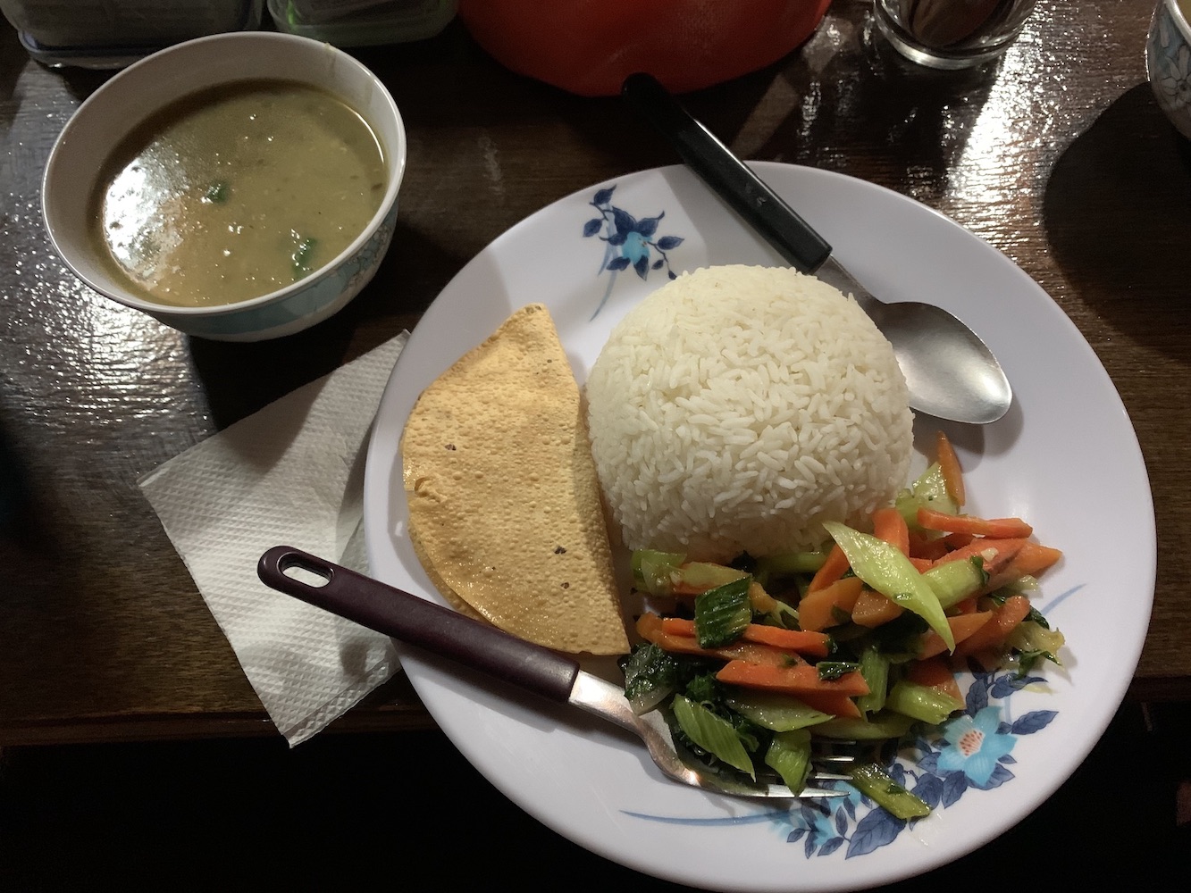
Facilities for trekkers have improved over the years, based on stories I’ve heard from people who trekked in Nepal in the 1980s. Now there are lodges with a dung- or wood-powered stove in the dining/lounging area, solar- or gas-powered electricity, and even intermittent wi-fi. The left-side photo is the lodge at Dzongla where, after arriving, some of our group quickly washed clothes to take advantage of the sun’s warmth before it set. That’s our guide Kim in the red jacket, and our guide Lhakpa hurrying off to the right. Food is simple, but hygienic—dal bhat (lentil soup with rice and vegetables shown in right-side photo) is always available. Click on each image to see a larger size.This first post would not be complete without a mention of the religious imagery along the trails. The Sherpa people who inhabit the Khumbu region came to the region from Tibet 400–500 years ago. The word “sher-pa” means “east-people”. They brought with them the precepts of Tibetan Buddhism, with its complex teachings focused on reducing suffering and developing compassion. Religious symbols along the trail help practioners (and perhaps trekkers!) who are seeking to improve themselves and their world. Common constructions along the way are chortans (the entire construction in the photo—also called stupas) that are prayerfully circled in a clockwise fashion, mani stones engraved with mantras (white lettering on the black stones) such as “om mani padme hum” that calm the mind, and prayer flags that are placed so the wind can blow prayers and mantras to imbue good will and compassion into all space.
To learn more about the Sherpa people and their way of live, refer to the writings of Frances Klatzel, a Canadian woman who has adopted the Sherpa religion and culture. This web site has her photo essay about life in the Khumbu and a link to a publications page with more information about her books: http://www.bergadventures.com/v3_main/Sherpa-Story1.php. While in Namche, we had the opportunity to meet Frances, who graciously provided a guided tour of the visitors center that explains Sherpa life and that she helped to create. It is adjacent to the local monastery, called a gompa.
The next post will describe the trek from Namche to much higher elevations.


I’ve been waiting for this! What a trek. Can’t wait for more.