

Why are there so many hills in San Francisco?
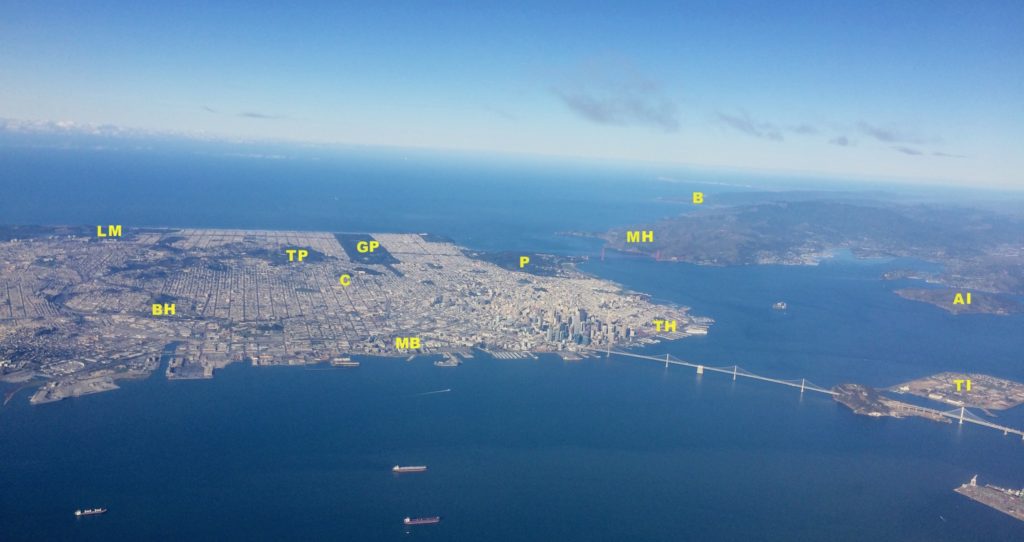
Any visitor to San Francisco will be impressed by the number of hills and how they contribute to the overall beauty of the city. People (like me) who have resided in San Francisco have found biking and walking routes to avoid the steepest hills, and have appreciated how the hills compartmentalize the city into distinctive neighborhoods and provide stunning views. Readers of a certain age will remember the 70s-era TV series “The Streets of San Francisco”, where Karl Malden and his sidekick chased criminals up and down the city’s crazily-steep avenues. As you may guess, it’s the underlying geology that has created these hills. In short, the hills are created by rocks that are quite resistant to erosion, whereas the low areas are underlain by rocks that are weak and easily eroded.
The bedrock of San Francisco is old—it was created during the Mesozoic Era, about 200–80 million years ago. These rocks are part of the Franciscan Complex, a heterogeneous unit that was named after San Francisco and that underlies vast swaths of northwestern California. These igneous and marine sedimentary rocks are in some places highly metamorphosed—they formed as parts of oceanic crust (igneous) that were mantled by marine sediments and then subducted beneath North America, in some cases to great depths. On-going tectonic activity has caused the rocks to be uplifted and eventually exposed at Earth’s surface, where they have been subjected to the forces of erosion. Some rocks resist the effects of erosion and form topographic highs; others succumb to erosion and form topographic lows. Below is a diagram to help envision how the Franciscan Complex was formed.
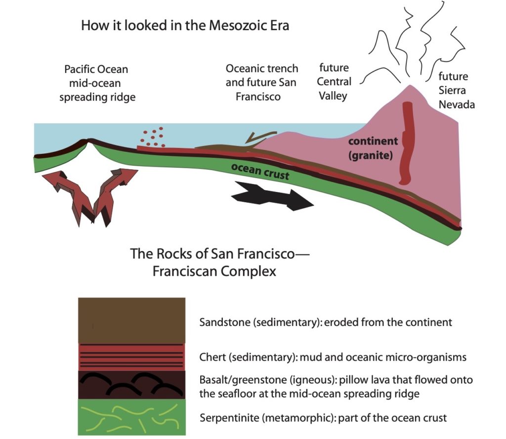
What eventually became San Francisco was at that time located in deep water, in the trench created by the down-going oceanic plate. The rock sequence shown above was created as the oceanic plate (serpentinite and basalt) moved toward the continent. Chert was deposited on top of the ocean crust as organisms died and their shells fell to the seafloor, and sandstone was deposited on top of the chert as the ocean crust approached the continent and sediments eroded from land were swept onto the seafloor. I will refer to this sequence as “normal”—it is how the rock types were arranged as they entered the oceanic trench. The process of subduction, however, then scrambled these rocks and we now find them in repeated and highly disrupted pieces.
Because the subduction process jumbled the rock sequence, the geology of San Francisco is complex—that’s why it’s called the Franciscan Complex! To me, the best illustration is still the map and cross section created by geologist Clyde Wahrhaftig for his classic book: “A Streetcar to Subduction”, first published in 1984.
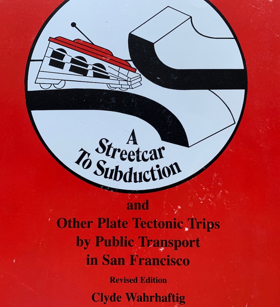
The book includes descriptions of field trips within the city that can be accessed via public transportation. Clyde famously never learned to drive and as a resident of San Francisco he knew well the public transportation options. This book is still available (just do an internet search); it’s also been made into an online tool with Google Earth links by the American Geophysical Union. [Side note: My husband recounts a conversation with Clyde while they were both commuting by train from San Francisco to the U.S. Geological Survey in Menlo Park in the mid 80s. Clyde exclaimed: Menlo Park is a good place for raising kids, but San Francisco is a good place for raising hell!]
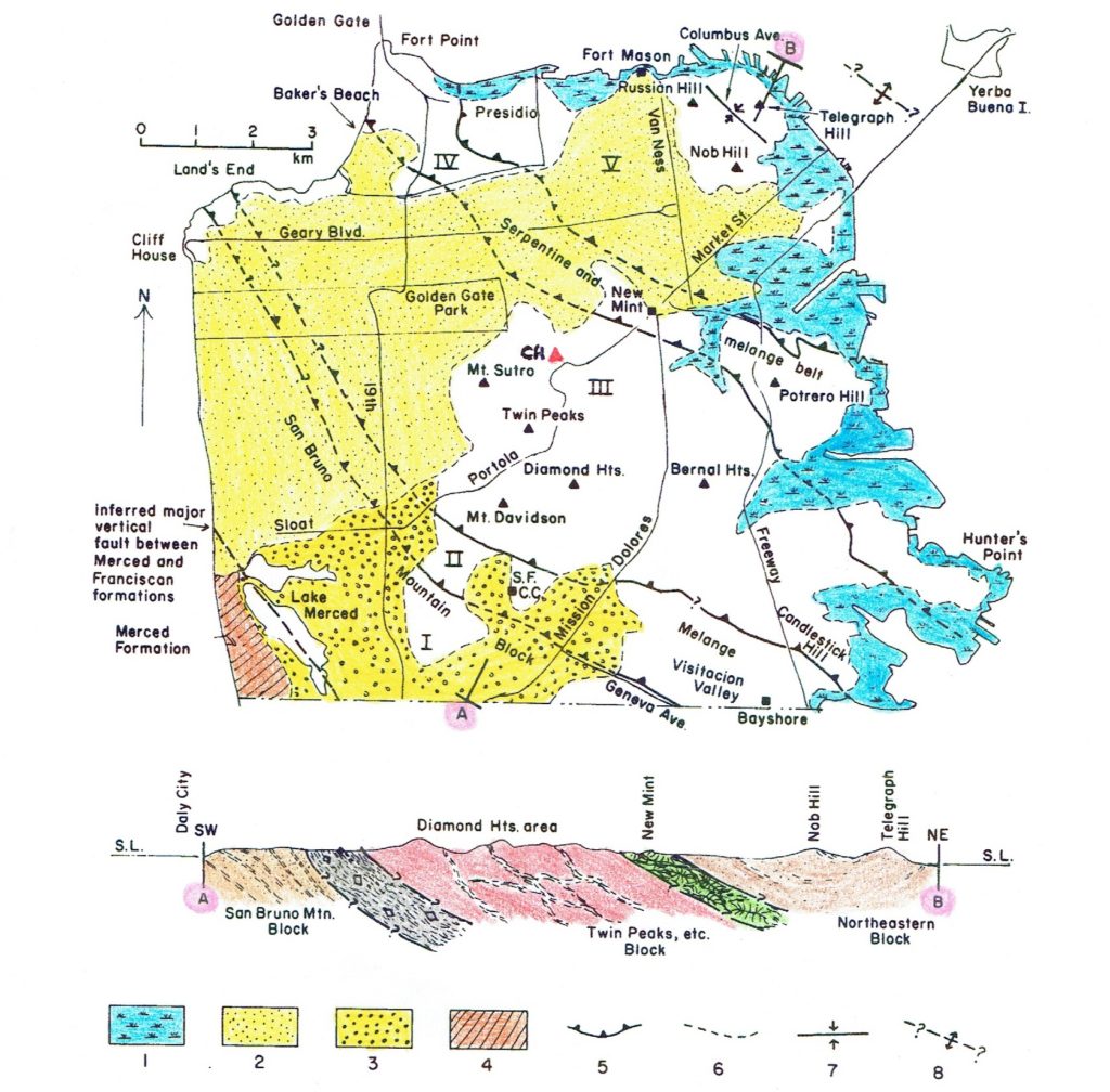
The white areas on the map are where bedrock is exposed at the surface; bedrock units are shown on the lower cross-sectional view. [I have highlighted in pink the “A” at the SW end of the cross section and the “B” at the NE end]. Note that the young sediments do not appear on the cross section because they form such a thin skin on top of the underlying rocks. The thrust faults shown on the map view separate blocks with distinctive rock types as shown on the cross-sectional view. From SW to NE (see rock types in “How it looked in the Mesozoic Era” diagram above): San Bruno Mtn block (light brown) is made of sand that was eroded from the continent and flowed into the trench as the oceanic plate approached land; melange (light grey) is highly sheared rock that is a jumble (melange=mixture) of stronger rock pieces in a weak mudstone or serpentine matrix; Twin Peaks block (red) is dominated by chert but also contains basalt and sandstone; serpentine and melange belt (green) is another zone of jumbled rock that contains some large coherent blocks of serpentine; Northeastern block (light brown) is sandstone from the continent.
The thrust faults in San Francisco are “fossil” faults that were active when the Franciscan Complex was being formed as an accretionary complex during Mesozoic subduction. As the oceanic plate descended beneath the continent, pieces of the igneous crust and overlying marine sediments were scraped off and accreted onto the continent. Some of the pieces even descended deep into the mantle, where they were metamorphosed and then expelled back upward into the accretionary wedge.
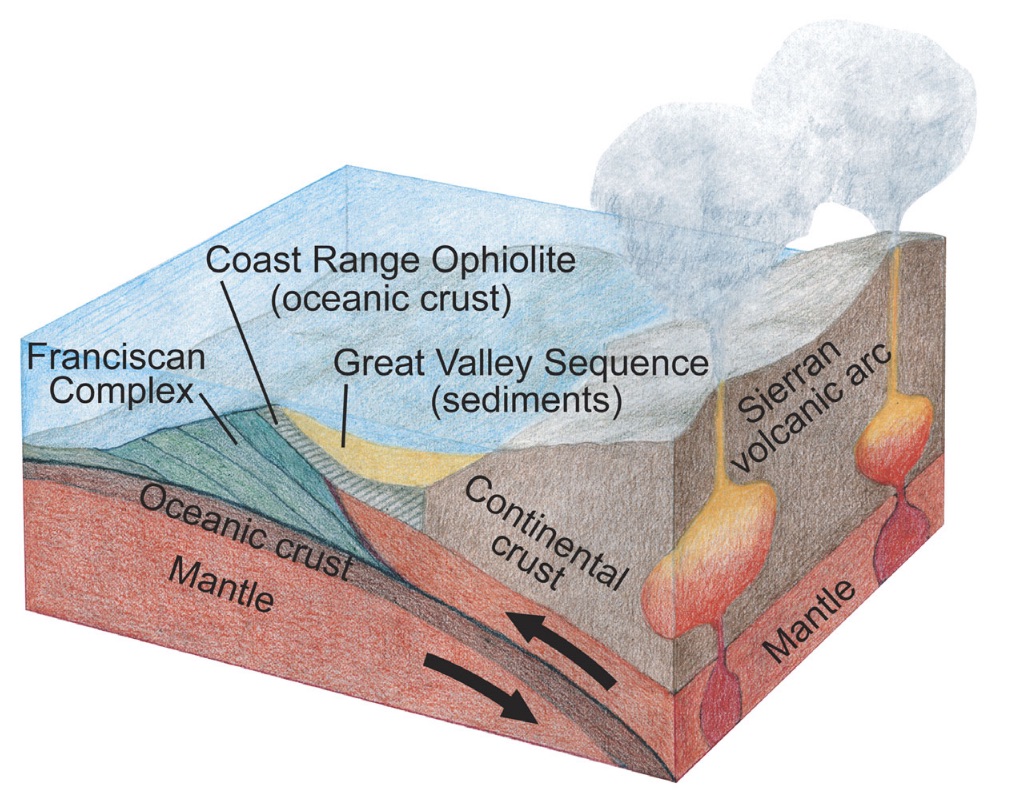
This 3-D image shows how the Franciscan Complex formed during subduction of an oceanic plate during the Mesozoic Era, when the Central Valley was a submarine basin and the Sierra Nevada was a chain of active volcanoes, like the Cascade Range in the Pacific Northwest today. Note the eastward-tilting lines within the Franciscan Complex. These are the faults where underlying slivers were thrust beneath overlying slivers. The slivers are progressively younger to the west. Go back up to Clyde’s cross section of thrust blocks that are the accretionary pieces—the Northeastern block accreted first and the San Bruno block accreted last.
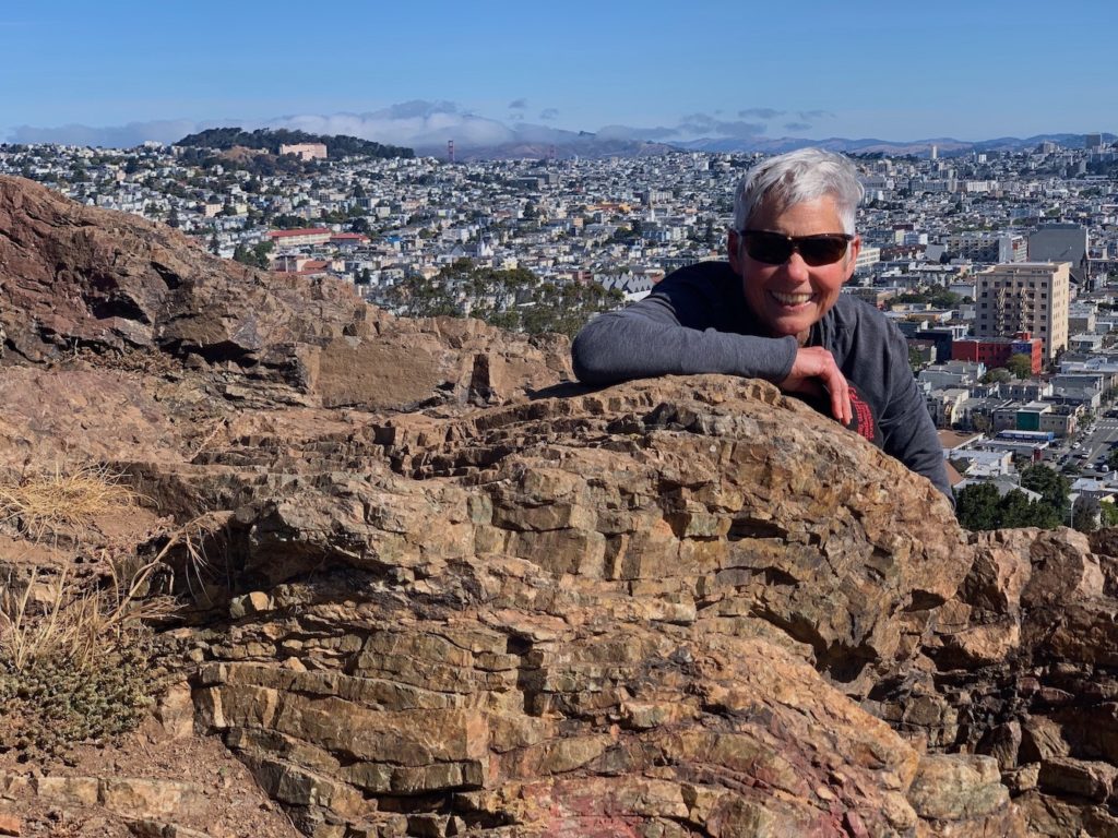
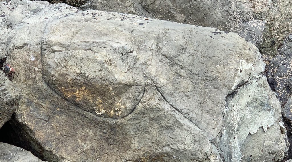
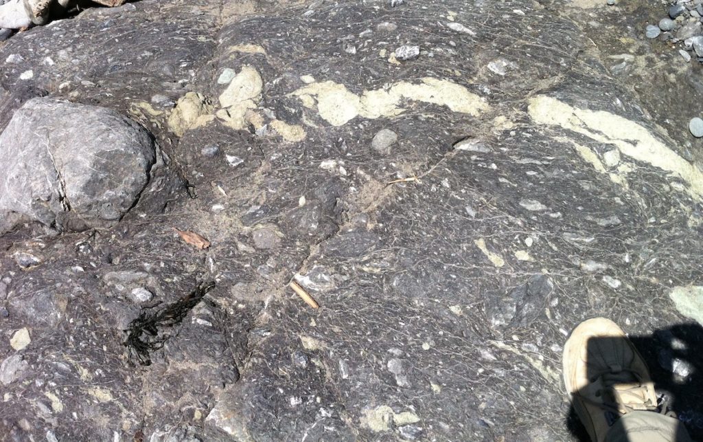
Now let’s look more closely at these rock types and where you can see them in the city. We’ll start with chert that, because it is the most resistant rock type, is readily visible in the numerous prominent hills of the Twin Peaks block.
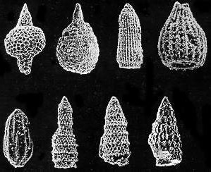
Why is chert so tough? Because it consists mostly of shells of microscopic organisms called radiolaria—single-celled zooplankton that live in the surface ocean and fall to the seafloor after they die. Because the shells are made of silica, they make a very durable rock after they are compressed and hardened. The red color comes from red clay that forms from dust particles that fall onto the ocean’s surface and become oxidized during the thousands of years it takes the particles to reach the seafloor. This scanning electron microscope image shows sub-millimeter-sized radiolaria from the Franciscan Complex.
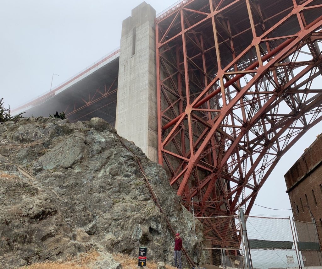
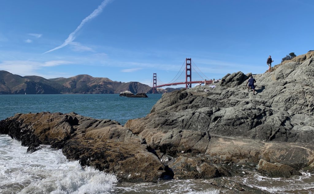
While at Fort Point, let’s look at serpentinite, the rock that underlies the southern end of the Golden Gate Bridge and that is found in the next block NE of the Twin Peaks block. Serpentinite forms the base of a “normal” vertical sequence; it is altered peridotite, an ultra-mafic rock (high in iron and magnesium, low in silica) that is the lower part of oceanic crust. Like the basalt, it was altered by hydrothermal processes, whereby ocean water flows into the crust, is heated by underlying hot magma, and changes the mineral composition of the peridotite to serpentinite.
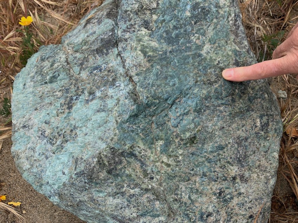
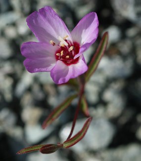
An interesting aspect of serpentinite is that it is low in nutrients that plants need (e.g., calcium and nitrogen) and often contains heavy metals such as chromium that plants don’t want. Nevertheless, a distinctive group of plants has figured out how to survive life in the harsh serpentine soils. In San Francisco’s Presidio (now part of the federal Golden Gate Recreation Area), park personnel have worked to restore delicate native plant communities that are unique to areas with serpentine soils; for example, the endangered Presidio clarkia shown in this photo.
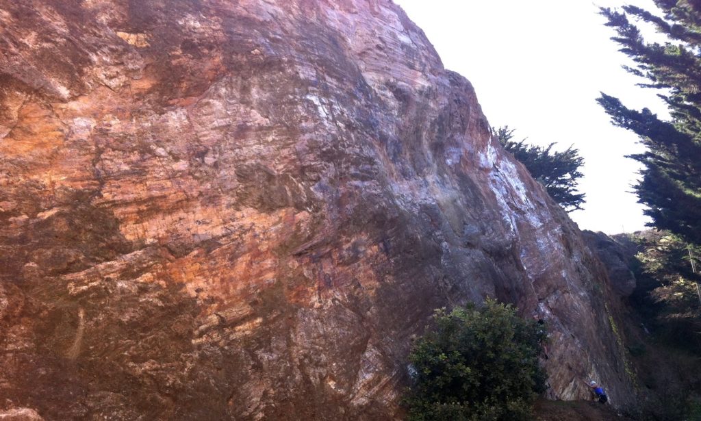
If you look at Clyde’s geology map above, you can see that the serpentinite belt extends from the Golden Gate Bridge at the north end of the city to Hunters Point at the SE edge of the city. Much of this belt is highly sheared melange that is very soft and so it erodes easily. Within the belt are coherent blocks of serpentinite that are more resistant; they can be viewed at Potrero Point, the New Mint (although the city has covered most of this exposure with cement), and at Fort Point (see above).
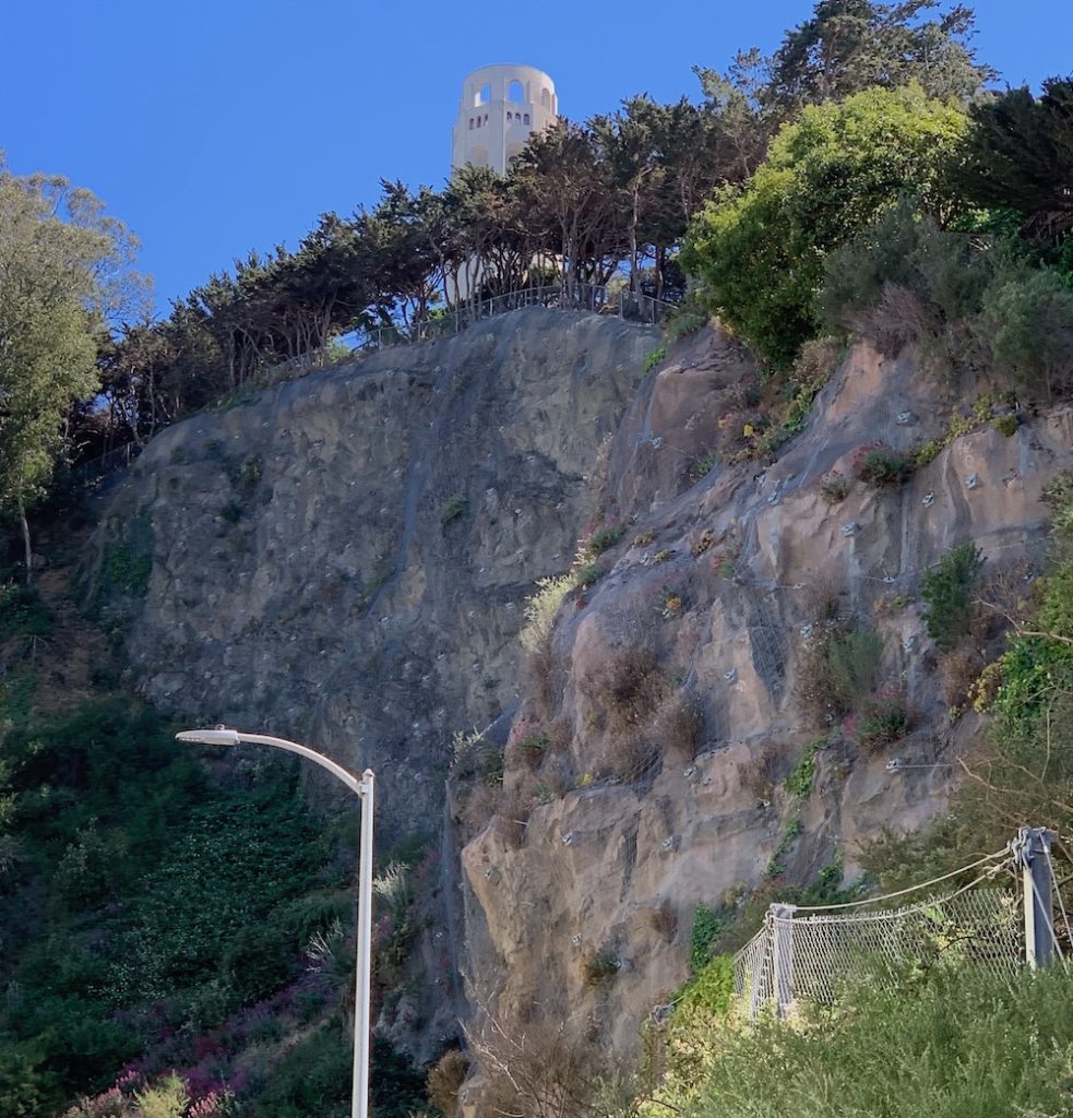
The Northeastern block is made of sand that was eroded from the continent. It would form the top of a “normal” sequence, but in this block is was disconnected from all the other rock types in the sequence. The sandstone is more resistant than basalt and most of the serpentinite, but it is not as resistant as chert. It underlies Telegraph Hill, shown in this photo. That’s Coit Tower poking up at the top. This sandstone was quarried in the 1800s (see https://www.kqed.org/science/2768/remember-the-quarries-of-telegraph-hill), creating steep slopes that are prone to landsliding. For this reason, the exposure is covered by wire mesh to keep rocks from falling on passersby.
Active faulting continues in the San Francisco Bay Area; during the past ~3 million years, the topography of the Bay Area was created. Some of the topography is a direct result of uplift along faults, but in San Francisco itself, most of the topography was created by differential erosion of ancient rocks. Hard durable rocks like chert make up the largest hills; somewhat durable rocks like sandstone and solid serpentinite rocks make up the smaller hills; and weak rocks like melange and highly-sheared serpentinite form the low-lying areas in between the hills.
RESOURCES
Geology and Natural History of the San Francisco Bay Area; A Field-Trip Guidebook, 2001 (https://pubs.usgs.gov/bul/b2188/). See Chapter 3 by Will Elder: Geology of the Golden Gate Headlands.
Rocks and geology in the San Francisco Bay region, by Philip Stoffer, 2002 (https://pubs.er.usgs.gov/publication/b2195).
San Francisco: Where plates meet: a blog about San Francisco geology written by Will Elder (park ranger and geologist) for the European Geosciences Union in 2020 (https://blogs.egu.eu/divisions/ts/2020/11/30/san-francisco-where-the-plates-meet/).
Golden Gate National Recreation Area web site, nature section: https://www.nps.gov/goga/learn/nature/index.htm.