The river of the west: the Columbia River’s source in British Columbia
May 29, 2022
Local-centric me! Until my recent trip to British Columbia, I thought of the Columbia River only as the geographic feature separating Oregon and Washington. Little did I know that it is so long and its watershed so vast, or that it originates in Canada and produces a huge percent of U.S. hydropower. The route of my recent trip was primarily within Canada’s portion of the Columbia River’s watershed, and although the river was not the focus of the trip, I was fascinated by what I learned. Maybe you’ll find it interesting too!
Recognizing the scale of what we now call the Columbia River, indigenous peoples in the Pacific Northwest named the watercourse “the big river” in their various languages. From the earliest days of human settlement, this river has been important for food (e.g., salmon), transportation, drinking and irrigation water, and, in modern times, power generation (hydroelectricity) and flood control. Because of its role in developing the Pacific Northwest, the Columbia has often been referred to as “the river of the west”, also the title of a 1997 book by Robert Clark chronicling the history of this great waterway.
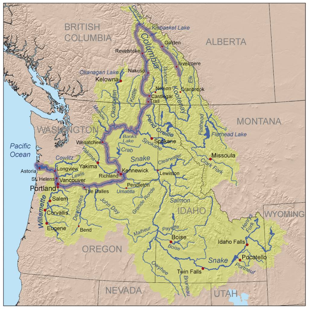
This map shows the Columbia River’s 2,000-km-long (1200-mile-long) main channel (wide purple line), its tributary channels (blue lines), and its watershed (greenish yellow shading). Although most of the river is in the U.S., the important headwaters are located in British Columbia, in the region we explored during a recent trip of the Association for Women Geoscientists. For information about that trip, see my previous post: https://landscapes-revealed.net/why-are-there-so-many-hot-springs-in-southeastern-british-columbia/. Places we visited included the river’s source area just south of Invermere and various stops along its course before it enters the U.S. in Washington State. Interestingly, the river first flows north from its source, takes a “big bend”, then flows south through Washington to where it turns sharply west. It forms most of the border between Washington and Oregon states until it flows into the Pacific Ocean just west of Astoria. Map is from https://en.wikipedia.org/wiki/Columbia_River.
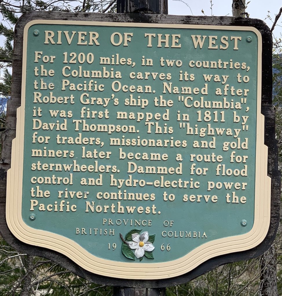
The Columbia River flows through Revelstoke (see map above) where our trip started. The sign on the left is in a park along the river. It explains the origin of the name (a ship named the “Columbia”), which is also the origin of the province’s name (British Columbia). There are many dams on the river. Electricity generated by water flowing through these dams makes up well over one third of all the hydroelectric power generated in the U.S.
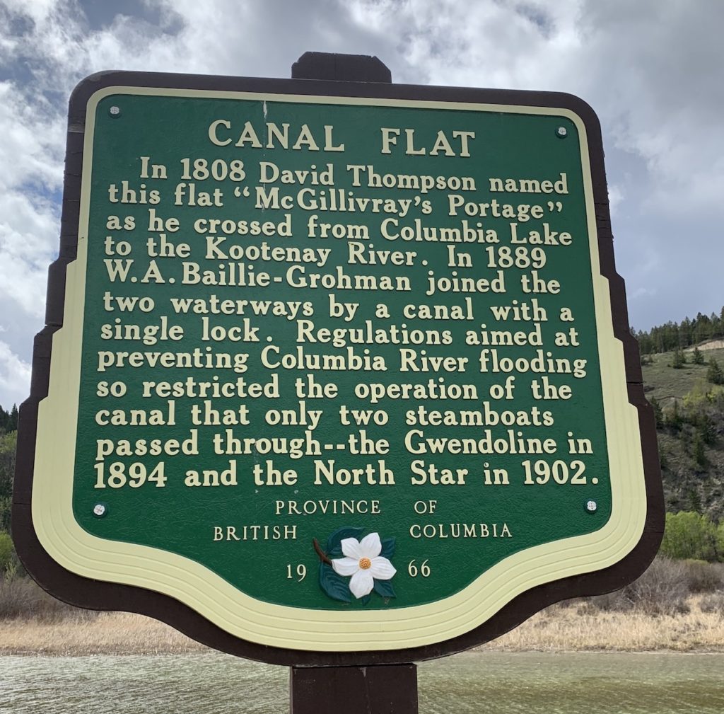
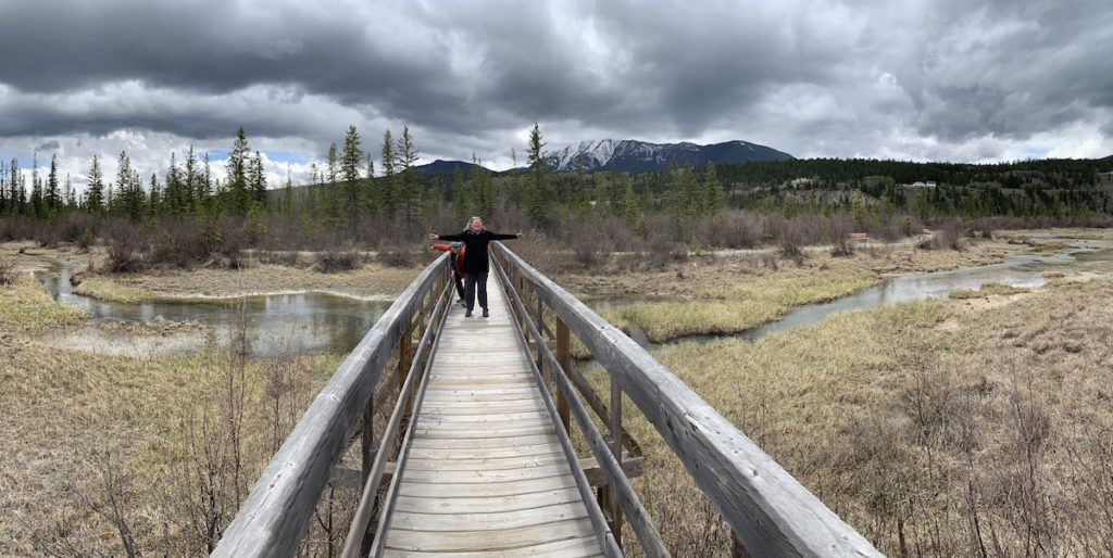
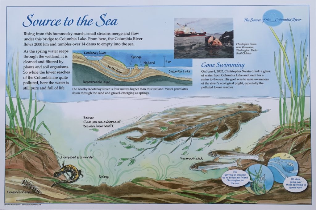
The sign on the right is in Canal Flat, the location south of Invermere (see map above) where the Columbia starts its course. Like many parts of the Columbia, the source area was altered, but today it has been restored to a more pristine state (see photo below). A map below shows the relationship between the Columbia and Kootenay rivers in this region.Here is the surprising source of the Columbia River! Usually, rivers begin at relatively high elevations in mountainous regions. But the Columbia starts in a valley, in a marsh that flows north to Columbia Lake, a natural lake fed by runoff from surrounding mountains, and beyond. An easy trail on the edge of Canal Flat village provides access to the marsh.
Signs along the trail to the marsh explain various aspects of the Columbia River’s origin and the role of plants and animals, including one human who swam the river’s length to raise awareness of its ecological sensitivity.
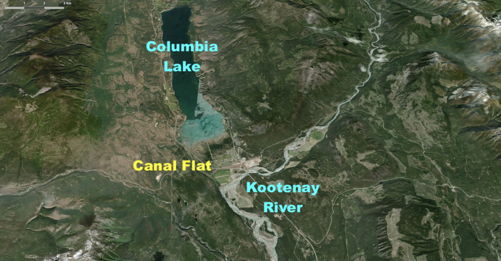
This map (from Apple maps) shows the relationship between the Columbia and Kootenay rivers. The Columbia originates in the marshy area on the north edge of Canal Flat village, where it flows north to become Columbia Lake and continue on its circuitous 2000-km-long path to the Pacific Ocean. The Kootenay River, in contrast, flows south from its origins in the Canadian Rockies. Incredibly, the Kootenay River is only about a km (several 1000 feet) from the Columbia River that flows in the opposite direction. Watershed boundaries tend to be features such as ridge crests that cause water to flow in opposite directions, but here in this valley, it is only a subtle topographic variation that separates the two watersheds. As explained in the next photo caption, glaciers have come and gone numerous times in this valley, and the flow directions and connections among various watercourses have undoubtedly changed numerous times as well. While the two rivers flow in opposite directions at Canal Flat, the Kootenay River is part of the Columbia River watershed because after flowing south from Canal Flat, it turns west and joins the Columbia at Castlegar (see river map above).
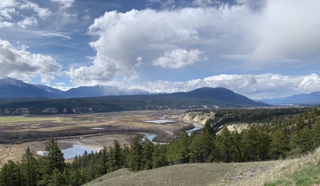
This photo shows the Columbia River north of Invermere and Columbia Lake. The view is to the northwest, toward the Purcell Mountains that are made of Precambrian rocks a little over 1 billion years old. This wide valley is referred to as the “Rocky Mountain trench”, a feature so large it can be seen from the International Space Station. [According to NASA, the assertion that Apollo astronauts could see it from the moon is NOT accurate: https://www.earthobservatory.nasa.gov/images/84881/the-rocky-mountain-trench.] The “trench” is a large valley formed by faults and modified by glaciers during the past 2.5 million years—the time of our present-day Ice Age with its alternating glacial and interglacial periods. The tan-colored bluffs in the valley are remnants of outwash stream deposits that completely filled the valley as glaciers melted since the last glacial maximum 18,000 years ago. These glacial deposits are now being eroded by the flowing water of the Columbia River.
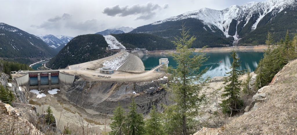
The northern extent of the Columbia River is the “big bend”, located about 140 km (84 miles) north of Revelstoke (see map above). On the bend is the first dam on the Columbia River. Mica Dam was named for Mica Creek that was named for the abundant mica-bearing rocks in the area. We took a day trip from Revelstoke to visit the dam that creates Kinbasket Lake (reservoir) to the east.Mica Dam is the highest dam in Canada and the second highest in North America (the highest is in Mexico). Completed in 1973, it is one of the largest earthen-filled dams in the world. In the photo, notice that the water level behind the dam (right side) is low. That is because of an agreement with the U.S. to provide space as a flood-control measure (more about the Columbia River treaty below). Hydroelectricity generation at this dam will need to wait until later in the year, when BC Hydro will be allowed to store more water behind the dam.
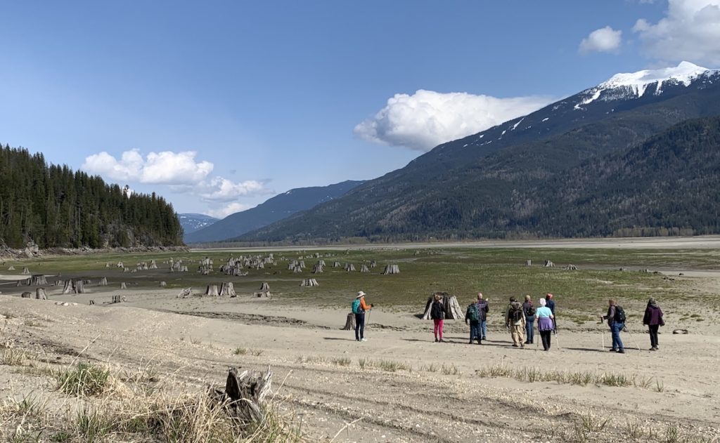
[Literary side note: I’ve just bought a book called “The Wave” by Christopher Hyde that was recommended by our trip leader. It is a fictional thriller based on the potential for the Mica Dam to fail during heavy rains and generate a catastrophically-huge wave downstream. A fictional account of a potential hazard that should be a fun read!]There are 14 dams on the main stem of the Columbia River and well over 200 dams on the river’s tributaries. These dams were created primarily for hydroelectric power, irrigation and flood control. The reservoirs created by the dams have provided many recreational opportunities, but they have also had negative consequences. We stopped along the Columbia River south of Revelstoke where flooding from a downstream dam destroyed well-established communities in the valley. As shown in this photo, we could see trees that died and evidence of human settlements that were wiped out.
Columbia River Treaty. This treaty between the United States and Canada was ratified in 1964. It was developed to address energy needs and flood control concerns within the Columbia River basin. As part of the treaty, three dams were built in British Columbia—Mica, Duncan, and Arrow (later renamed Hugh Keenleyside)—to supply hydroelectric power and storage for flood control. For example, the reservoir behind Mica Dam was low in May to provide space for spring runoff and prevent flooding (see photo of Mica Dam above). Payments associated with the treaty end in 2024, and negotiations are underway to revise and update the agreement.
Canada, in particular, has strong concerns about weaknesses in the existing treaty that removed productive agricultural and forestry lands from local economies and displaced communities (see flooded valley bottom land in photo above). Dams also inundated traditional First Nations’ sites and artifacts, and impacted fish and wildlife habitat. If you are interested in water law, this is an interesting case study. British Columbia’s provincial government has an excellent explanation of the treaty’s history and need for change: https://engage.gov.bc.ca/columbiarivertreaty/history/. I found an interesting article about the differences between U.S. and Canadian views, and the need for fixing the treaty: https://columbiainsight.org/how-and-why-to-fix-the-u-s-canada-columbia-river-treaty/.
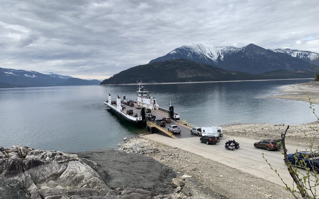
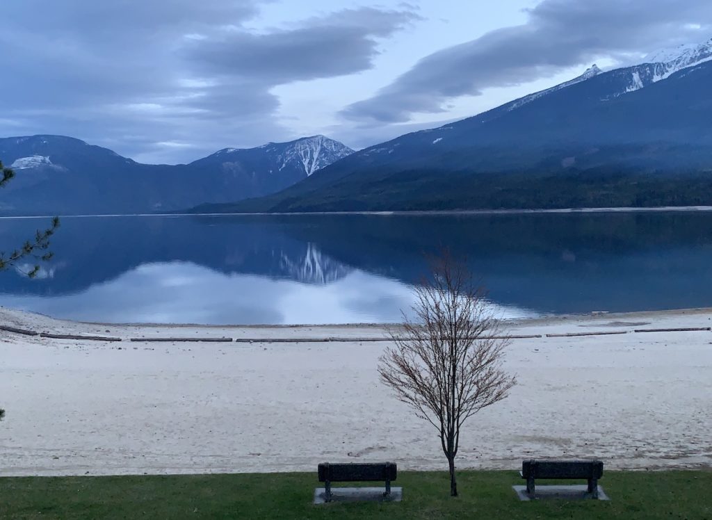
Because of all the reservoirs and natural lakes on the Columbia River, ferries are an important transportation link. South of Revelstoke, we took this ferry to cross from the west to the east side of Upper Arrow Lake (reservoir) on our route to Halcyon Hot Springs and Nakusp (marked on map above). Note the rock in the lower left of the photo, where hot magma intruded into metamorphosed sedimentary rocks about 170 million years ago. The magma cooled to create light-colored granite adjacent to dark-colored meta-mudstone.I’ll end this post with a late afternoon view to the west across Upper Arrow Lake, a reservoir on the Columbia River, at Nakusp.
The headwaters of the Columbia River involve stories of glacial action, indigenous settlements, efforts of diverse groups vying for resource use, and international negotiations. We can see a big river like the Columbia as a metaphor for many of our human endeavors. The Canadian experience motivates me to learn more about this “river of the west” in my own country!
Thank you so much for these great and informative articles. I am reading the book Astoria and how important the Columbia was to First Nations people and those who worked to make the area a trading mecca.. It was great to learn how early the area along the Columbia was inhabited. Keep ’em coming!
Landscapes Revealedon May 30, 2022 at 2:14 pm
Thanks Kathy! I’ve been wanting to read that book so now am even more motivated to do so!


Such a beautiful area.
I’d like to go back later in the season when it’s possible to do more hiking and snow isn’t covering the higher-elevation rocks!
Thank you so much for these great and informative articles. I am reading the book Astoria and how important the Columbia was to First Nations people and those who worked to make the area a trading mecca.. It was great to learn how early the area along the Columbia was inhabited. Keep ’em coming!
Thanks Kathy! I’ve been wanting to read that book so now am even more motivated to do so!