

Sierra Nevada de Santa Marta: Earth’s highest coastal mountain
My friend Maria met me in Medellín, and from there we flew north to Santa Marta, located on the Caribbean coast. Santa Marta was founded in 1525, and is the oldest surviving Spanish settlement in Colombia. Prior to the Spanish conquest, the native Tayrona people had lived in the region for thousands of years. In a story common throughout the Americas, arriving Europeans decimated the indigenous population and caused the remaining people to abandon principal settlements such as the Ciudad Perdida (lost city) that we visited (theme of next post).
The Sierra Nevada de Santa Marta (SNSM) is a triangular-shaped, isolated mountain located southeast of Santa Marta. It is called the highest coastal mountain on Earth. Just 42 km (26 miles) from the coast, Pico Cristóbal Colón (Christopher Columbus peak) reaches an estimated height of 5,730 m (~18,800 ft). Although the Andes extend south–north through most of Colombia, the SNSM is separated from the Andes and is higher than any of the Andean peaks in Colombia, including the active volcanoes.
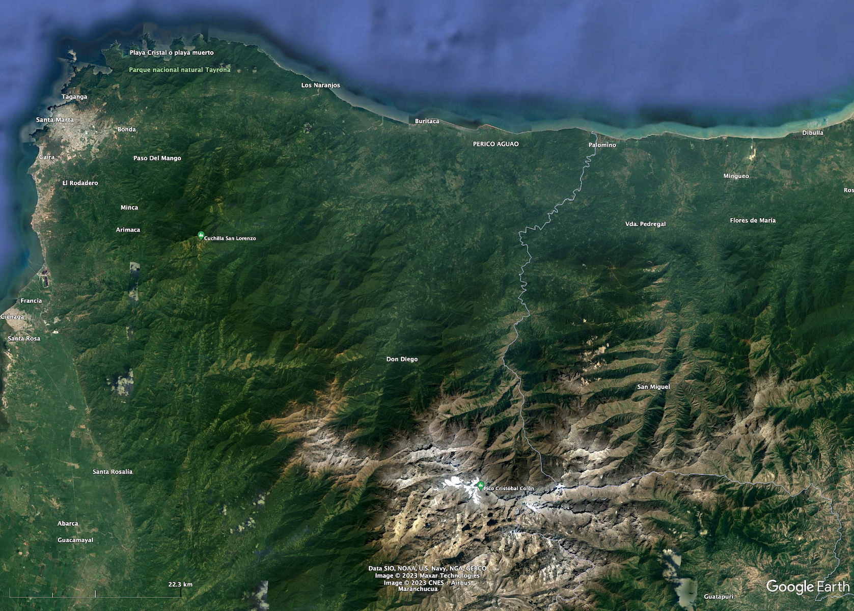
Unfortunately, we never saw the high peaks of the SNSM because of cloud cover and because we were too close and could only see the forested northern slopes.
Geology of the SNSM
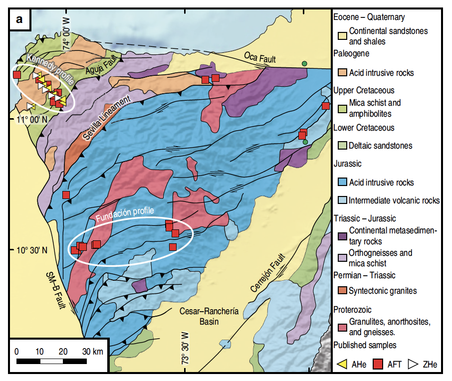
Even in this small region, rocks have a wide range of ages, from Proterozoic (~1 billion years old) to Quaternary (young sediments now being deposited in the low-lying areas surrounding the triangular-shaped mountain). Rocks such as granulites, gneisses, and mica schist are metamorphic rocks that were altered by high temperatures and pressures, indicating they were deeply buried before being uplifted 10s of kilometers (even 10s of miles) to achieve their current elevation of nearly 6 km (~19,000 ft) above sea level. “Acid intrusive rocks” are silica-rich rocks such as granite that were formed from the cooling of magma underground. All rocks that overlaid these deeply-formed rocks eroded away long ago.
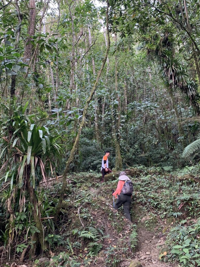
Left photo: Maria and our guide Leo climbing a steep trail amidst lush tropical vegetation. Right photo: looking down at a waterfall that is 100s of feet high (~200 m?) and is one of many waterfalls in this region of very steep topography. Such topography, even in a wet, tropical location that is eroding rapidly, suggested to me a mountain range that is rising upward at a fast rate.
And so it is! Geologic data (see geology map above) indicate that the Sierra Nevada has been lifted vertically many times during the past 66 million years because of plate interactions such as those shown in my first post: https://landscapes-revealed.net/bienvenidos-a-colombia-welcome-to-the-northwest-corner-of-south-america/. Evidence suggests that the most recent pulse of uplift has been occurring during the past 1–2 million years—that’s super recent in geologic time. For millions of years the region has been in a challenging location among four interacting tectonic plates that have separated this mountain from the Andes to the south, rotated it in a clockwise direction, and uplifted it to heights greater than any other in northern South America.
Santa Marta and Tayrona National Park
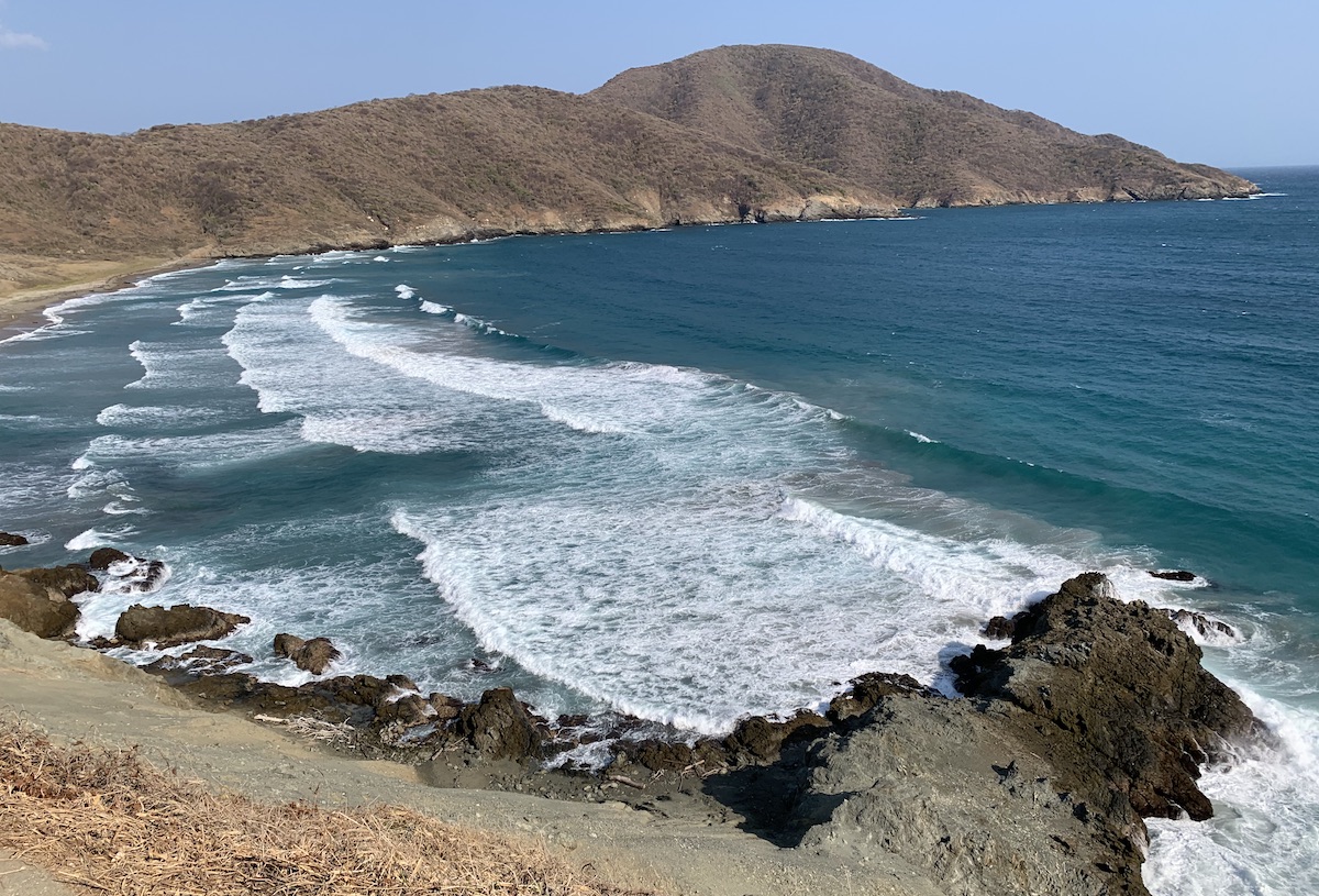
Although we spent most of our time hiking in the Sierra Nevada, we found a little time to explore the city of Santa Marta and the adjacent Tayrona coastal park.
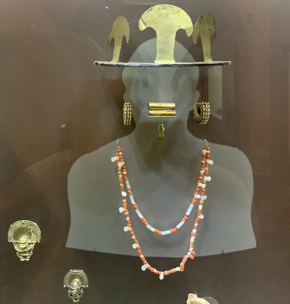
Left photo: the museum displays jewelry made from gold and semi-precious rocks so that visitors can see how they would have been worn by the native people. Imagine coming upon these people with shining gold ornaments in their headdresses, ears, and noses, reflecting a high level of artisanal skill. Unfortunately, it also led the Spaniards to loot the region and take many riches back to Spain. Fortunately, Colombia has been working with Spain to repatriate items back to Colombia.
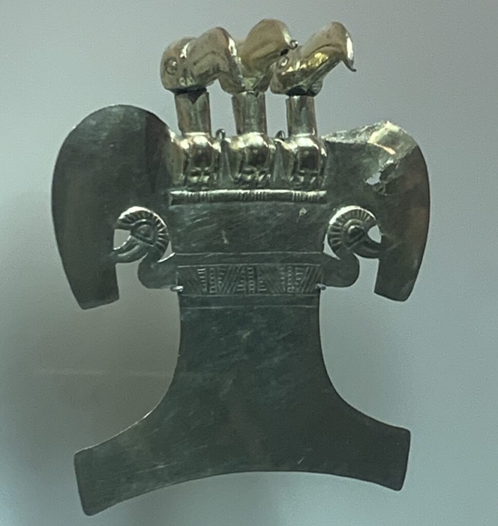
Right photo: This gold piece would have been worn as a breast plate. Eagles and other birds were revered for their ability to fly.
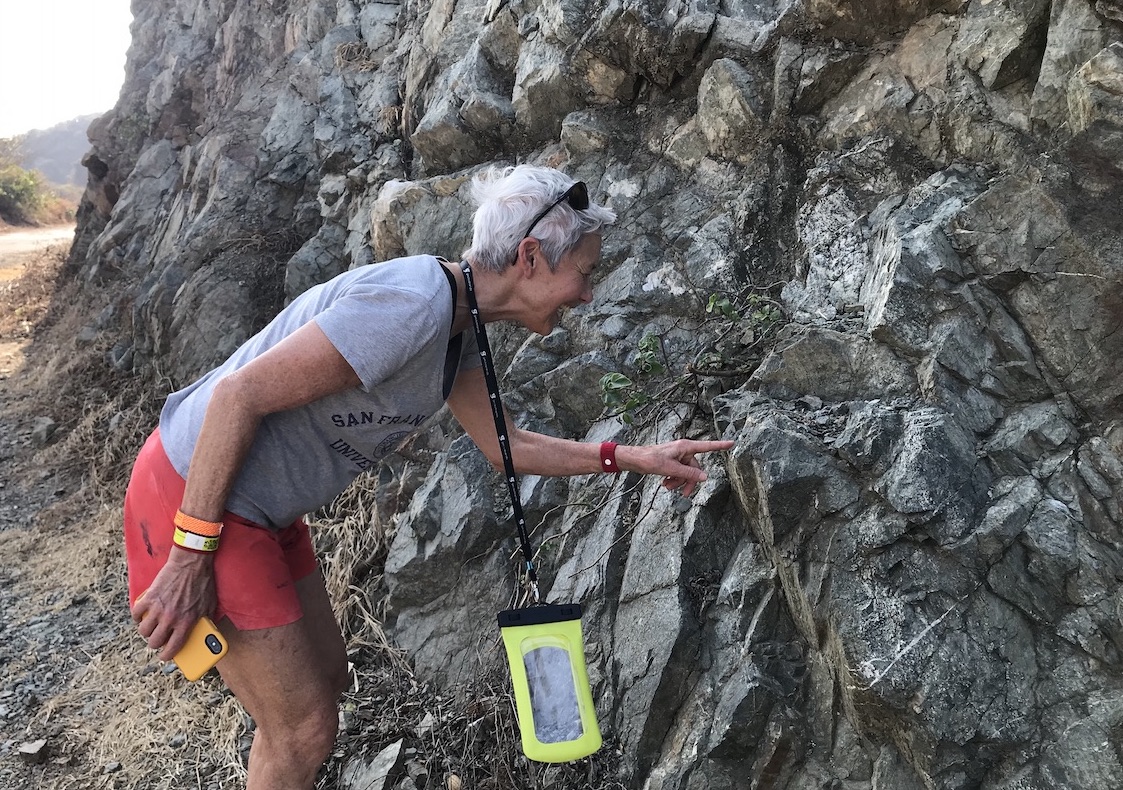
Left photo: Here I am examining rocks that are pieces of oceanic crust that have been uplifted and attached to the edge of the continent.
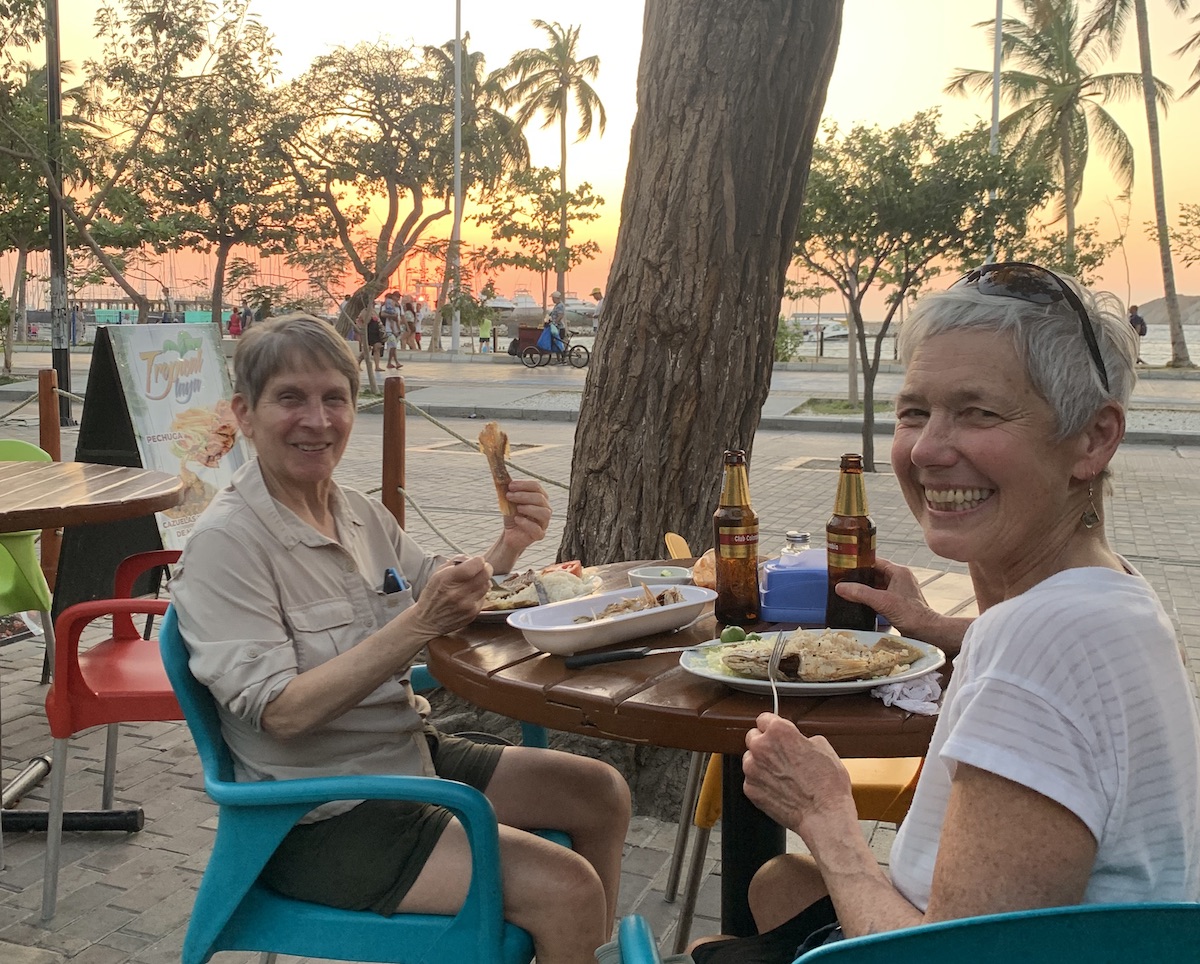
Right photo: Maria and I enjoyed fresh fish from the sea, delicious fresh fruit from the land, and of course the seaside setting for dinner and sunset.
In the next post, I’ll show photos of our two treks in the Sierra Nevada of Santa Marta.
Thanks for your interesting and lucid posts!
Thanks for reading Jane!