Our Colombian trip ended in Bogotá, in the Eastern Cordillera. The active volcanoes associated with the offshore subduction zone are farther west, in the Central Cordillera. For maps of the plate tectonic setting, see my first Colombian post: https://landscapes-revealed.net/bienvenidos-a-colombia-welcome-to-the-northwest-corner-of-south-america. The landward position of the Eastern Cordillera, east of the active volcanoes, is a region geologists refer to as the back-arc—that is, the region behind the magmatic arc of volcanoes. This post is about the back arc near the town of Villa de Leyva, whose location is shown on the map below. We visited the town and two nearby paleontology museums: Centro de Investigaciones Paleontológicas and Museo Comunitario El Fósil.
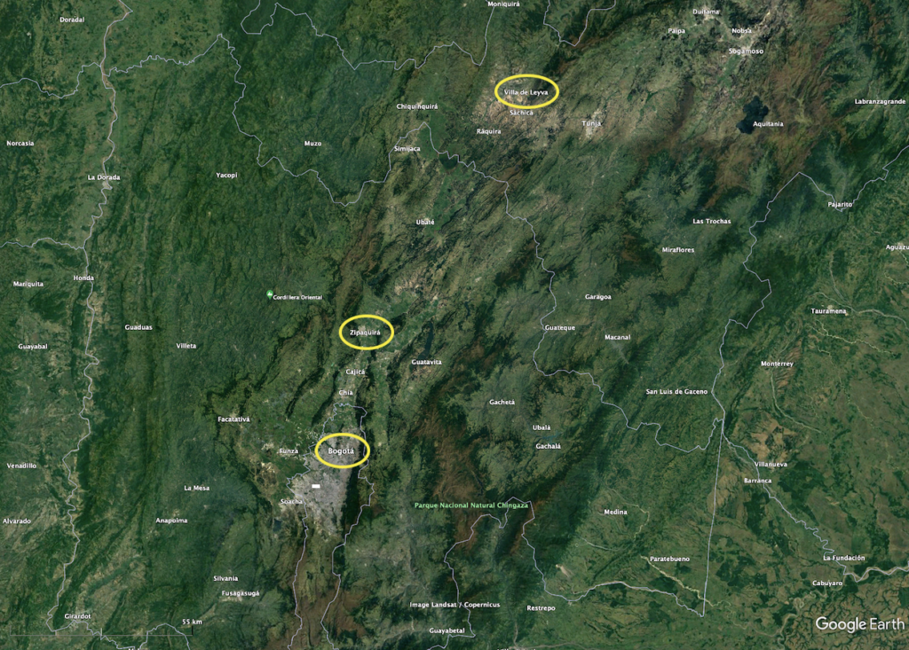
This Google Earth image shows the Eastern Cordillera locations of Bogotá, Colombia’s capital city; the town of Zipaquirá, with its Catedral de Sal to be explained in my next post; Villa de Leyva, the location of this post. To see the position of Bogotá in Colombia, please refer to my first post (see link above). The river along the west (left) side of the photo is the Magdalena River that continues north all of the way to the Caribbean coast west of Santa Marta.
Villa de Leyva
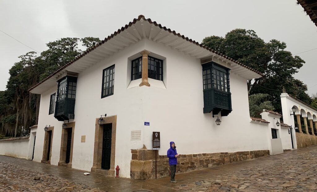
This town is located about three hours north of Bogotá. It is one of the few towns in Colombia with well-preserved colonial style and architecture. The streets are still paved with cobblestones and many buildings date from the sixteenth century. Villa de Leyva is one of Colombia’s principal tourist attractions. It was declared a National Monument in 1954.
Maria in front of a Villa de Leyva historic building adjacent to cobblestone streets. The first laws of Colombia as an independent republic were created in this building during a 1812 convention attended by the most famous politicians of the time. One attendee was Simón Bolivar, called the “American Liberator” for his role in leading Colombia, Venezuela, Ecuador, Peru, Panama, and Bolivia to independence from Spain.
Centro de Investigaciones Paleontológicas (paleontology museum)
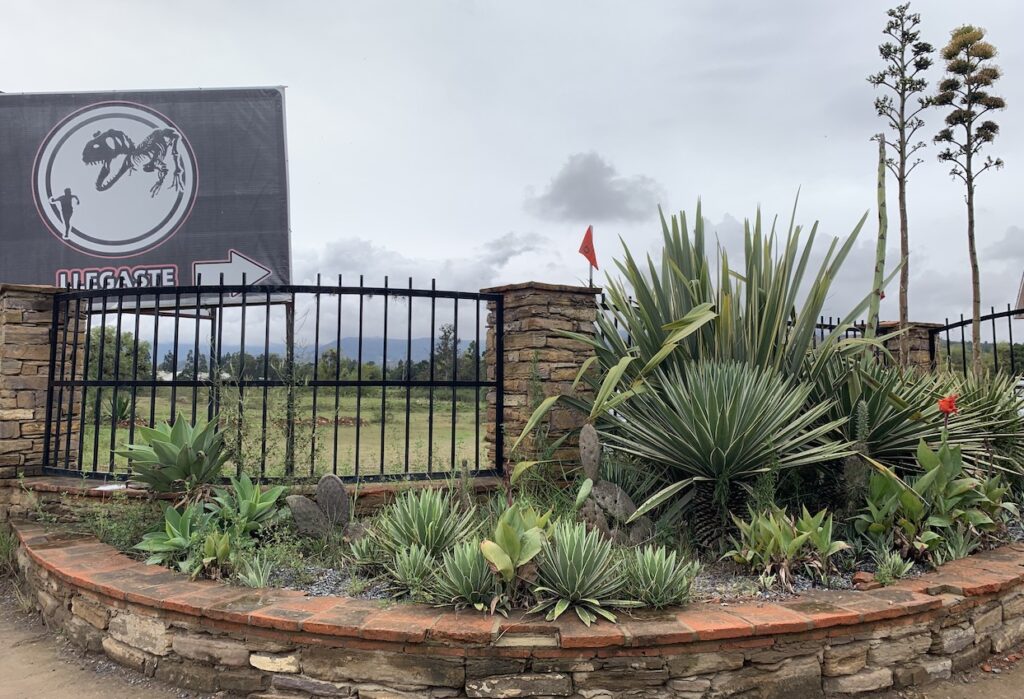
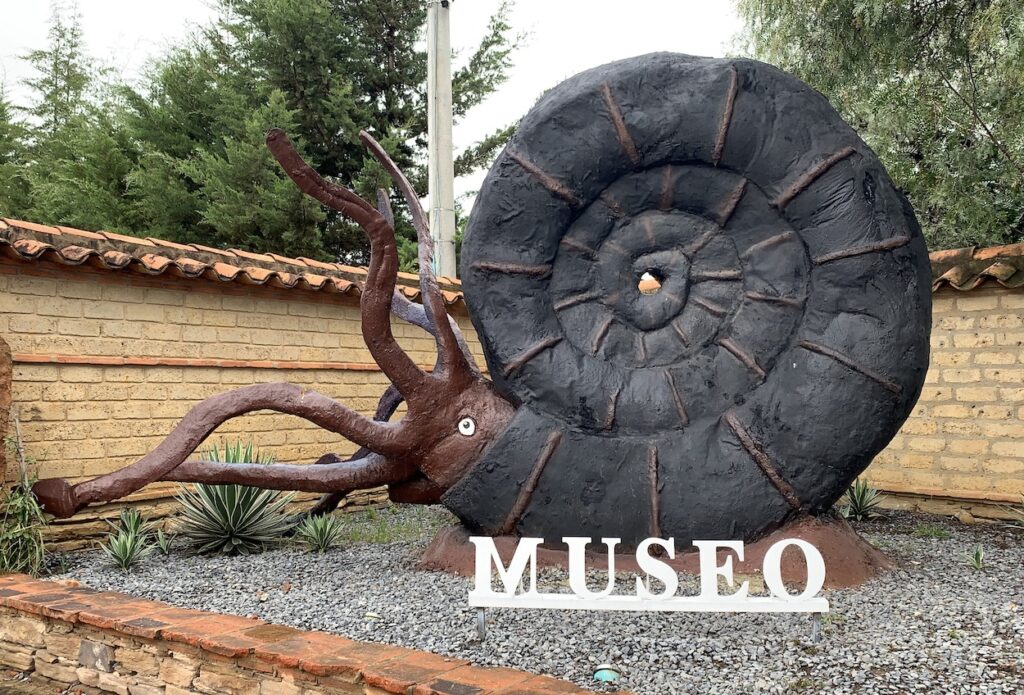
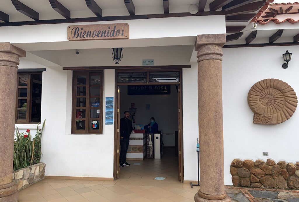
The entry to Centro de Investigaciones (Center of Investigations), a privately-funded museum focused on collecting and displaying fossils from the region. Left photo: This sign is misleading because the museum contains fossils of marine reptiles and other oceanic organisms, not land-based dinosaurs like the T-rex illustrated on the sign (llegaste = you arrived). Right photo: This reproduction of an ammonite is more accurate because fossils of these organisms are abundant in the region.
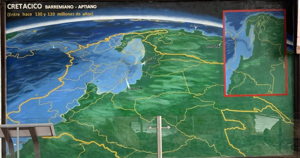
During the Cretaceous (Cretacico) Period, the back-arc region from Bogotá to Villa de Leyva was in a shallow part of the Pacific Ocean called the Paja Sea. The thick yellow line is the current outline of Colombia. Thin yellow lines are departments (i.e., provinces) within Colombia. Notice that all of Panama was under water at that time. The light blue color indicates shallow parts of the ocean, whereas the dark blue color indicates deep parts of the ocean.
Two factors enabled marine water to flood inland: (1) The back arc region was extending—that is, pulling apart—which caused the land to sink beneath the ocean. Starting at the end of the Cretaceous Period (~65 million years ago), plate interactions changed and caused compression in the back-arc region. Continued compression uplifted the land ~8 km (26,000 ft) to create the Eastern Cordillera we see today. (2) During the Cretaceous Period, Earth was in a “greenhouse state” with no ice, even at the poles. As a consequence, sea level was about 170 m (550 ft) higher than it is today.
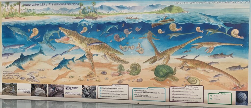
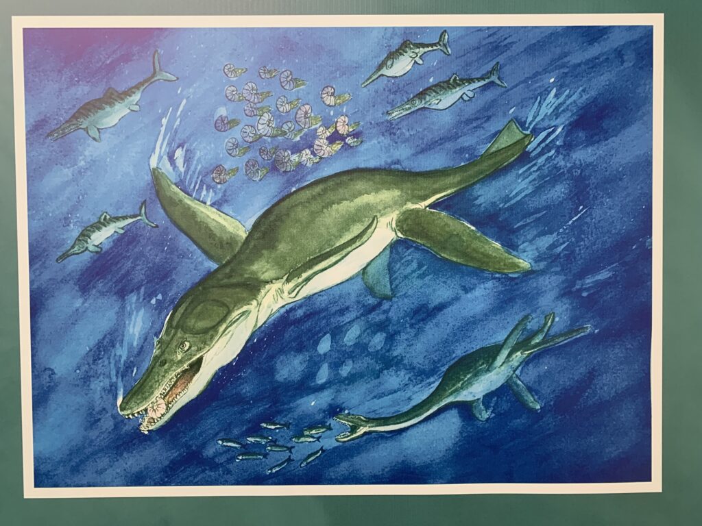
This diorama illustrates the types of organisms that lived in the Cretaceous ocean. Marine reptiles such as species of Plesiosaurus and Pliosaurus—the largest animals in this display—grew up to 12 m (40 ft) long. These animals are sometimes mistakenly referred to as dinosaurs but they are more closely related to lizards. Other organisms are marine turtles, fish and many ammonite species.
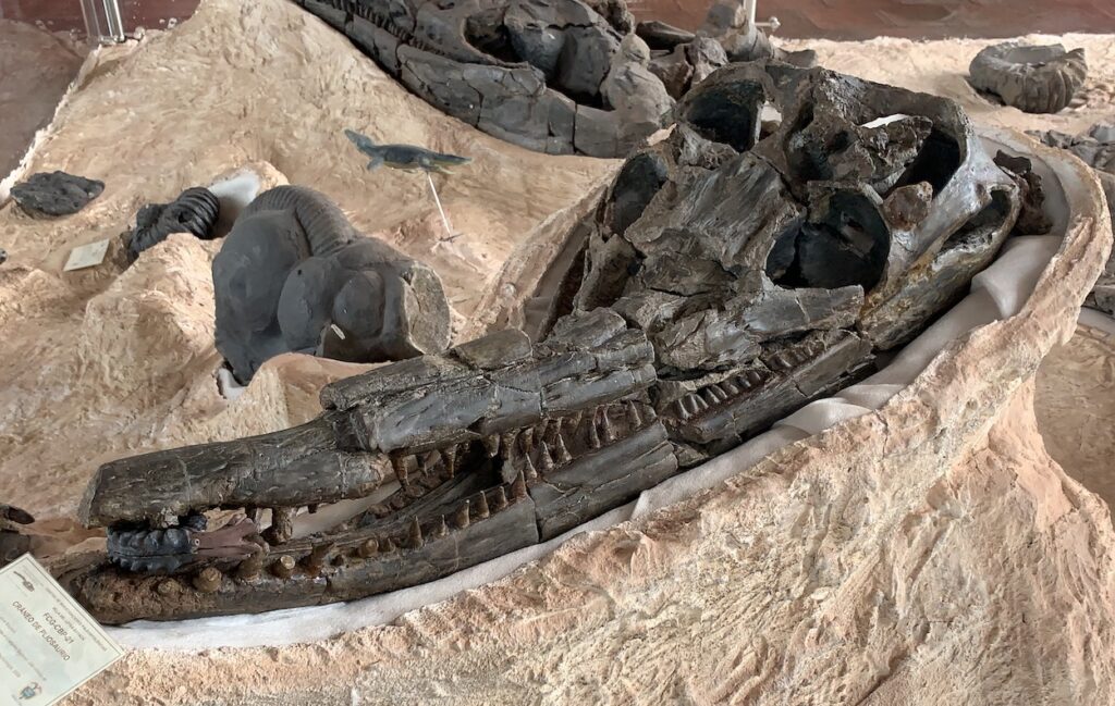
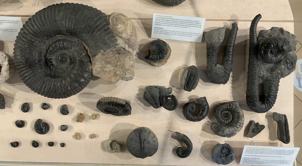
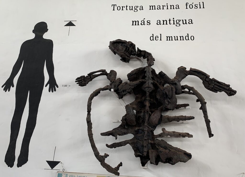
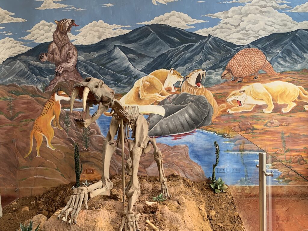
Left photo: Head of a fossil pliosaur with ammonite “lunch” in its mouth. Right photo: Partial body of a pliosaur fossil.Ammonites were a group of marine cephalopods (phylum molusca). The fossil ammonites in this photo are no larger than a human hand, but some species ranged up to 1.4 m (4.5 ft) in diameter. They were an incredibly diverse group, but they disappeared in the end-Cretaceous mass extinction event about 66 million years ago. Their closest relatives today are octopuses and squid.The museum has several fossil tortugas (marine turtles). They call this one the oldest marine turtle in the world. It was pretty big (1.80 m = 6 ft).Because of tectonic processes, the area around Villa de Leyva was lifted up above sea level during the Cenozoic Era (past 66 million years). Oceanic sediments with marine fossils are therefore overlain by terrestrial sediments with land-based fossils. Shown above is a fossil of a saber-toothed tiger in front of a diorama with other terrestrial organisms such as a giant sloth and an armadillo relative. These fossils must be less than 3 million years old because that is when Panama became attached to South America and organisms could migrate between North and South America, an event called the Great American Biotic Interchange. For more information about the event, link to this post: https://landscapes-revealed.net/the-great-american-biotic-interchange/.
Museo Comunitario el Fósil (the community fossil museum)
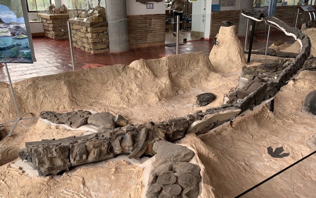
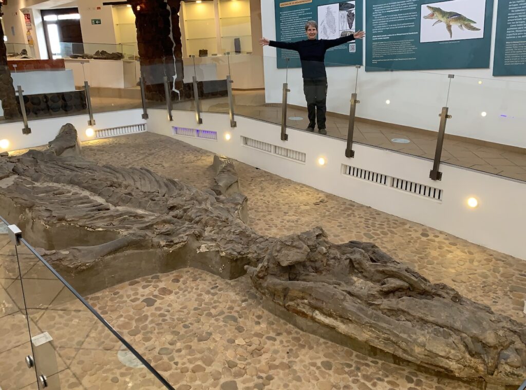
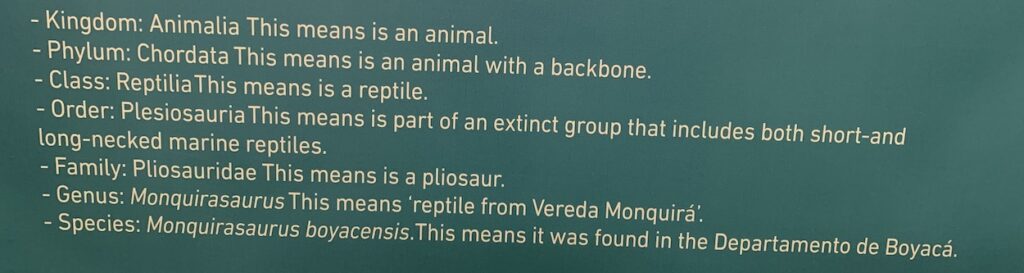
The entry to Museo el Fósil, which is named “the fossil” because the museum was built around the remains of one organism—a fossil of Monquirasaurusboyacensis. The fossil was found in a field and although there was a proposal to move it to a museum, the community insisted it was their fossil and they wanted to keep it local. So a museum was built around the fossil, which now gets to remain exactly where it died in the Cretaceous ocean and became fossilized after it was buried by more sediments. Maria stretching her arms to indicate the length (7.3 m / 24 ft) of the fossil Monquirasaur.Here is the complete classification of the Monquiasaur. It was originally classified as Kronosaurus boyacensis, an Australian pliosaur. However, a recent investigation revealed large differences, and the new name—Monquirasaurus—is in honor of the local community of Vereda Monquirá.The Monquirasaur was a formidable marine predator at the top of the food chain. It was capable of eating large ammonites, fish and other marine reptiles. It had a streamlined body for fast swimming and large teeth to pierce its prey.
There is a third paleontology museum in Villa de Leyva, but we did not have time to visit it.


Completely fascinating!!!!
Thanks Karen!
What a great find!!!
Yes! I particularly liked the fossil that got its own museum!