Discovering what killed the dinosaurs in Gubbio, Italy
September 27, 2022
Our 4-week trip to Italy in August and September was mainly focused on trekking in the Dolomite Mountains—those posts to come later! During the planning process, I realized the town of Gubbio is located just 4.5 hours south of Venice, where we were flying in and out of. We had to go there! A rock outcrop just east of Gubbio is where geologists figured out what caused the second largest mass extinction in Earth’s history—the extinction 66 million years ago that killed at least half (some say up to 75%) of the species living at that time, including the dinosaurs. This event ended the Cretaceous Period and the Mesozoic Era, called the Age of Reptiles. Following this mass extinction, life returned during the Cenozoic Era, called the Age of Mammals. Once the large reptiles were extinguished, mammals thrived, leading eventually to Homo sapiens. The first period of the Cenozoic Era is the Paleogene Period, so the boundary is referred to as the K/Pg boundary (K for Cretaceous and Pg for Paleogene).
Gubbio and the Bottaccione gorge
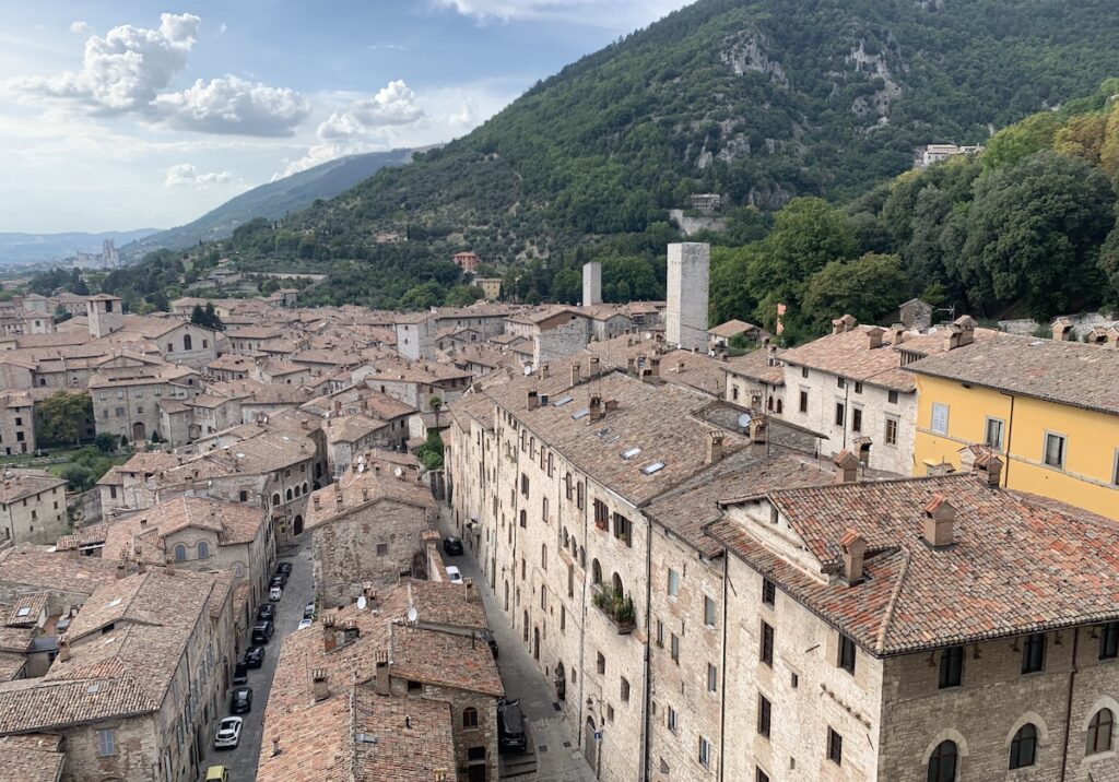
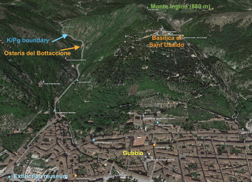
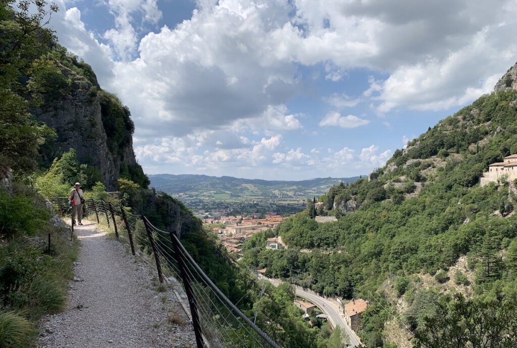
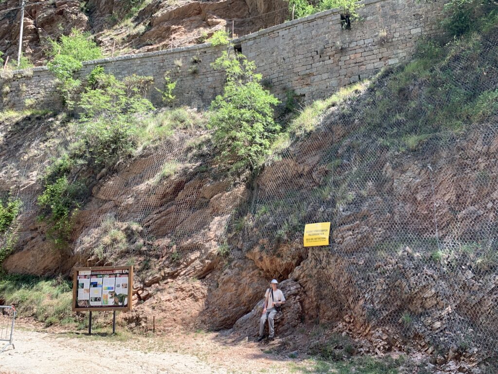
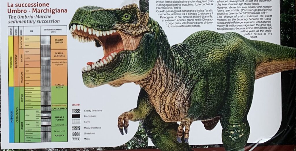
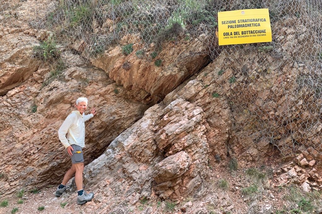
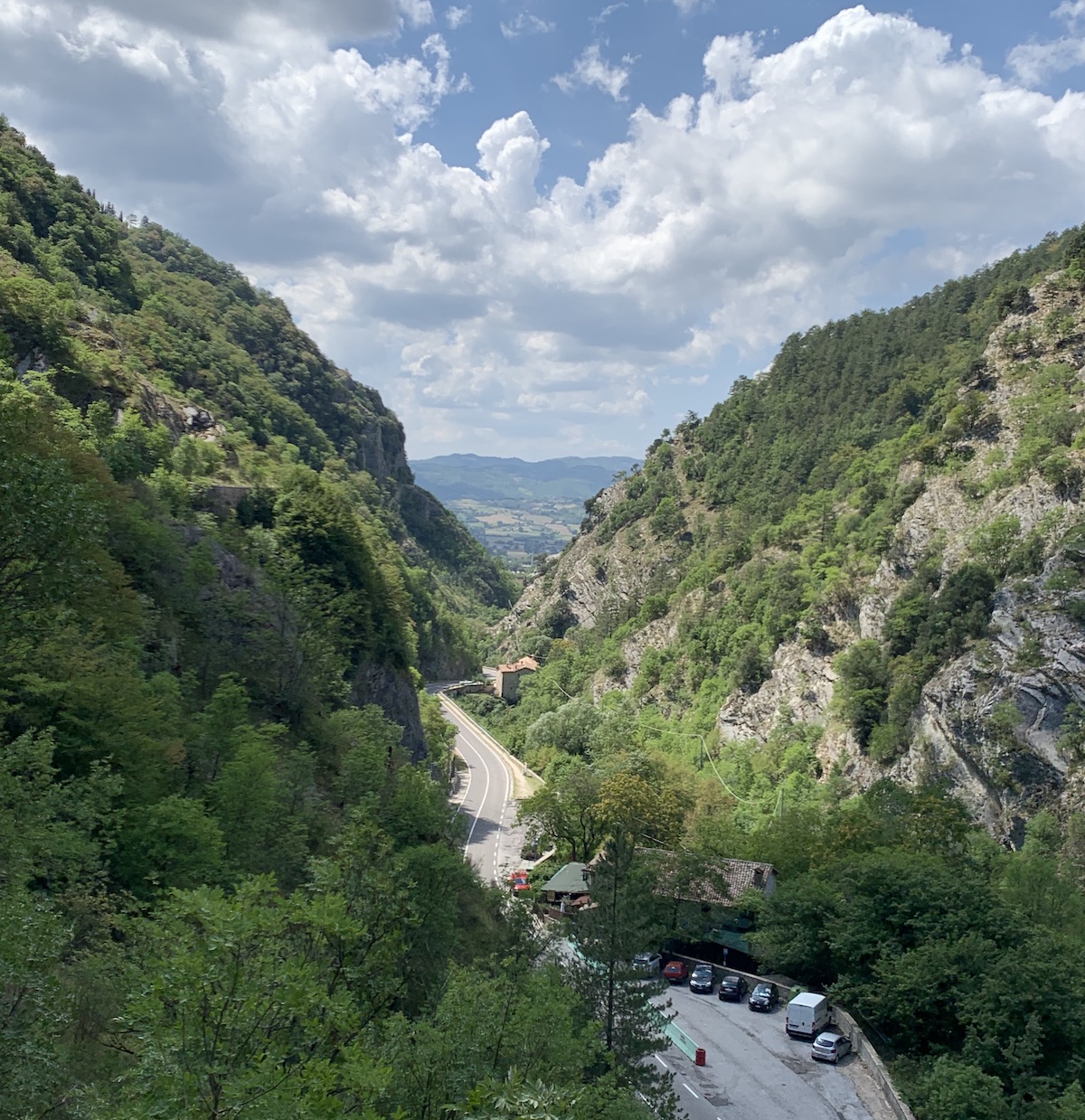
Gubbio is a charming medieval town in the central Apennine Mountains about halfway between Venice, to the north, and Rome, to the south. This view is looking northwest across the old town. Gubbio is in a valley formed by a fault that up-lifted the mountain to the northeast, and down-dropped the valley to the southwest. Humans have apparently occupied this valley since the Middle Paleolithic period 120–80,000 years ago. So the region is rich in both human and geologic history. Bottaccione gorge, where we saw the K/Pg boundary outcrop, is the valley that cuts the slope on the right side of the photo.This Google Earth image is a view to the northeast from Gubbio. We decided to take the scenic route to reach the K/Pg boundary site. From Gubbio we hiked up the zig-zag path (right side of photo) that leads to the Basilica di Sant’Ubaldo, dedicated to Gubbio’s patron saint. We continued to the top—Monte Ingino—where we could look down on the Bottaccione gorge (left side of photo). On the way back to town, we followed a trail leading to a path along the top of an aqueduct that was constructed in the 14th century. The name of the gorge—Gola del Bottaccione—means “throat of a big-water barrel” and refers to the water of the aqueduct. We continued on the aqueduct until it dropped down to road level—see path on slope along the right side of the road. The K/Pg boundary outcrop was then just a 1-minute walk along the road—see location in blue color. The Osteria is a restaurant I’ll refer to later.This view is to the southwest, down the Bottaccione gorge to the town of Gubbio in the valley. We were walking on top of the ancient aqueduct to reach the K/Pg boundary site shown on the Google Earth image above.Here is the K/Pg boundary outcrop—the actual boundary is the recessed layer behind Jay’s head. Note the aqueduct at the top of the photo. The flat top of the aqueduct is a path that comes down to the road just a short distance to the left of the photo. The sedimentary rocks are the Scaglia Rossa limestone. “Scaglia” means scaly, referring to how the limestone breaks apart in thin layers. “Rossa” refers to the reddish color. The outcrop is even labeled (yellow sign), and described (signboard on posts). Note that the layers are tilted toward the left (toward the northeast). This deformation occurred during the past 50 million years, when the Apennines were being created.This part of the signboard shows the sedimentary succession that includes the K/Pg boundary layer. It’s not very clear, but the colors tell the story. The end of the Mesozoic Era is colored blue, and the last period of the Mesozoic—Cretaceous—and its subfields are colored green. The Cenozoic Era is colored yellow, and the first period of the Cenozoic—Paleogene—and its subfields are colored orange. The rock types indicated in the legend (top to bottom) are cherty liimestone (contains silica in addition to calcium carbonate), black shale, clays, marly limestone (mixture of both regular mud and carbonate mud), limestone, and marls (both types of mud). Scaglia Rossa limestone spans the K/Pg boundary, which is why the bottom half is colored green and the top half is colored orange.
How the limestone formed and the stories it tells
Limestone forms from the hard parts of organisms that extract calcium, carbon, and oxygen from sea water to make their calcium carbonate (CaCO3) shells. These organisms include familiar animals such as corals, clams, and snails that live in shallow water. The organisms in the Scaglia Rossa limestone, however, are less familiar single-celled protists called foraminifera (animal-like) and coccoliths (photosynthesizing algae). These pelagic organisms live in the surface waters of the ocean and when they die, their hard parts fall to the seafloor and collect as carbonate mud. As the mud gets buried by more sediment, it eventually hardens into rock.
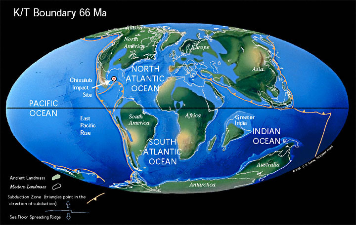
This paleogeographic map shows the positions of the continents at the time of the K/Pg mass extinction. [Note that the first period of the Cenozoic Era used to be called the Tertiary and so you will see the term “K/T boundary” used in older publications.] The Scaglia Rossa limestone was deposited in a deep part of the western Tethys Ocean (not labeled) that separated Eurasia from Africa and other southern continents. The Mediterranean Sea is a remnant of this once much larger ocean. White lines are the outlines of present-day continents. Note that Italy was under water at the time of the K/Pg extinction. Also note the Chicxulub impact site, where an asteroid hit Earth 66 Ma (millions of years ago) and caused a mass extinction. Figure from http://www.scotese.com/K/t.htm.
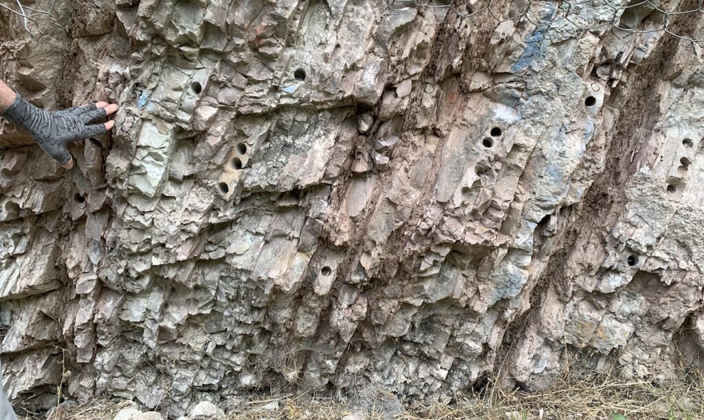
Here is a close up of the Scaglia Rossa limestone at the K/Pg boundary site. The thicker layers are limestone and the thinner layers are clay. The layers contain only calcium carbonate from organisms’ hard parts, and clay that was airborne dust that fell to the ocean surface and eventually settled to the seafloor. The lack of any larger-sized sediments like sand indicates the site was far from land and any sediment input from rivers. This location in Italy is famous for many reasons. It is a nearly 100-million-long archive of Earth’s history, so well preserved because pelagic sediments collect slowly and continuously away from the influence of faults and currents.
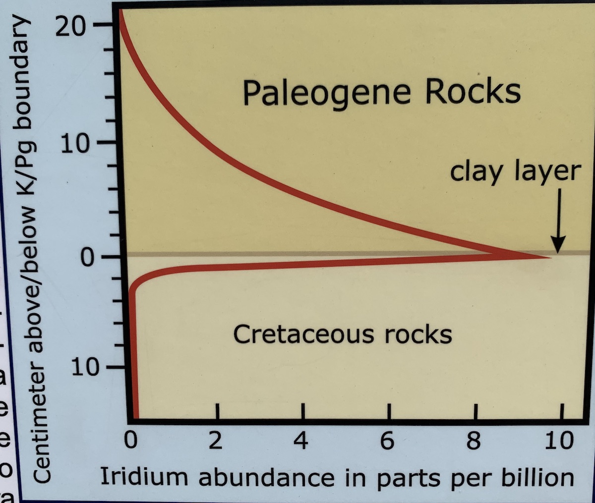
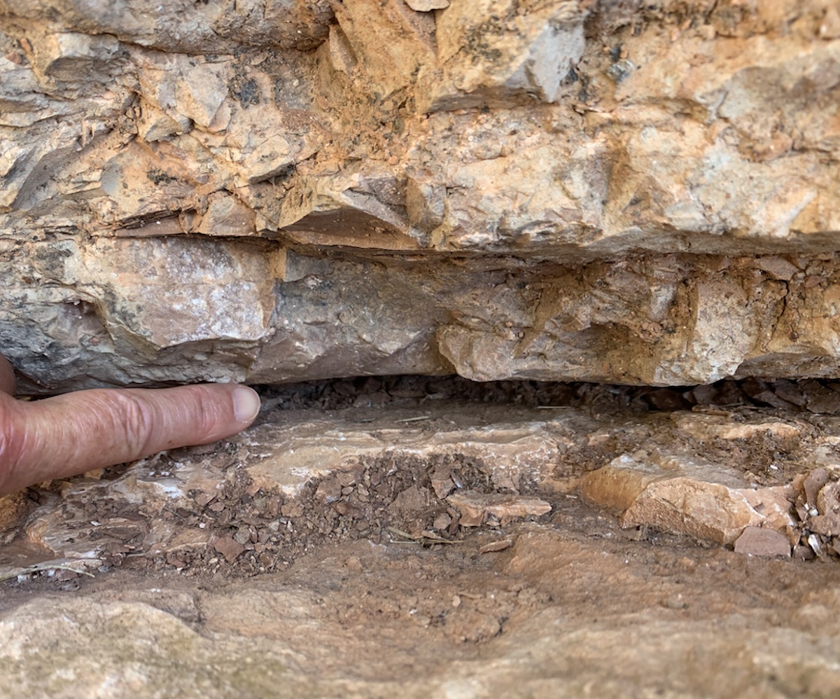
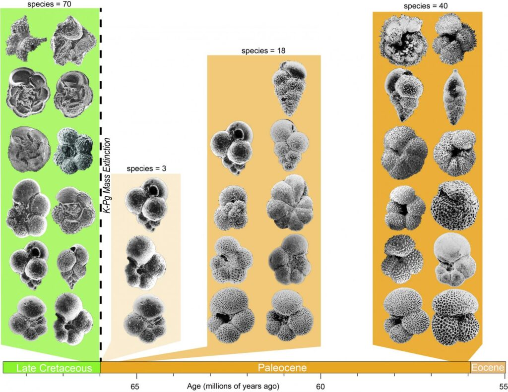
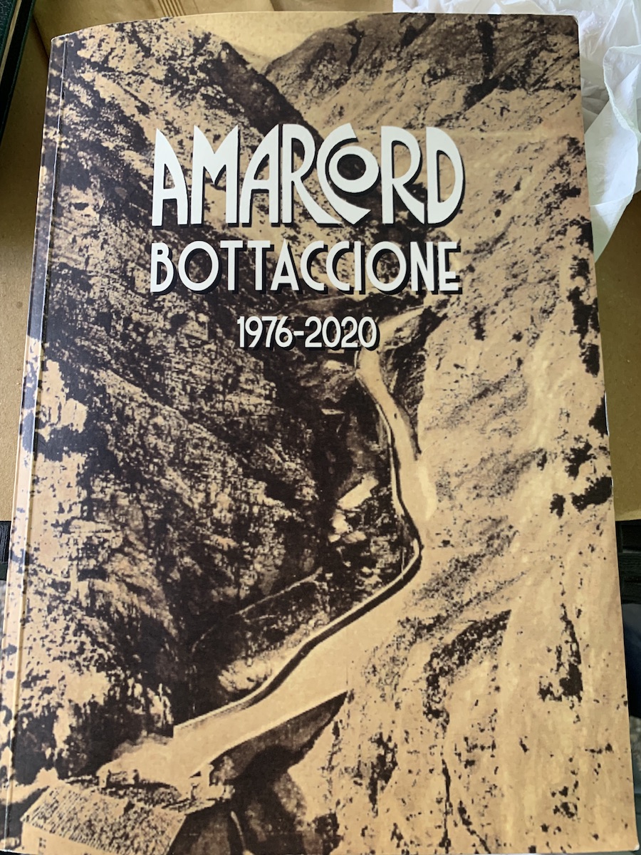
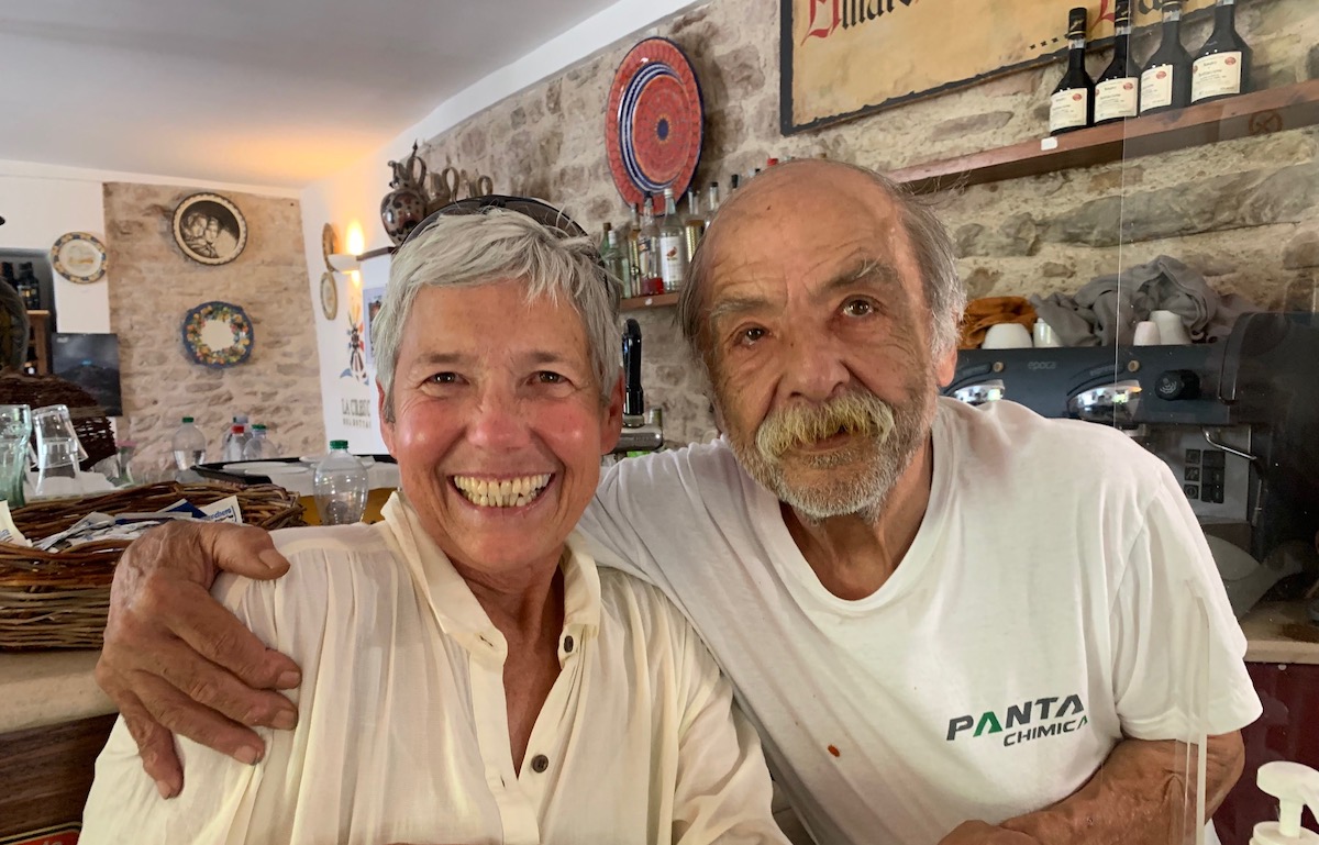
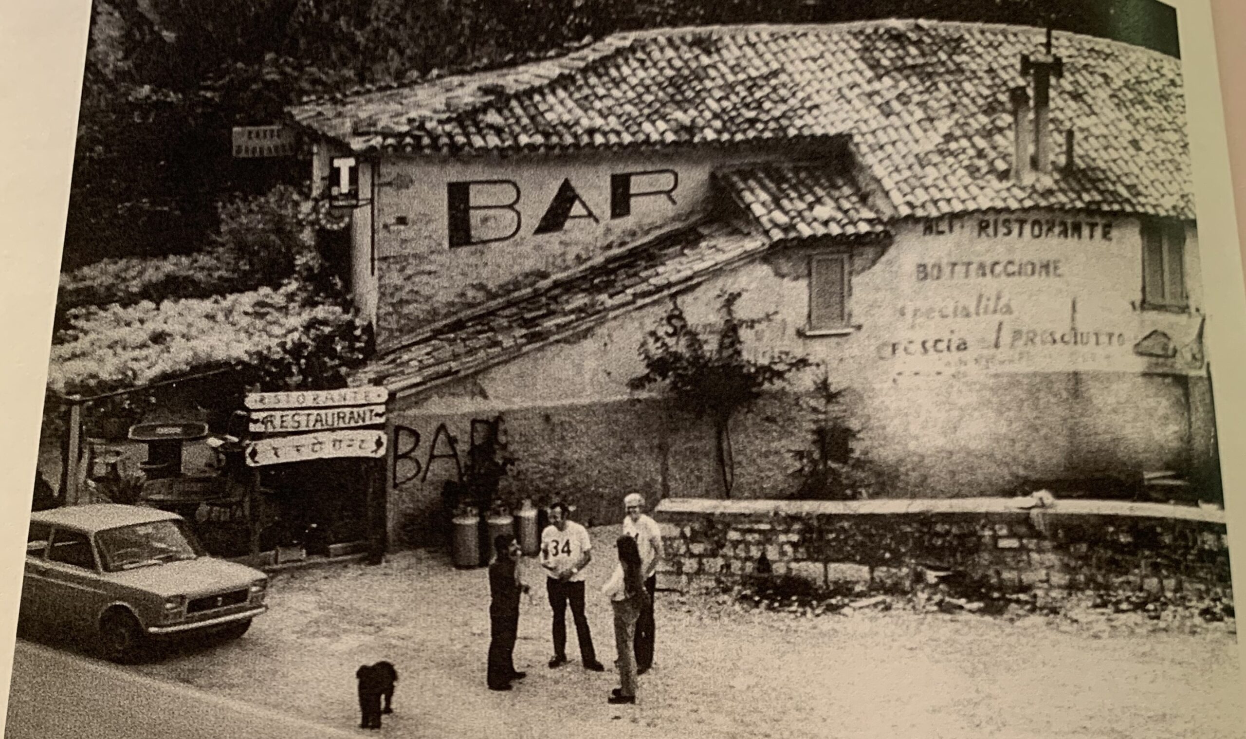
And what are those holes? They are cores extracted from the rock to measure paleomagnetic directions. Walter Alvarez, a geology professor at the University of California, Berkeley, tells the story of how he and colleagues started working on a project to measure ancient magnetic field directions that then led to the mystery of the mass extinction and what caused it. Alvarez’ book—”T. rex and the crater of doom” (see reference below)—is an accessible account of the chronology and well worth a read.Here is a closeup of the boundary. The boundary is recessed because many geologists have come here to sample the rock! The limestone is a more whitish color below the boundary and a redder color above the boundary. What can’t be seen without a microscope is the disappearance of life. Prior to Alvarez’ work, an Italian geologist had identified the clay layer, where most foraminifera had disappeared, as the K/Pg boundary. Alvarez and his colleagues then focused on figuring out what had caused this extinction. The “Sezione Stratigrafica Paleomagnetica” sign refers to the record of magnetic reversals that Alvarez and colleagues measured in the nearly 100-million-year-long sedimentary sequence. Photo courtesy of Jay Ach.The photo on the right is a closeup of the K/Pg boundary clay, a very thin layer (where my finger is) between limestone layers. The diagram on the left is from the signpost at the boundary site. It shows iridium concentration across the K/Pg boundary. Alvarez’ father, Luis Alvarez, was a physicist who suggested measuring iridium to figure out how long the extinction took. They were surprised to find a concentration in the clay layer so high it could not have come from Earth, where iridium is rare. Iridium is more common, though, in extra-terrestrial bodies and in 1980, Walter and Luis Alvarez, and two nuclear chemists, published a paper in Science journal hypothesizing that the extinction occurred very quickly, as a result of an asteroid impact from outer space. This was a controversial idea in 1980, but 40 years later, it is well accepted. Since then, scientists have discovered the Chicxulub impact site on the Yucatan Peninsula (see “K/T boundary 66 Ma” map above), found high iridium concentrations in many other locations, and identified other evidence such as quartz crystals with shocked structures from the impact.When we think of mass extinctions, we tend to focus on large charismatic organisms such as dinosaurs. But the extinction also affected small organisms and those living both on land and in the sea. The disappearance of single-celled foraminfera (forams) was what had already enabled Italian geologists to identify the K/Pg boundary in the Scaglia Rossa limestone. This figure shows the diverse group of planktonic forams that were living during the end of the Cretaceous Period (green), the very small group that survived the extinction event (light tan), then the increasing diversity of shapes as the forams recovered during the early Paleogene (orange). The surviving forams were initially small in size as well as number. For organisms to survive they had to reduce their nutritional needs and/or find refugia where they could hang out until conditions improved. Figure from https://www.eurekalert.org/news-releases/699615. This study showed that it took millions of years for organisms to rebound after the cataclysmic event.A fun thing to do after visiting the K/Pg boundary site is to have lunch at Osteria del Bottaccione, located just a 5-minute walk down the canyon. The top middle photo shows the Osteria—photo taken from the aqueduct path above the road. The bottom photo shows the Osteria (then called Ristorante) in 1976, when Walter Alvarez and colleagues had organized an international conference to exchange ideas about this important sedimentary sequence—even before the impact hypothesis had been concocted. In the photo are Jack the dog, Aldo Biancarelli (Osteria owner), Bill Lowrie (paleomagnetist), Peggy Larson, and Walter Alvarez.
One conference participant initiated a green guest book that geologists could sign after visiting the K/Pg boundary site. In the Osteria, I knew to ask for the “green book” and sure enough, they brought them all out. They are now on the 3rd book, which I excitedly signed. Several years ago, one of the Italian geologists working in the area decided to scan all three books and save them in a volume (Amarcord Bottaccione 1976–2020; upper left photo). It was fun to look through the book and see names of geologists from around the world. I even got to get a photo with Aldo (Osteria owner), who was still working at his restaurant 46 years later!
Other local attractions
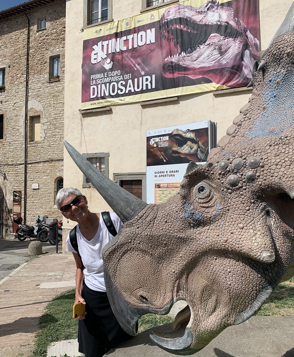
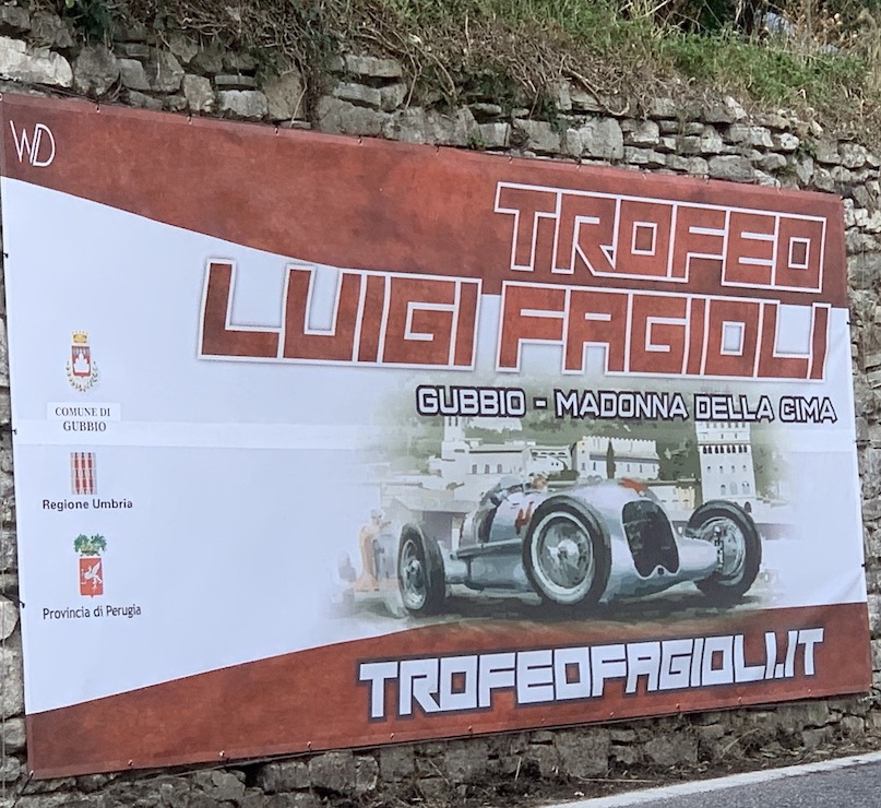
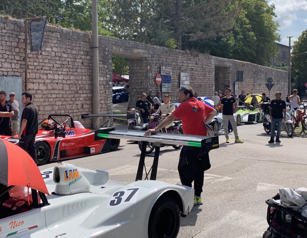
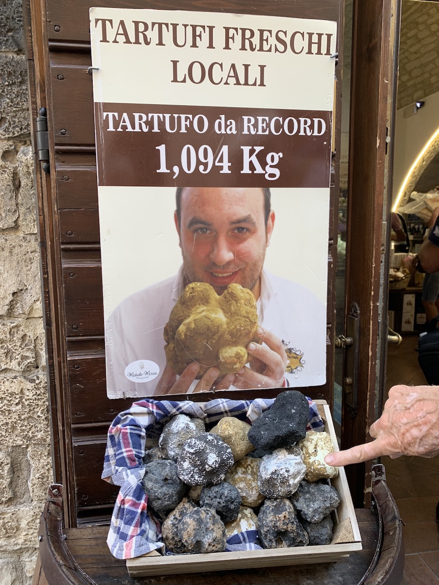
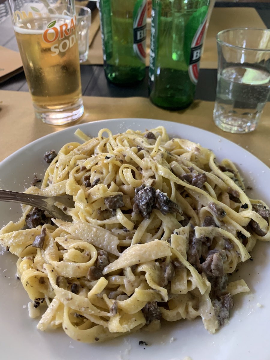
During the weekend when we visited Gubbio, there was an event that struck us as highly ironic. In town there is a museum about dinosaurs and extinctions (left side photo; see location on Google Earth image above). It’s pretty good. Along the road in Bottaccione gorge we had seen a sign for a car race (center photo) and the next day, when we went to visit the museum, we found a huge lineup of fancy cars that would be racing up the canyon during the next several days. Burning lots of fossil fuels and releasing CO2, thus moving us closer to Earth’s next mass extinction…It was mushroom season in Gubbio and throughout the region. The sign on left is about tartufo (truffle) mushrooms. At the Osteria del Bottaccione, I sampled the tagliatelle with mushrooms. Delicious!
Closing notes
I wanted to include more details about how geologists came to figure out the cause of the K/Pg mass extinction event. But the story is long! I suggest reading “T. rex and the crater of doom”, a short, readable account of how this discovery was made. Walter Alvarez’ other book—”The mountains of Saint Francis”—explains the geology of the Apennines with more depth for those interested in the bigger picture story. It was from Callen Bentley’s 2017 blog (reference below) that I got essential information about the site’s location and the green book in the nearby Osteria.
While an asteroid certainly hit Earth 66 million years ago, not everyone agrees that this was the main cause of the mass extinction. Effusive basaltic eruptions in India (called the Deccan Traps, “trap rock” being an old term for basalt plateaus) also affected Earth’s atmosphere and climate. It is possible that both events contributed to the extinction.
Just this week NASA’s Double Asteroid Redirection Test (DART) successfully hit an asteroid with the goal of redirecting its path. Although this asteroid was not on a path to impact Earth, the test was to show that we might be able save ourselves if we discovered an asteroid that was headed our direction. So we can at least have some hope that WE won’t go extinct because of an asteroid impact!
Resources
Walter Alvarez, 1997, T. rex and the crater of doom, Princeton University Press, 185 p.
Walter Alvarez, 2009, The mountains of Saint Francis, W.W. Norton and Company, 304 p.
Your work to write these blogs is much appreciated. Thanks so much.
Landscapes Revealedon September 28, 2022 at 1:29 pm
Thanks for reading Nancy!
John Ferrison September 28, 2022 at 12:44 pm
Karen, Thank you for including me in your travels and your continuing education. Iceland and Italy both provide new areas of exploration for me. Can’t wait to see where we go next. John Ferris
Landscapes Revealedon September 28, 2022 at 1:28 pm
Thanks for reading John!
Steve Shattuckon October 31, 2022 at 6:23 pm
I’m confused. Was the extinction of the dinosaurs in the Cretaceous period caused by an asteroid hitting in what is now Chixulub, Mexico or Gubbio, Italy or was this the same area before Pangea split up? A novice question for sure but I’m confused.
Landscapes Revealedon October 31, 2022 at 8:14 pm
A good question! Yes, the dinosaurs were “done in” by the asteroid impact in Mexico. But huge amounts of eject that spewed from the impact site got lifted into the atmosphere and carried around the planet. The particles then fell to make thin layers (rich in iridium) that have now been found around the globe. Pretty cool to see how events in one place can have such a world-wide impact.


Your depth of knowledge knocks me out, Karen. Thank you very much for this fascinating and dense explanation and description!!!! Best, ksue
Thanks ksue!!
Your work to write these blogs is much appreciated. Thanks so much.
Thanks for reading Nancy!
Karen, Thank you for including me in your travels and your continuing education. Iceland and Italy both provide new areas of exploration for me. Can’t wait to see where we go next. John Ferris
Thanks for reading John!
I’m confused. Was the extinction of the dinosaurs in the Cretaceous period caused by an asteroid hitting in what is now Chixulub, Mexico or Gubbio, Italy or was this the same area before Pangea split up? A novice question for sure but I’m confused.
A good question! Yes, the dinosaurs were “done in” by the asteroid impact in Mexico. But huge amounts of eject that spewed from the impact site got lifted into the atmosphere and carried around the planet. The particles then fell to make thin layers (rich in iridium) that have now been found around the globe. Pretty cool to see how events in one place can have such a world-wide impact.
Wonderful. Thanks for your reply.